After pushing a little bit farther than expected yesterday, I wasn’t exactly sure what goal I should set for today. I knew I had about 60 miles to Guitar Lake, and if I could get there in 2 days, that would make an easy 16 mile last day for a seven day finish. But I wasn’t sure exactly how to cut up that 60 mile section. Rae Lakes was about 28 miles away, so I could camp there and then push to Crabtree Meadow or Guitar Lake the next day, but that would include Forester Pass (13,100’) for a pretty big day. I had to clear at least two passes today: Mather Pass (12,100’) and Pinchot Pass (12,100’). To continue past Rae Lakes would add Glen Pass (11,900’), a distance that most hikers would spend 3-5 days covering.
Eventually I figured I should just hike and see how I was feeling later in the day. The scenery was fantastic today, so I was taking many more pictures, just like yesterday.
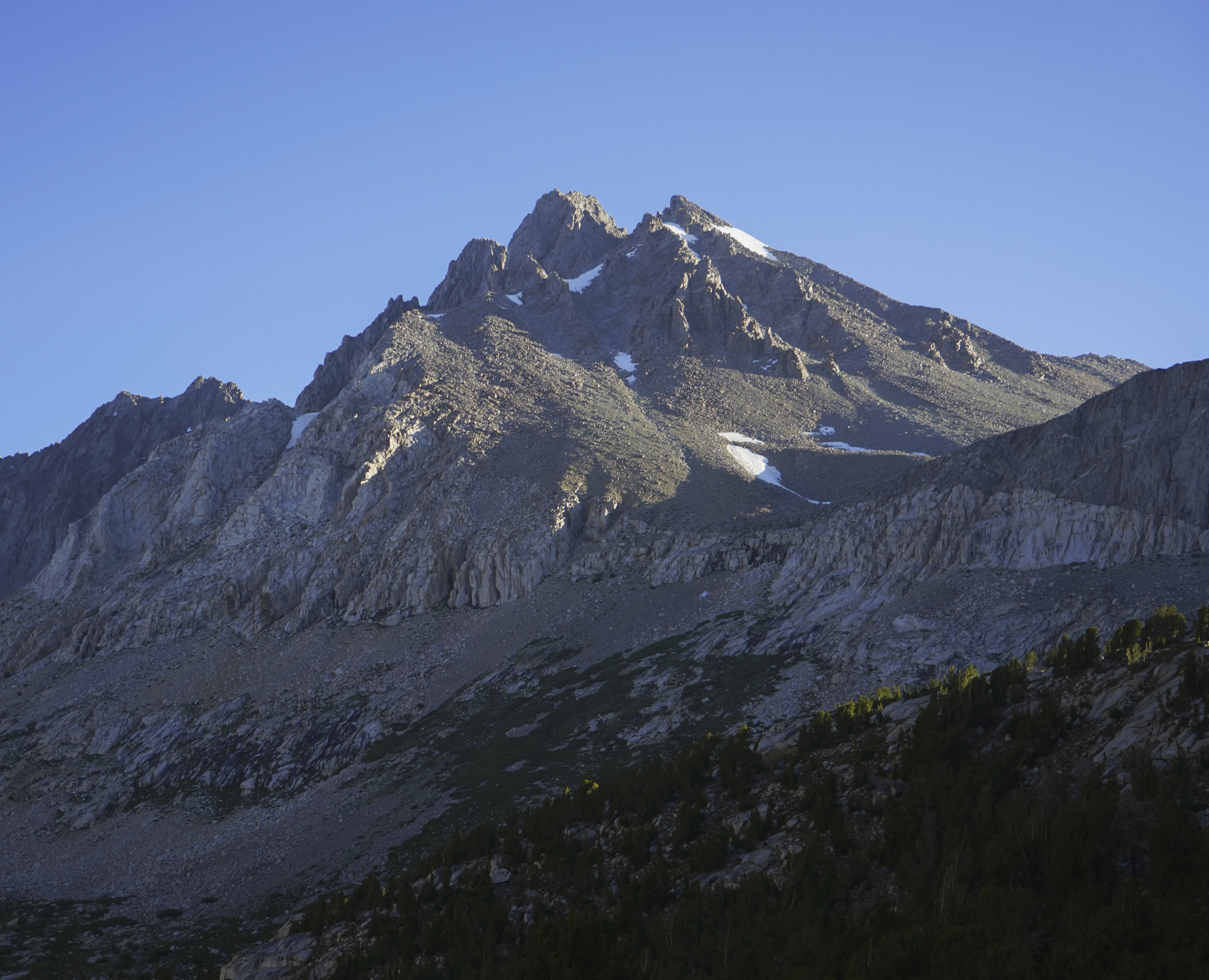
The view back to sunrise on Middle Palisade (14,019’) while ascending Mather Pass.
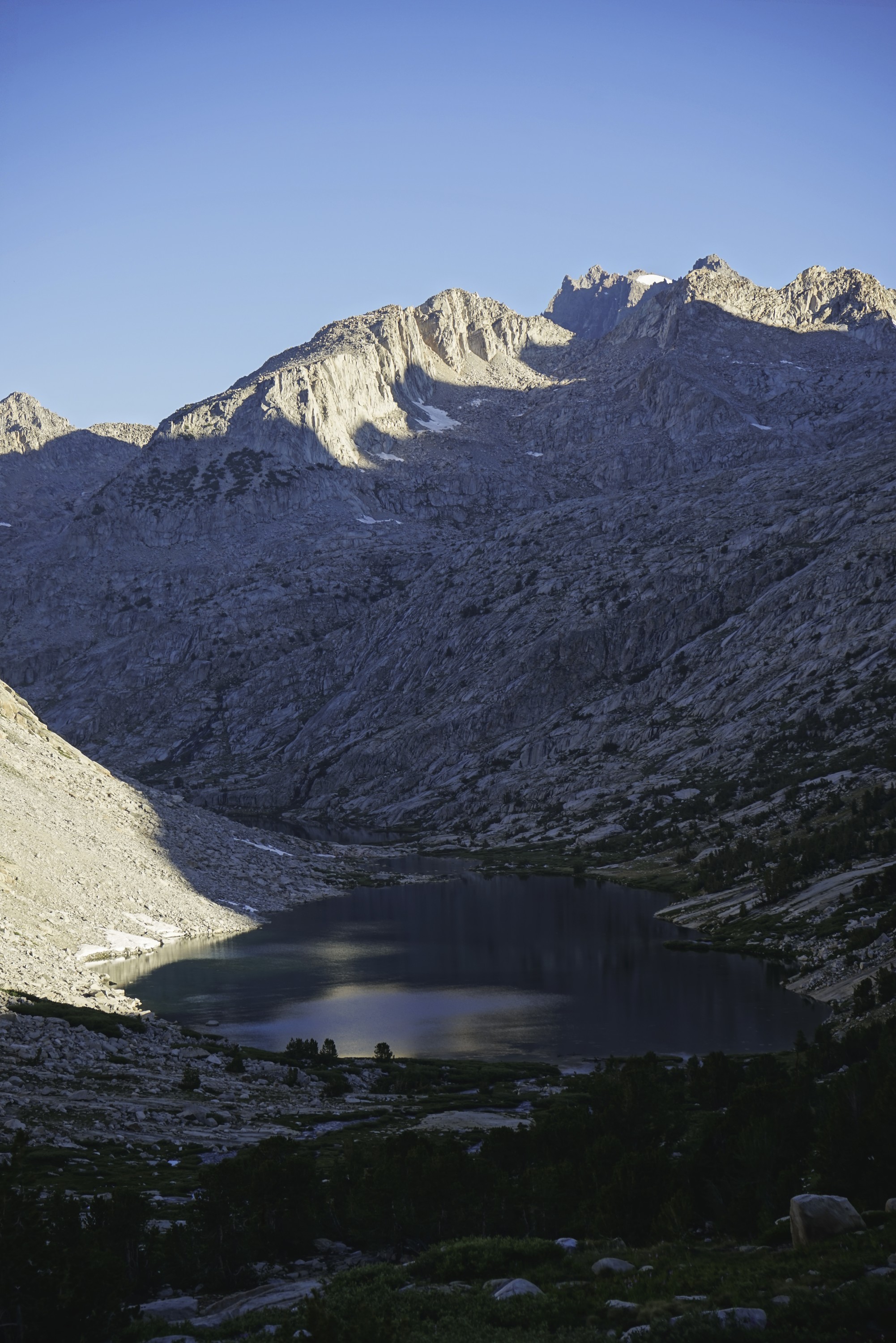
Morning light playing over the upper Palisade Lake with the Palisade Crest and Mount Sill behind.
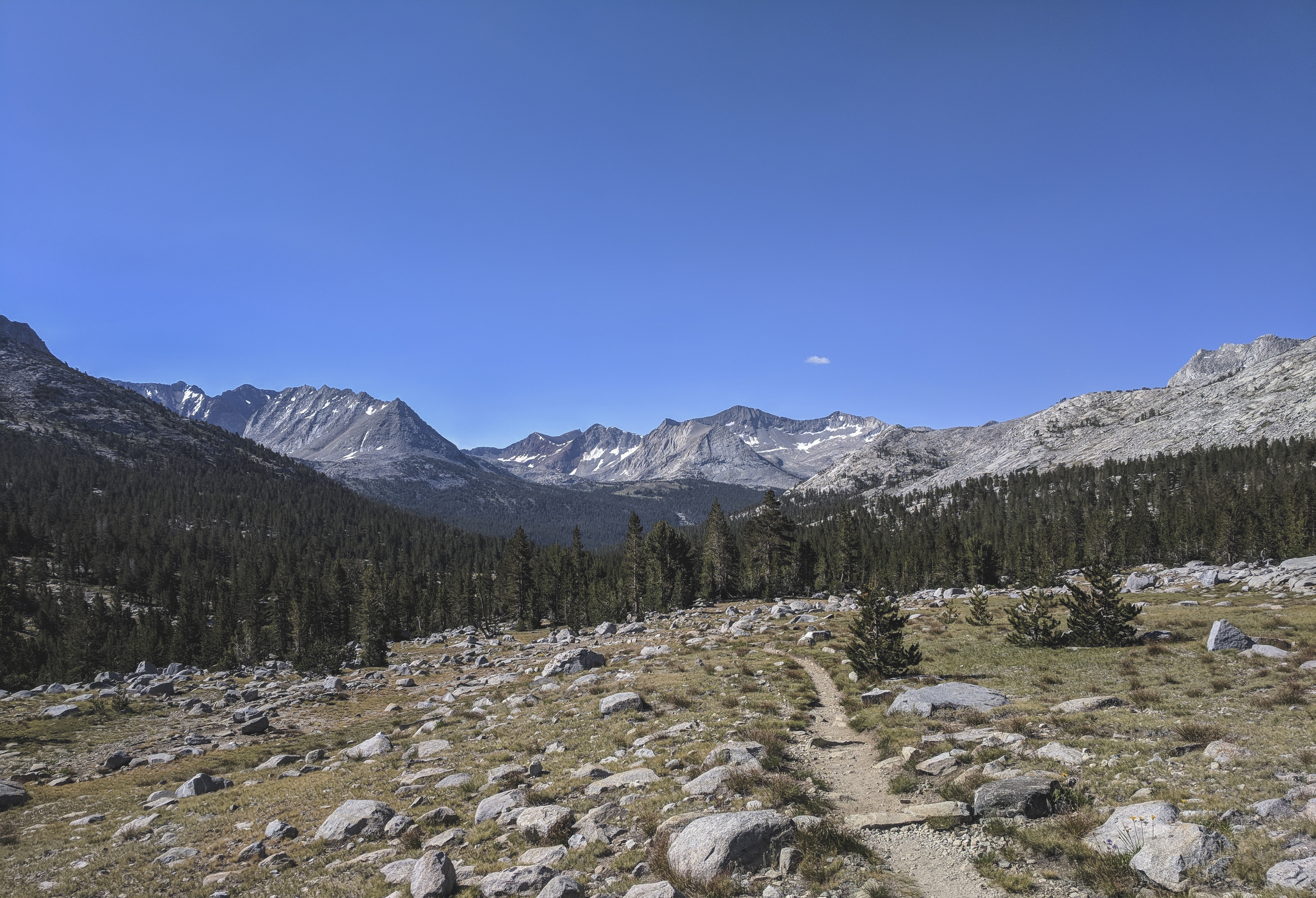
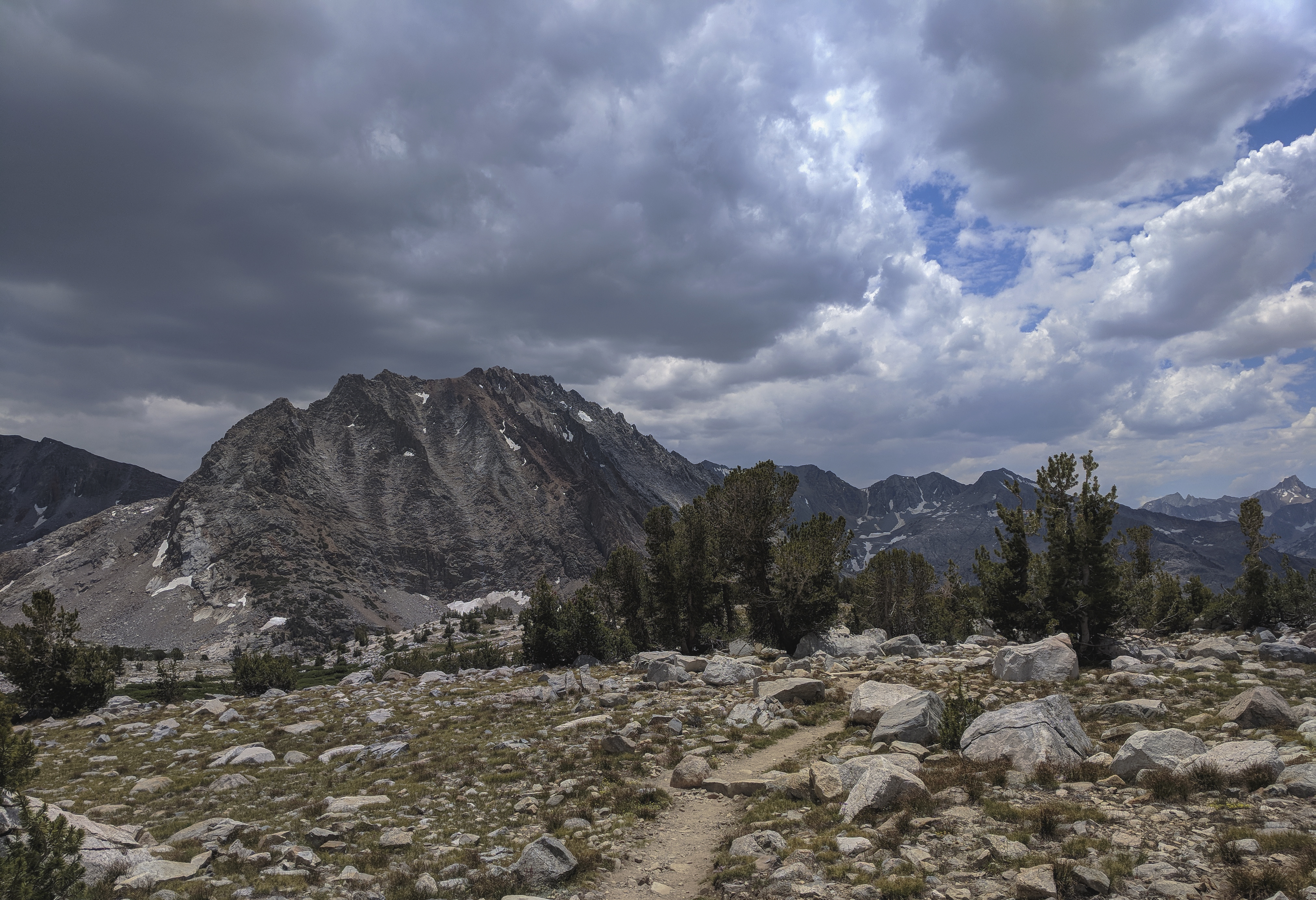
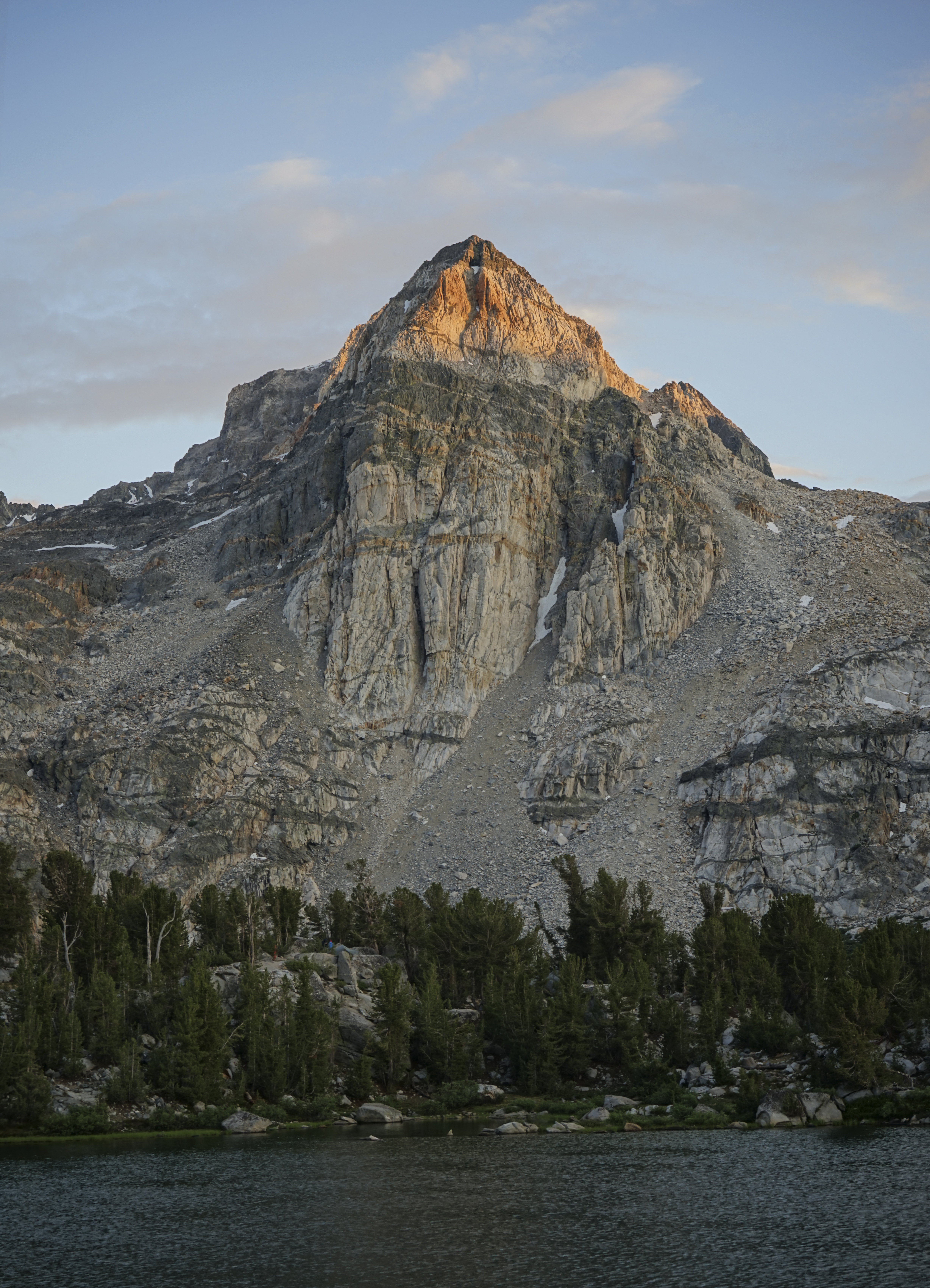
The view south from the basin south of Mather Pass as the trail descended back into the trees. Pinchot Pass lies behind the very pointy mountain on the left (White Mountain), to the left of the shorter, reddish mountain (O’Burley Peak).

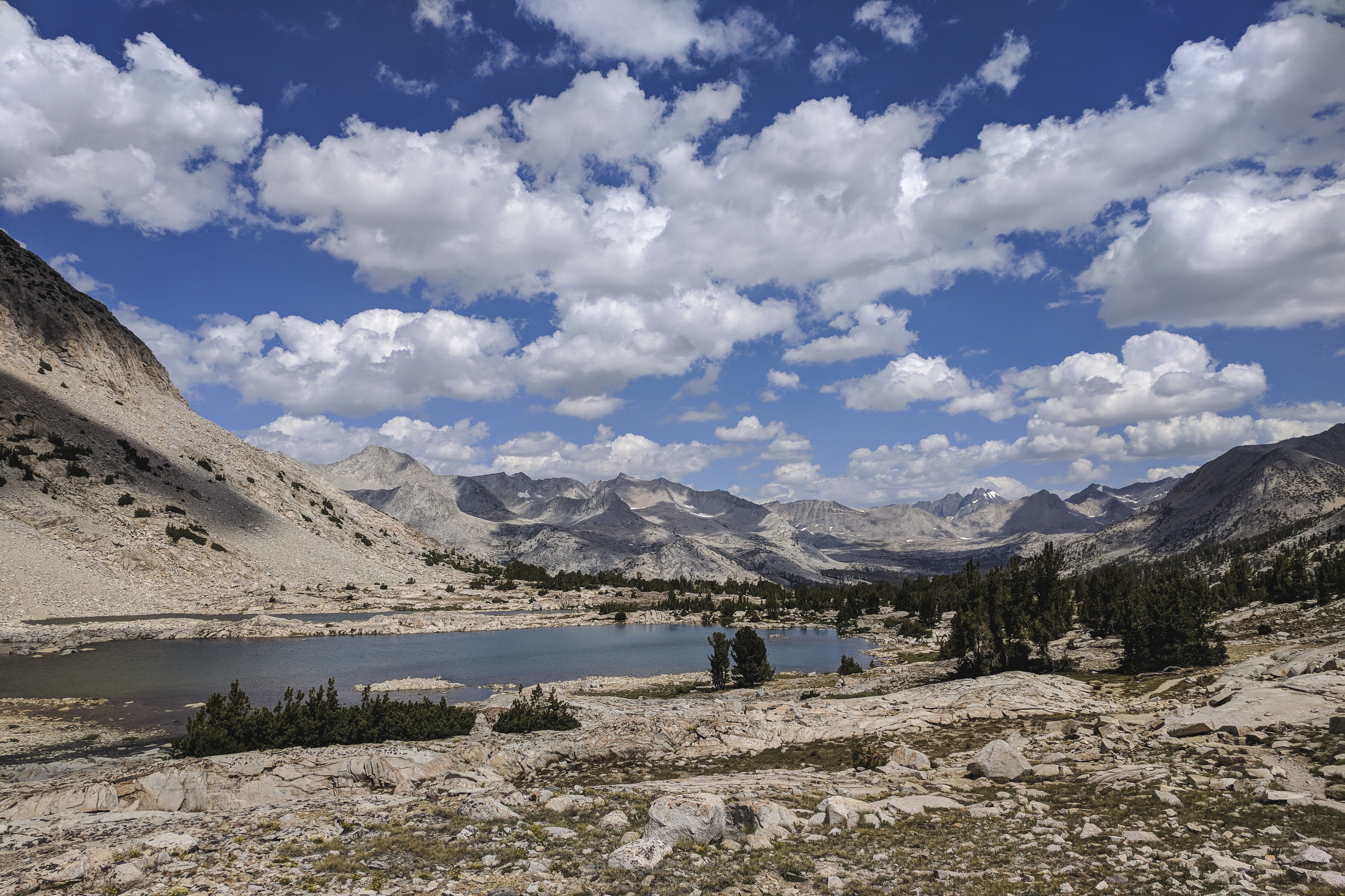
The red rock of O’Burley Peak contrasted nicely with the blue waters of the tarn below. The climb from the low point between Mather and Pinchot Passes was quite steep and hot for almost a mile. This was probably the third most difficult climb going southbound, in my opinion, behind the Golden Staircase, and the climb to Bear Ridge.
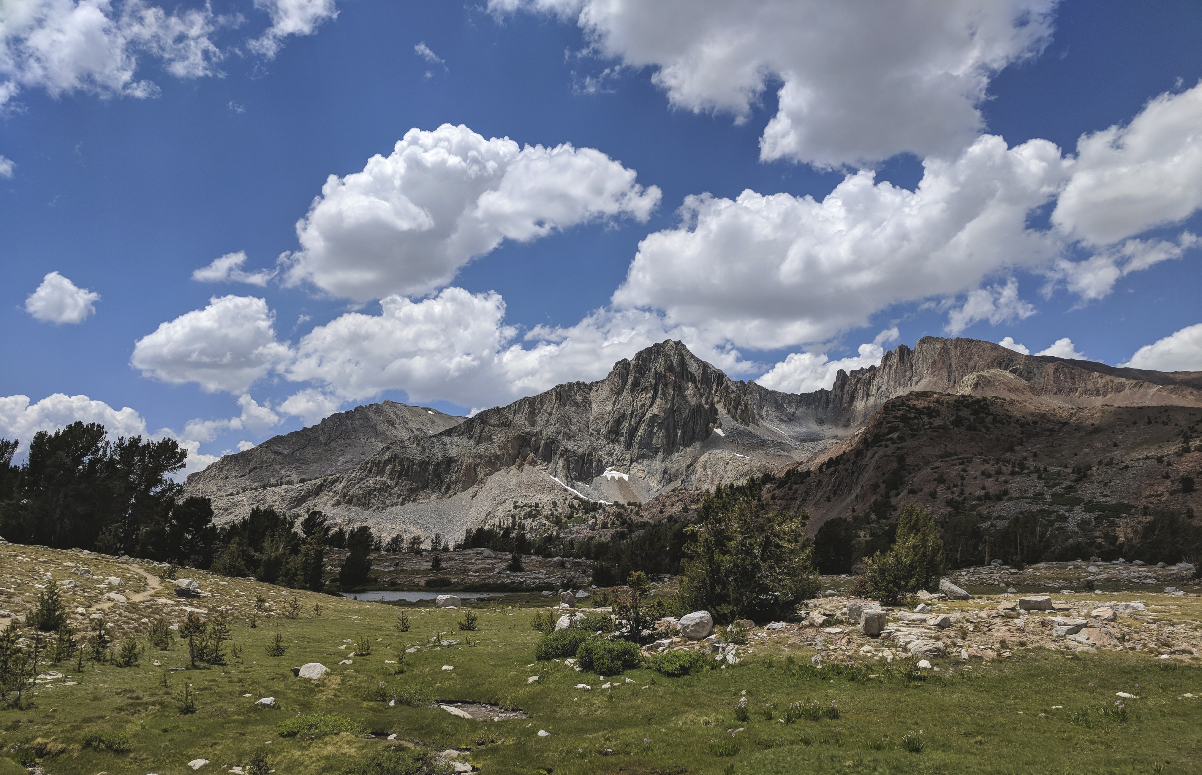
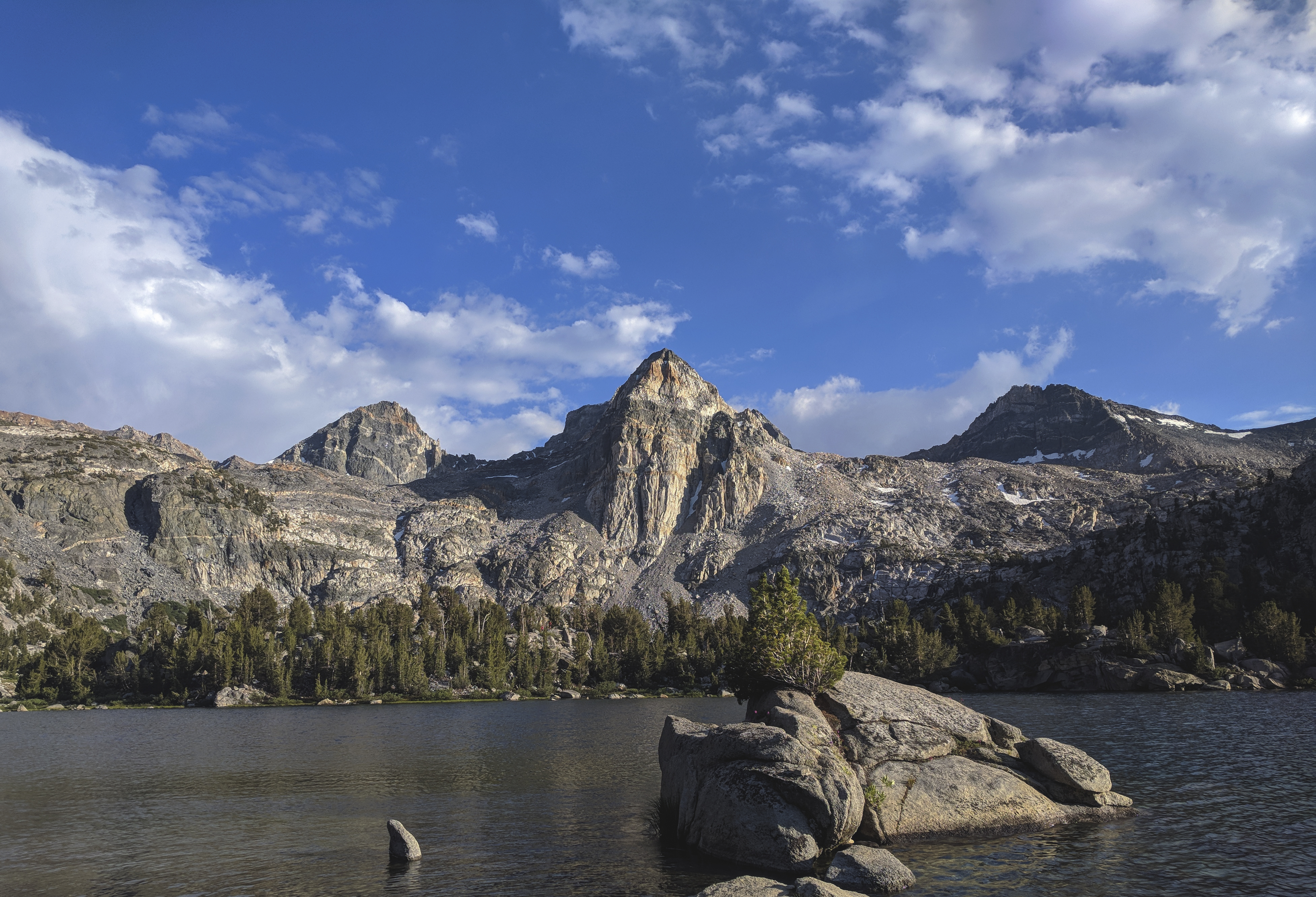
The view back to the north from Lake Marjorie. The tall, dark peaks on the right-ish side are the Palisades, and the low pass in the lighter colored rock in front of them is Mather Pass.
The sky was kind of dotted with clouds in the late morning, which started to bunch and darken in the early afternoon. I figured there could be a storm or rain, but I would down below treeline for the next several hours, so I wasn’t too worried.
The red rocks of Crater Mountain provided a nice contrast to the surrounding granite. Some PCTers I ran into headed north were very excited as these were the first mountains they had seen that weren’t white granite.
The descent from Pinchot Pass was brutal. The trail just dropped and dropped and dropped, from 12,100’ to 8,500’ over 8 miles or so of rough trail. My feet were beginning to get really sore, and I knew that every step down was a step up that I would have to take later.
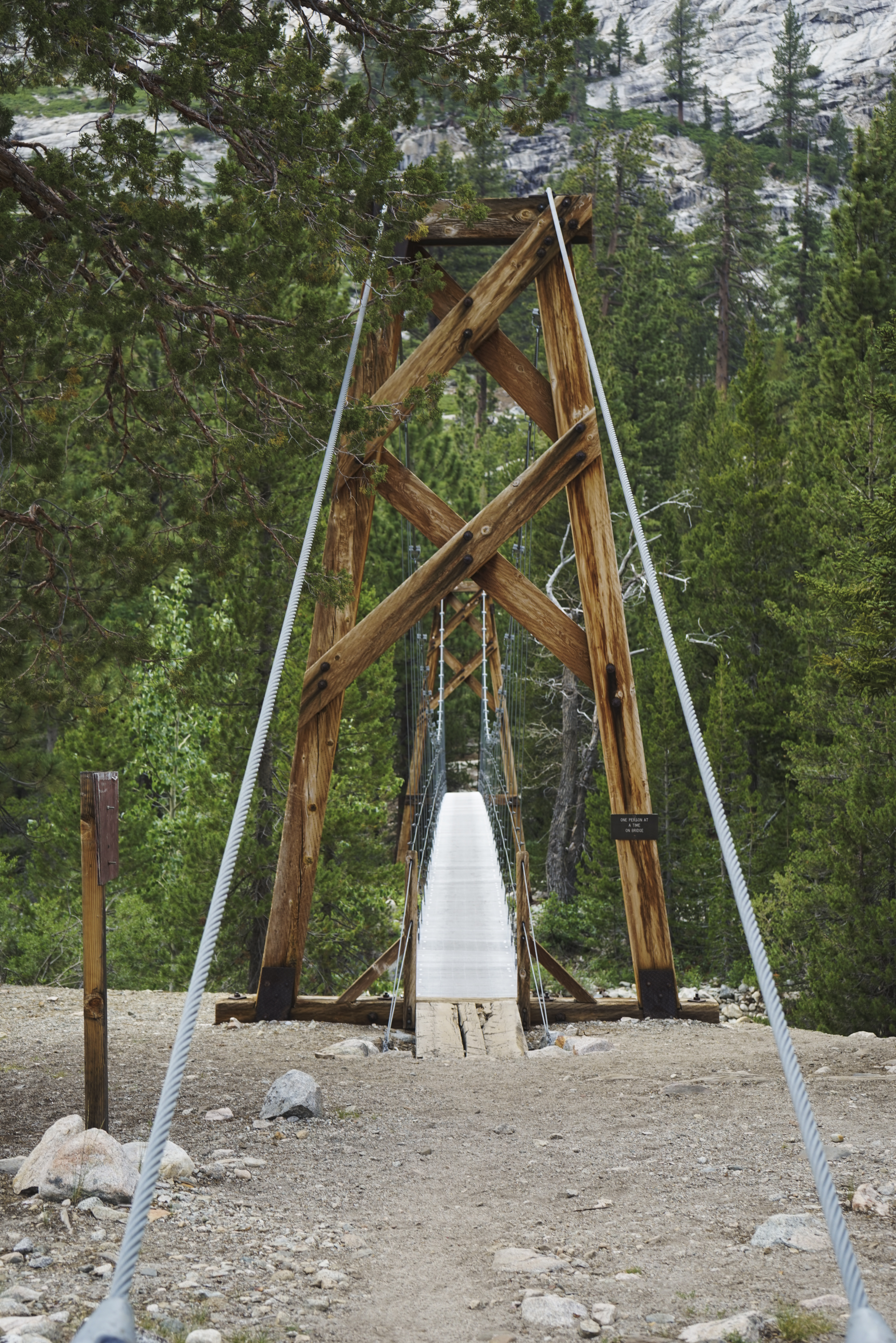
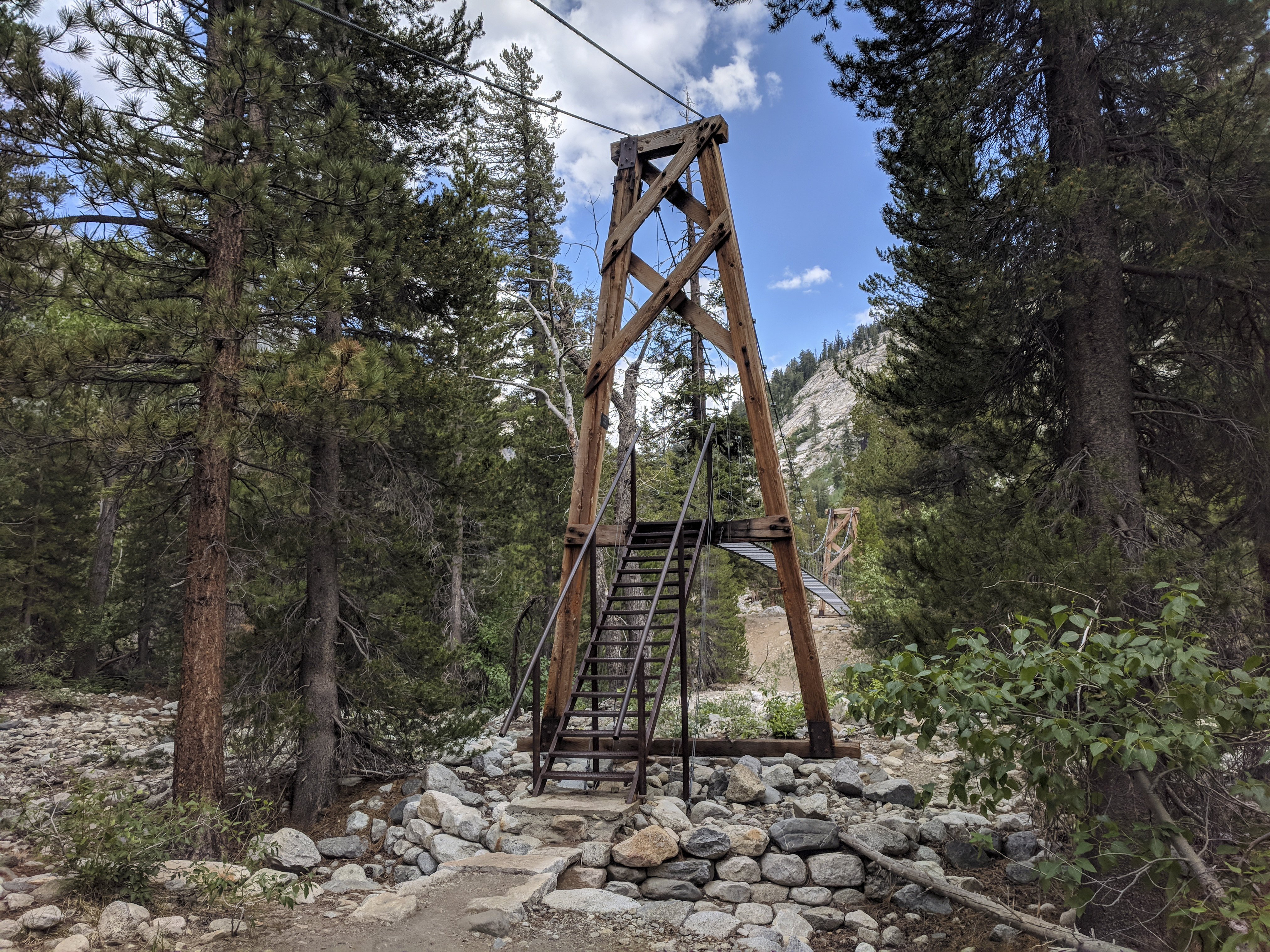
At the Woods Creek junction, there’s an enormous suspension bridge, it probably spans 50 feet. It didn’t really seem necessary at this time of year, but I could imagine that when Woods Creek is flowing, the water could get really high and scary. Additionally, this is a pretty popular section of trail, so I suspect the cost of the bridge is justified in the number of lives it saves.
<iframe width="560" height="315" src="https://www.youtube.com/embed/xRaPTuLZeRI" title="YouTube video player" frameborder="0" allow="accelerometer; autoplay; clipboard-write; encrypted-media; gyroscope; picture-in-picture" allowfullscreen></iframe>
This isn’t a wood-slatted-desk suspension bridge, it’s cables strung between the spans with a catwalk as the deck. It’s very wobbly, and a little bit of an adrenaline rush to get across.


From the trail junction, the trail climbs again towards Rae Lakes. Eventually, Fin Dome comes into view, a sign that you’re getting close to Rae Lakes.

Early summer in the Sierra is baby season. I snapped this picture of a baby marmot just before he ducked into his hole to hide from me.

The Rae Lakes area is really, really beautiful. I thought it was probably the most scenic section of the trail. In this basin are a series of alpine lakes with a group of mountains at the head which are striped with different kinds of rocks, forming a gorgeous contrast.
Right at the head of the basin sits the Painted Lady, presumably so named for the different colors of rock bands in the mountain’s face. I decided to call it a day here, even if it was a bit earlier than the other days. I was treated to a gorgeous sunset.
This area is very popular, I was camped near probably a dozen other groups. I overheard some of them talking, and two different groups had requested ranger assistance via radio. There was a man who burned his foot somehow (I would later learn that he accidentally poured boiling water on it while cooking inside his tent), and a woman who hurt her ankle descending Glen Pass. Unfortunately, I didn’t have much in the way of supplies or skills to be able to help, but some other folks nearby did.