This morning I wasn’t sure (again) what a reasonable goal for the day was. Guitar Lake was about 31 miles away, but would require clearing Forester Pass and the small, punchy climbs down near Wright Creek and Wallace Creek. I had also heard rumors that the weather was going to be a bit worse today than yesterday. To accommodate for this, I figured I would try to be off of Forester Pass before 2 PM, when Sierra storms are usually getting started. I figured if I could do that, it would be pretty easy to put back the 15 miles to Guitar Lake in the remaining six and a half hours of daylight.
I had also heard some rumors that Glen Pass was very rocky and difficult, which were emphasized by seeing someone who had hurt themselves hiking on this section of trail.
On my climb towards Glen Pass, I was treated to a gorgeous sunrise over the Painted Lady and surrounding mountains.

I was able to knock back Glen Pass fairly quickly. So quickly, in fact, that I got the Strava CR on the segment from Rae Lakes to the top of the pass, even with 30+ lbs on my back. I was pretty surprised by this, actually, as the Rae Lakes Loop is fairly frequently run in a day, and I had seen someone doing just that the other day.
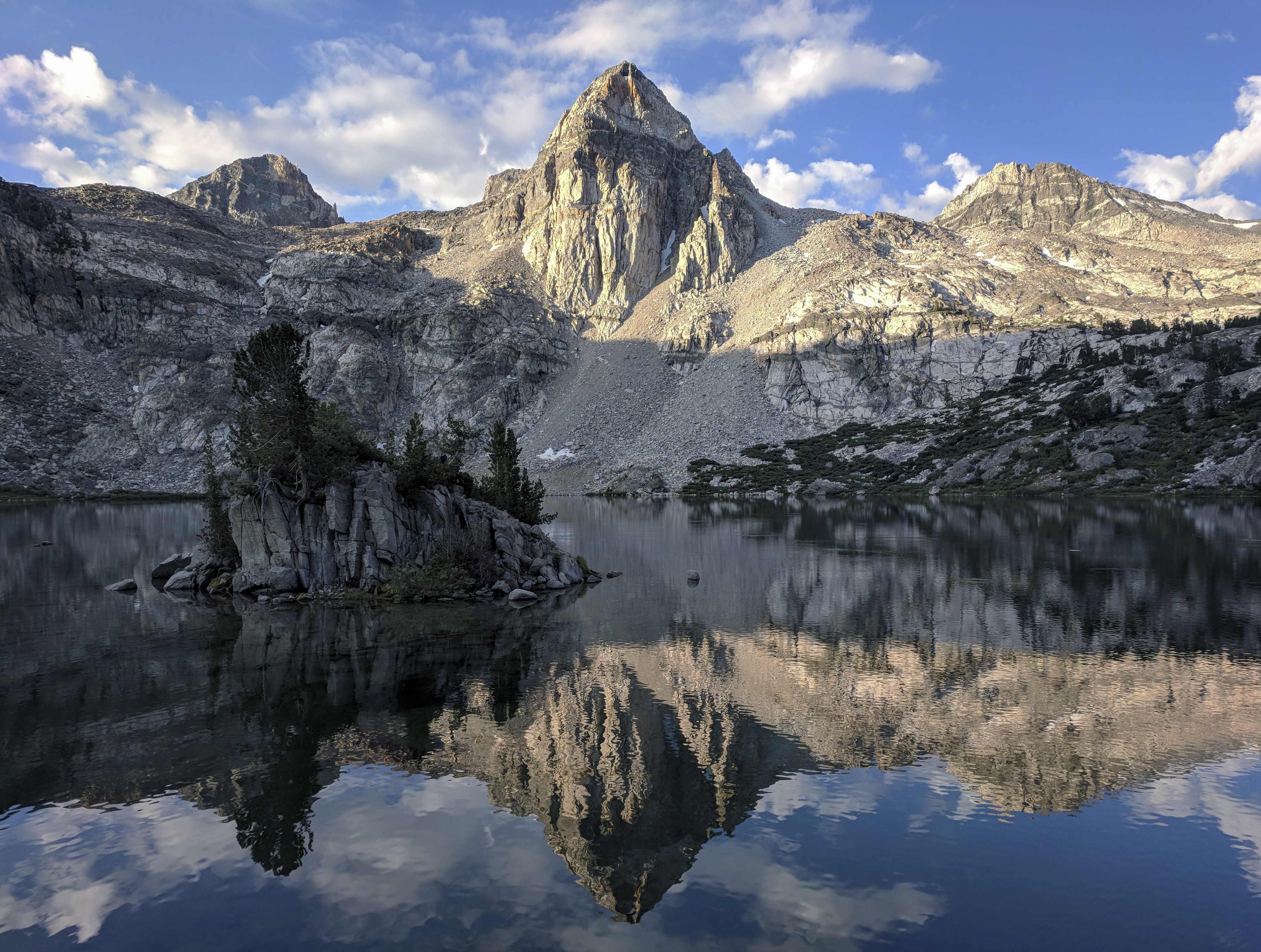
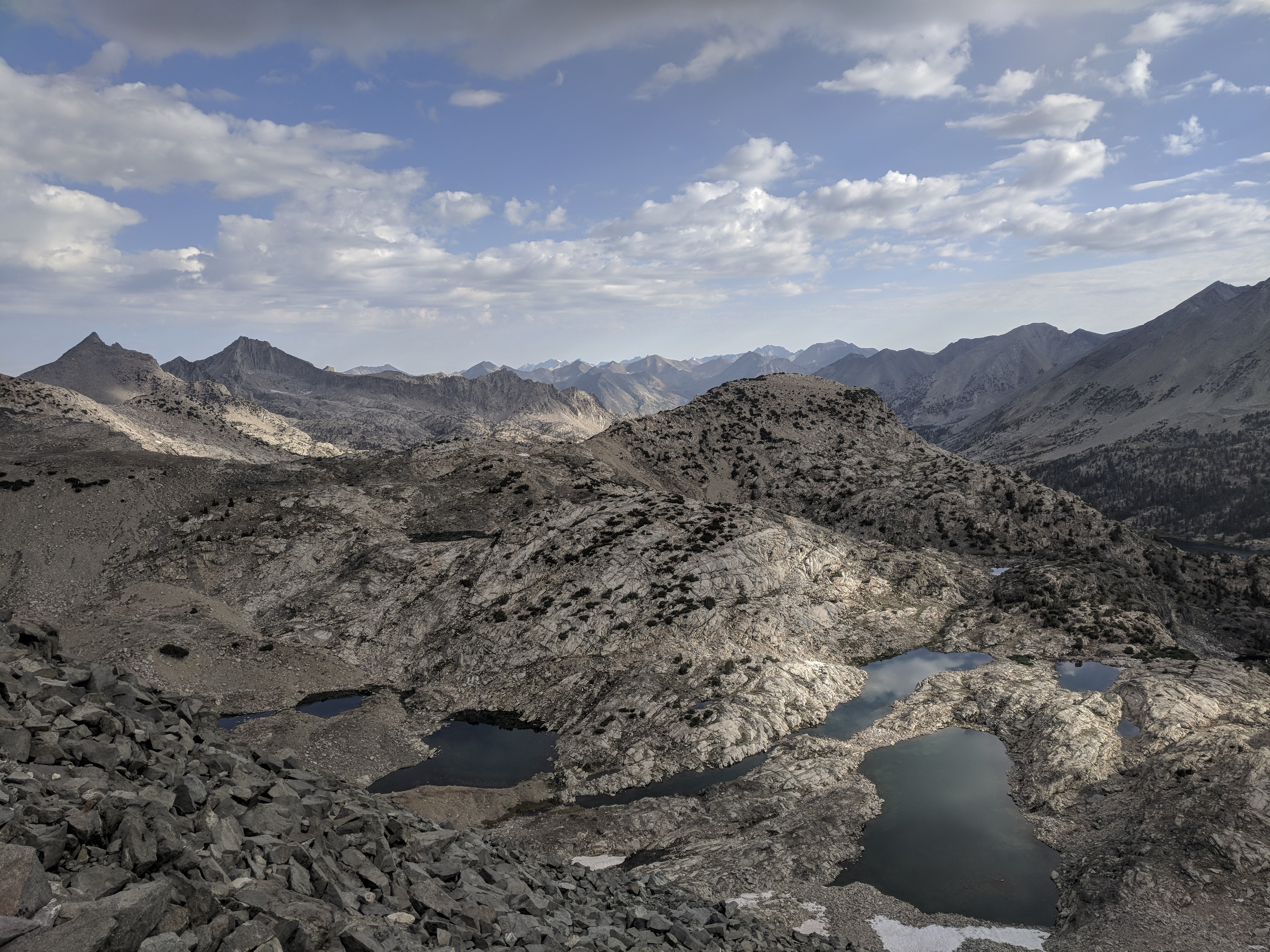
I didn’t find the rocks on Glen Pass much worse than Mather Pass, but I did try to be a bit careful. The view looking back to the north was beautiful, as the sunlight played off the high tarns just below the pass.
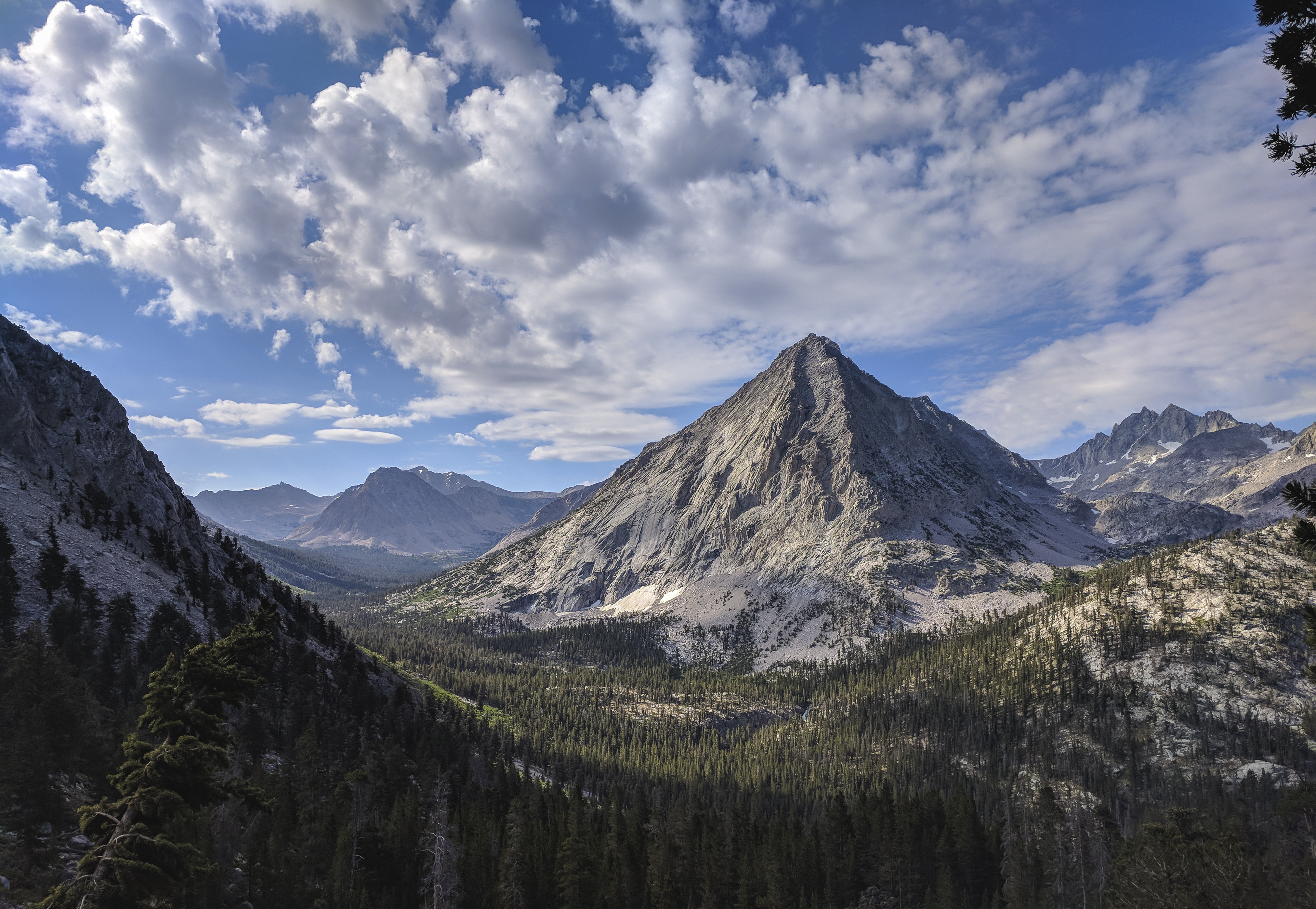
After Glen Pass, the trail drops down to 9,500’ before starting the long climb up to Forester. Here, the prow of East Vidette stands imposingly above Bubbs Creek. Funnily enough, I remember walking past here last year and taking just about the same picture, but it didn’t turn out anywhere near as well. It’s funny how conditions like clouds, and the way the light is shining can make such a big difference.

At the bottom of this drop, I ran into a mother Grouse and her babies wandering around in the grass.
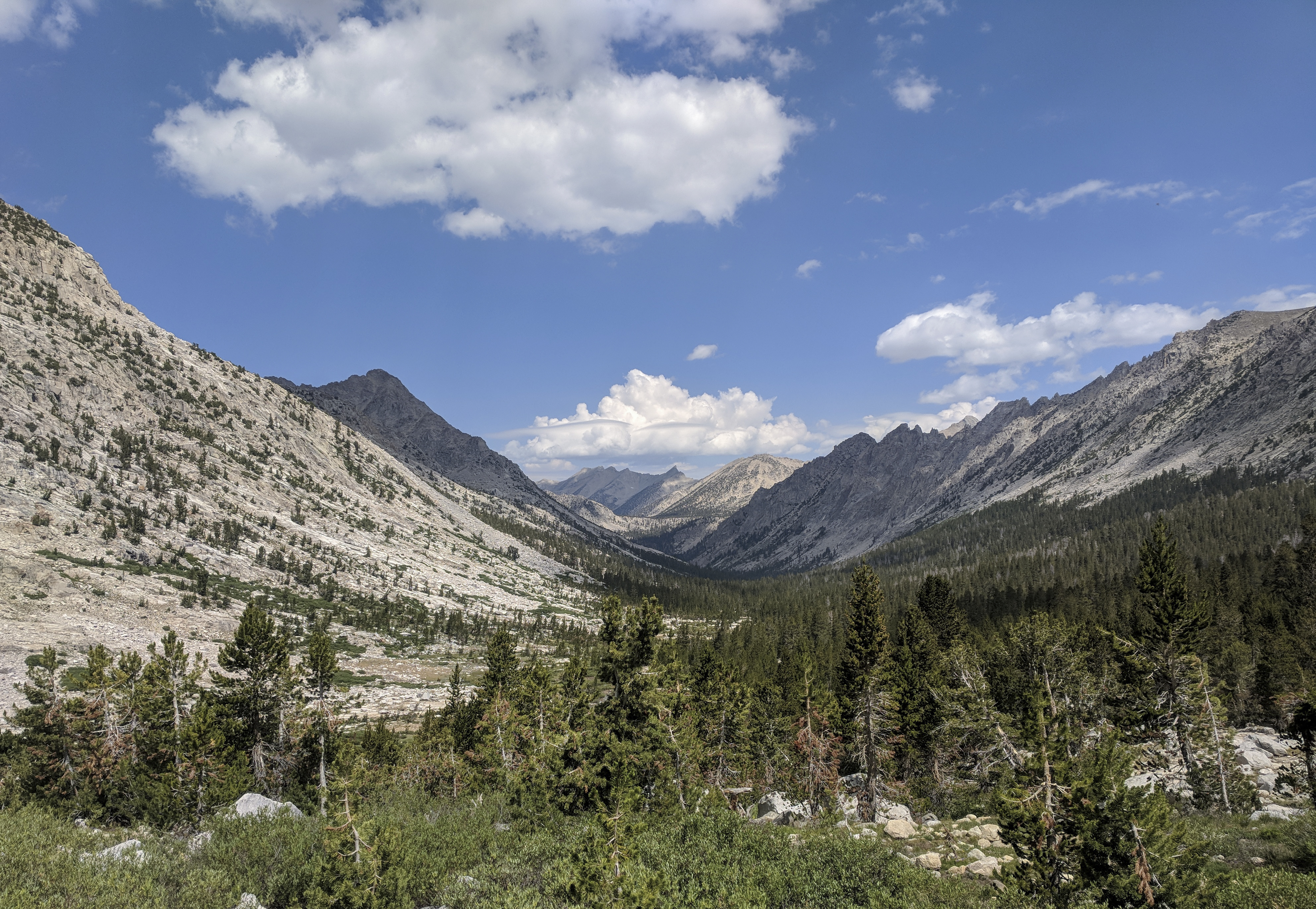
I pushed the pace a bit up Forester Pass, eager to get to the top before 2 PM. Fortunately, the weather was holding just fine. Here’s the view back down the wide Bubbs Creek valley.
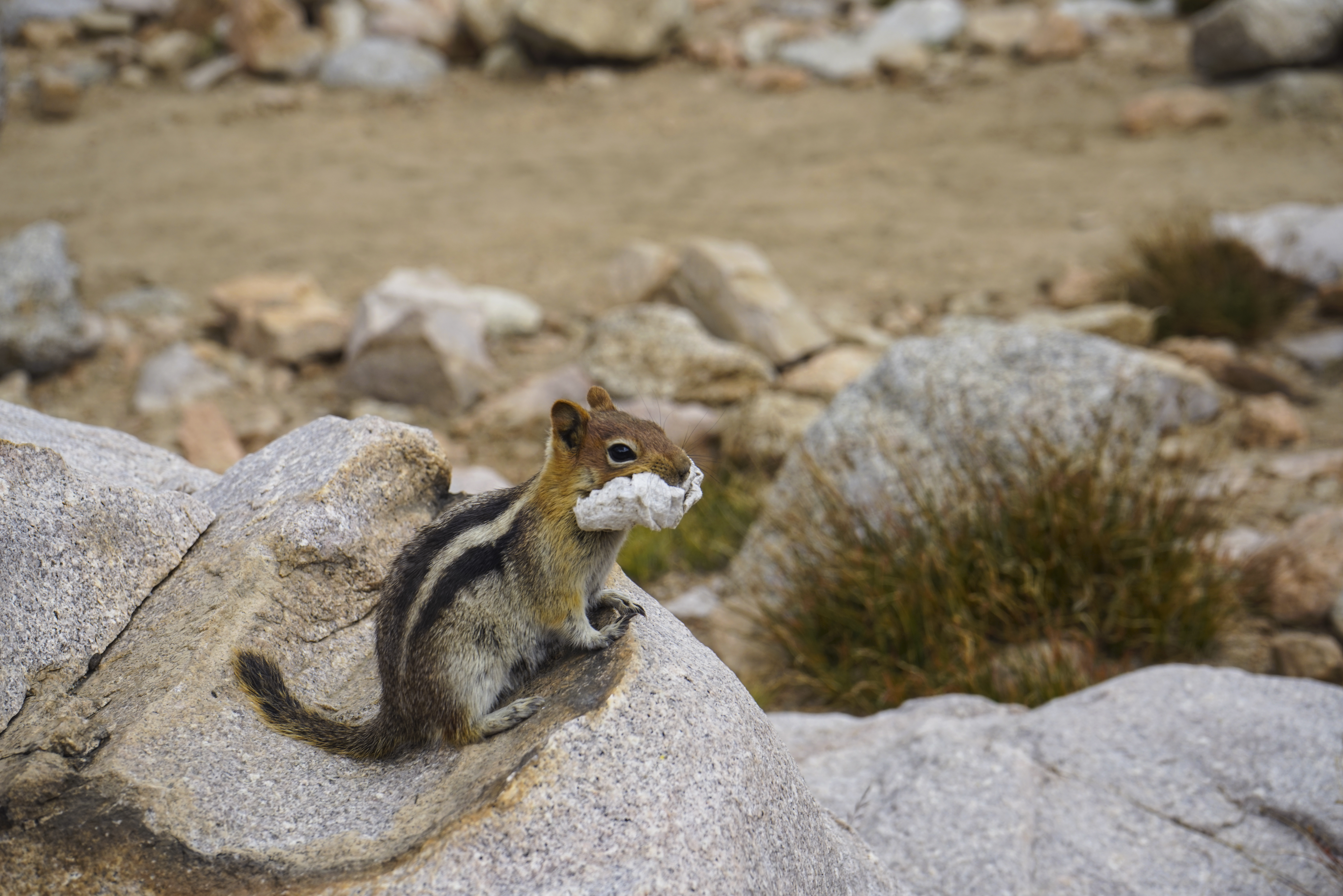
I ran into this chipmunk (actually it’s a Golden-mantled Ground Squirrel) halfway up Forester Pass. He was running around with what looked like someone’s garbage in his mouth. Gross.
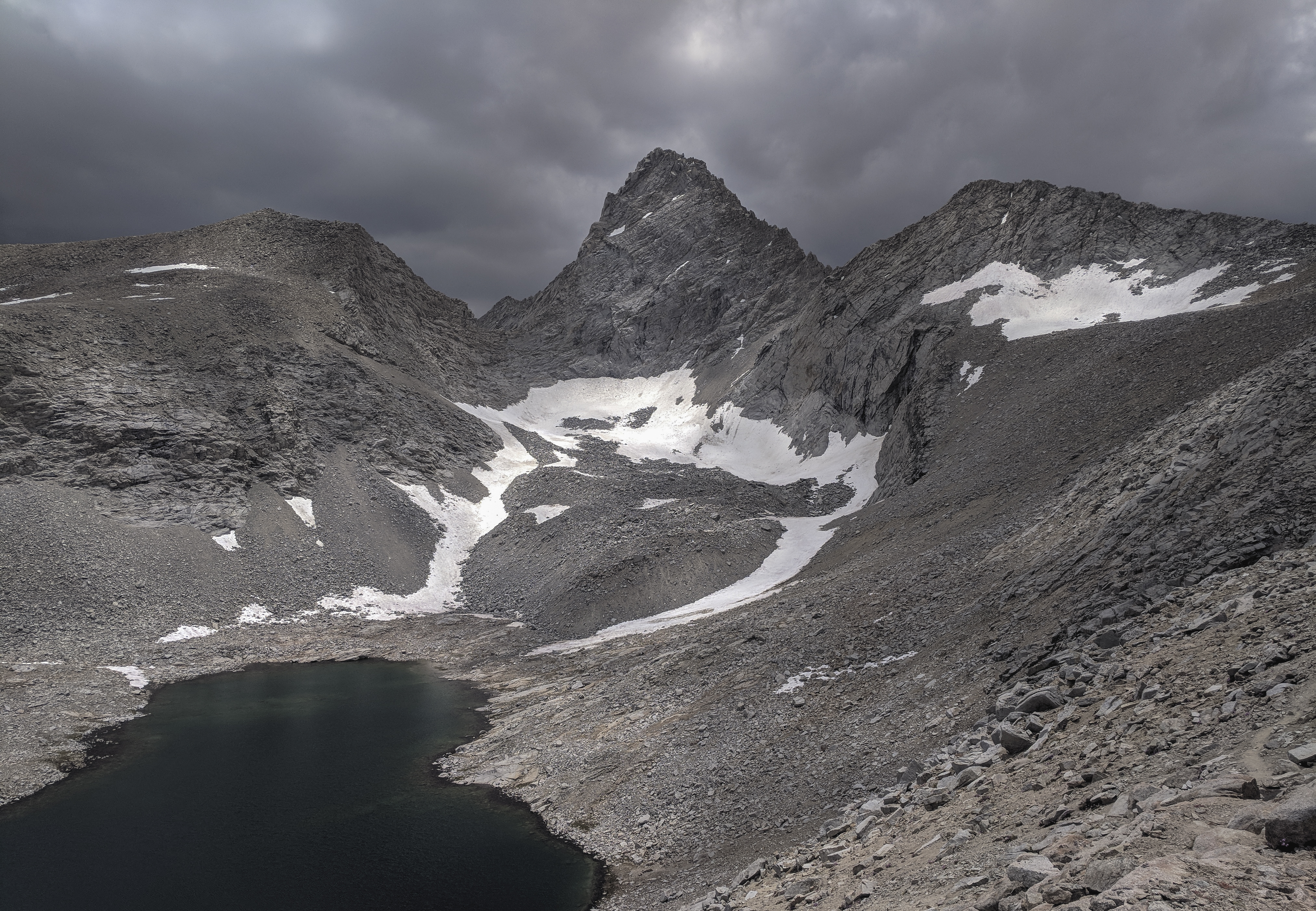
As I neared the top of Forester Pass, the clouds grew darker and darker around Junction Peak (13,888’). But I was hammering, and figured I would be over in under an hour, and it was only noon.

I made it to the top of Forester around 1 PM and hung out there for maybe ten minutes. I chatted with a woman who was just starting her 9th trip on the JMT (Wow!). She said she was an ex-olympic swimmer.
As we were chatting, the storms continued to brew and it started to rain in the basin north of the pass. When I heard the first thunderclap maybe a couple miles away, just east of Junction Peak, I knew it was time to hustle. If that storm blew just a little bit east, I would be in the heart of it, in a high alpine basin with no cover. Bad news.
I hustled down the pass before coming into the basin where I set a good pace. But the storm picked up a bit, with thunder every couple of minutes. I was starting to get worried as I was still a good distance from tree cover, so I ran for about a mile and a half, putting back a 10:29 mile, at 12,000’ carrying a 30 pound pack. Not bad!
Eventually I made it into the tree cover just above Tyndall Creek and hid under some trees with some PCTers for half an hour or so. Probably not actually the best place to be, but I figured it was better to risk it and stay dry (it was alternating rain and hail now) than head into the open and risk getting struck by lightning, and the thunderstorm wasn’t on top of us anyways.
When I hadn’t heard thunder for a little while, I said goodbye to the PCTers (they were heading north) and headed out across a meadow. At about the same instant as I stepped into the meadow, lightning hit in the next group of trees I was headed for, about half a mile away. I promptly turned around and ran back to the same spot.
I hunkered down with my bunkermates for another half hour or so before the weather above us started to clear up. When the skies cleared up enough, and the thunder stopped for a little longer, I braved it again. This time without another pant-shittingly close lightning strike.
As I kept hiking, I passed some folks pointing at something to the west. I checked it out when I got to a clearing and there was the tree that the lightning had struck, on fire. Fortunately, it was somewhat isolated, so it didn’t seem like it was going to spark a big fire.

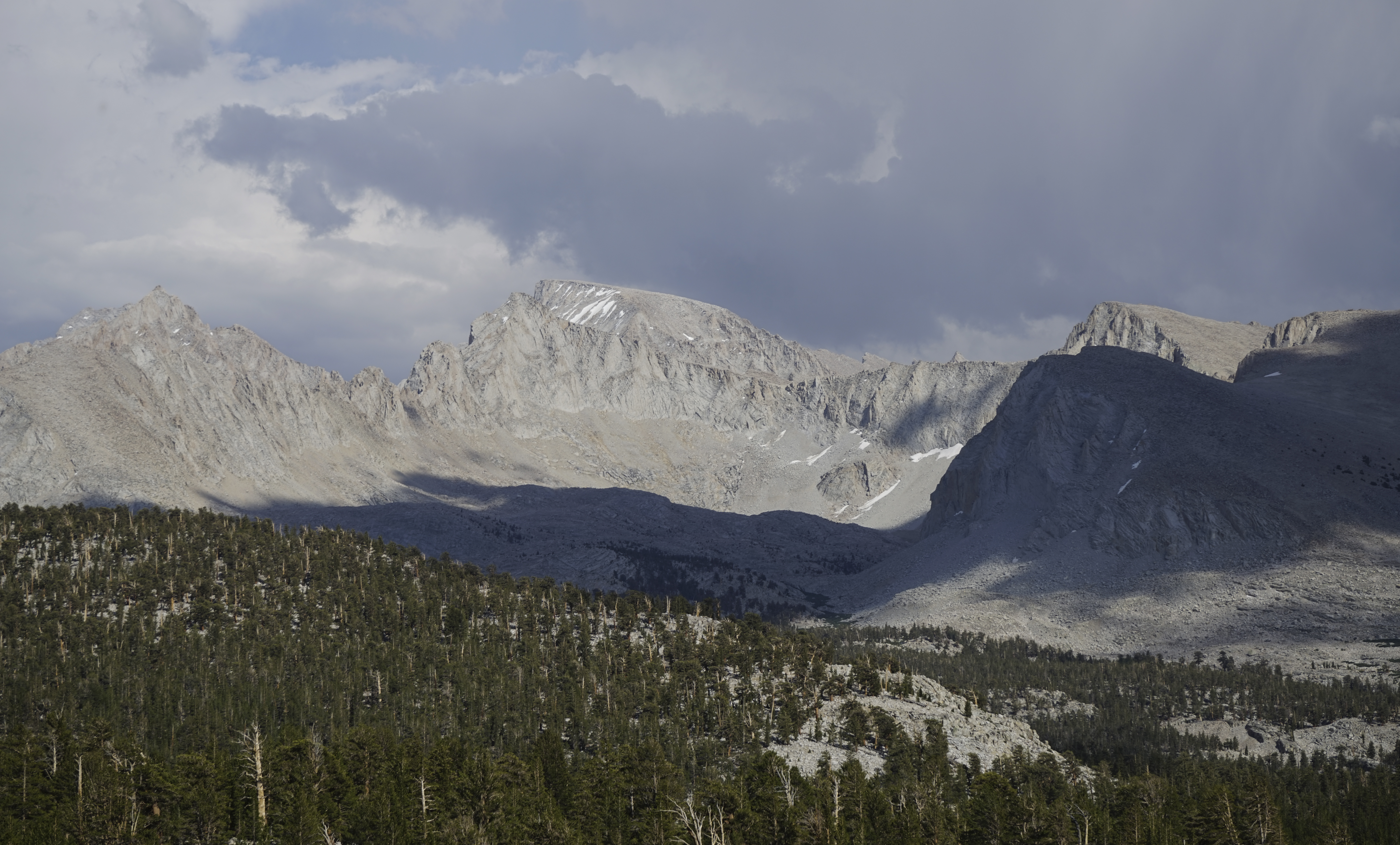
Continuing south, the weather began improving, enough that I felt fine crossing the Bighorn Plateau, a high, open expanse offering great views of the Kaweahs to the west and Mount Whitney to the south (pictured).
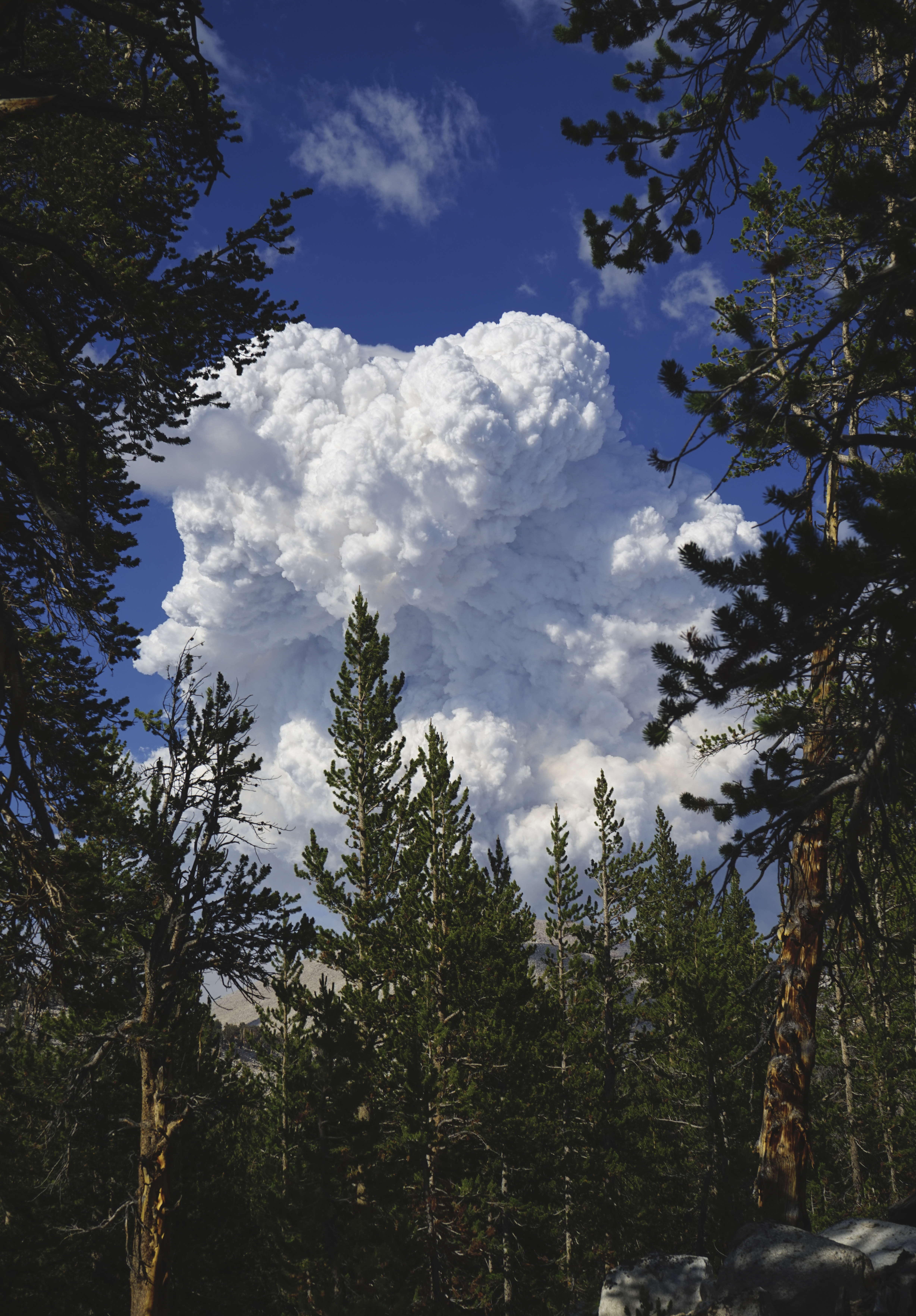
Later in the day, I noticed another thunderhead forming to the east. Fortunately, I was well clear of any more scary sections. But the cloud kept growing taller and taller. I passed two different groups who thought it was a volcanic eruption. By this time, I had guessed that the lightning storm had ignited a fire, and the heat from the fire was pulling the surrounding air upwards, forming an enormously tall cloud. I spotted some smoke building up in the cloud as well, which confirmed my theory.
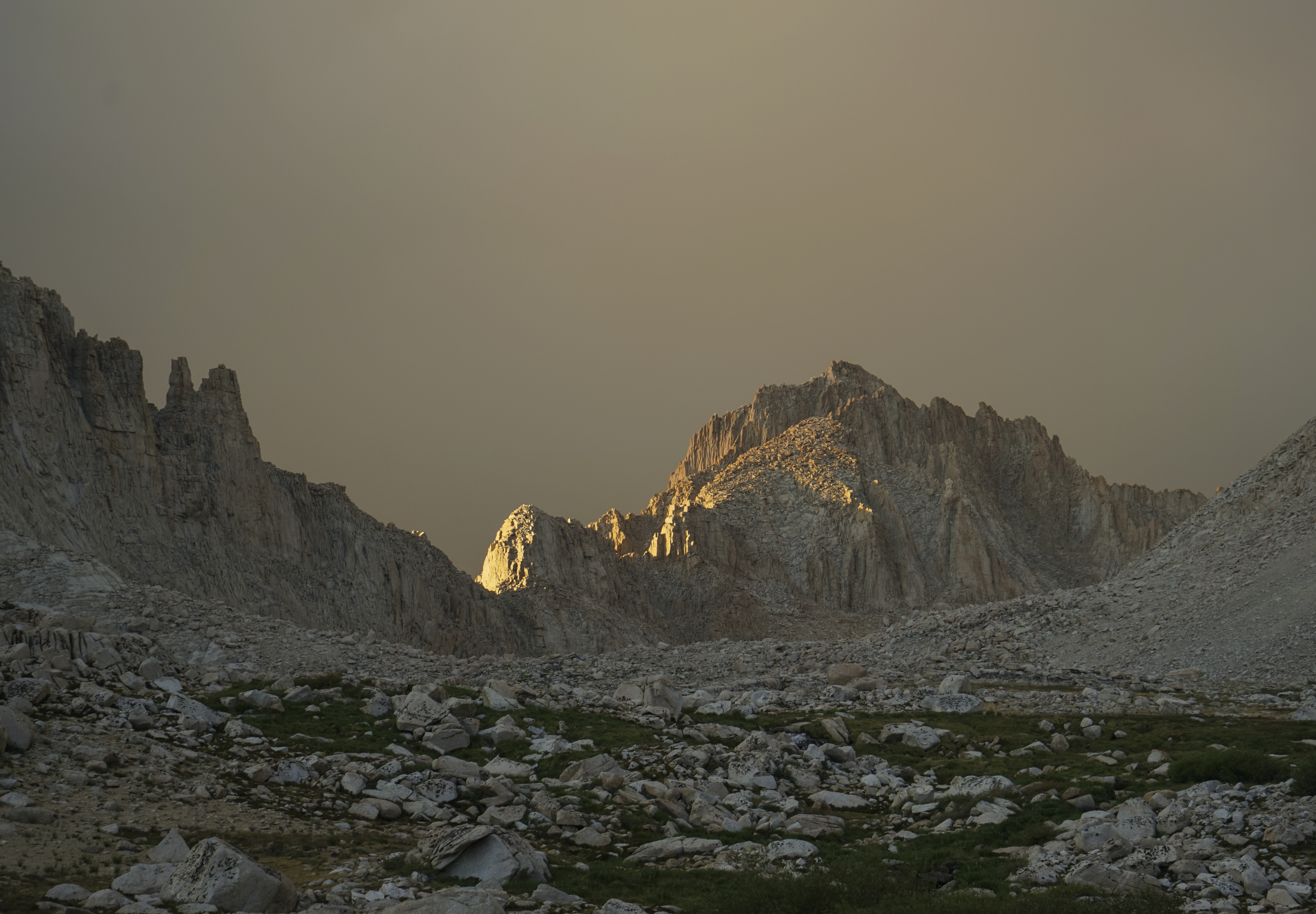
I managed to push on to Guitar Lake before the end of the day, arriving around 7:30. By this time, the wind had shifted to blow South/South-West. It was blowing smoke from the fire straight over Mount Whitney and Guitar Lake. As the smoke cloud descended on us, flakes of ash started to fall on everything. I was glad I had the tent and rainfly this night. Here’s Mount Morgenson under a haze. This peak is named for fallen backcountry ranger Randy Morgenson, whose story is told in the excellent book The Last Season.
I figured that given the weather events of the day, it would be wise to get an early start the next day. I decided I would aim to catch the sunrise on Mount Whitney at 5:45 AM, which should leave me with the option of climbing Mount Muir (14,019’) on my way down. I was kind of eager to summit Muir, as I had tried and failed on my previous Whitney climb. In the event the weather still looked bad in the morning, I would just hustle over Trail Crest (13,600’) and down to safety on the other side.