We were in no rush the next morning and didn’t finish breakfast and packing up until about 9. We set out up the trail to continue over Franklin Pass, figuring we would continue on in the direction of Little Claire Lake.

Florence Peak above Lower Franklin Lake.

Higher up the trail.

Looking back over Lower Franklin Lake towards the foothills.

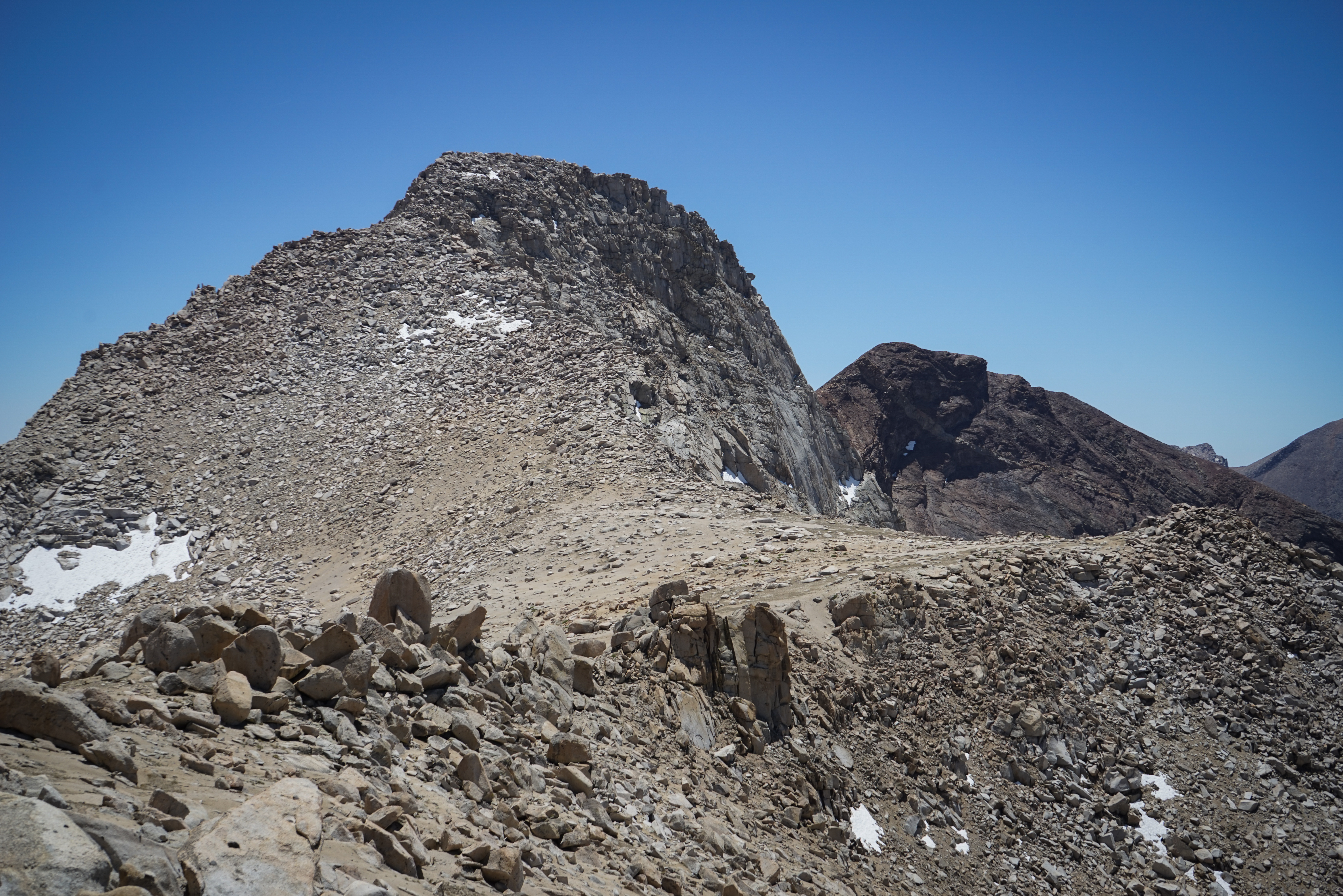
Florence Peak from Franklin Pass. We shed our backpacks and hid them among the rocks at the pass, making sure to pull out our bear canisters and anything else that a marmot might find tasty. Then, we headed off for the summit, traversing the sandy ridgeline northeast of the peak.
When we reached the steeper northeast face of the peak, we had to scramble over boulders all the way to the summit. The description in Secor says to stick left to keep it easier, so we went up and cut left whenever the difficulty exceeded our comfort level. There were some moderately tricky class 3 sections here and there, but we reached the summit easily around 11:30, an hour after leaving Franklin Pass.

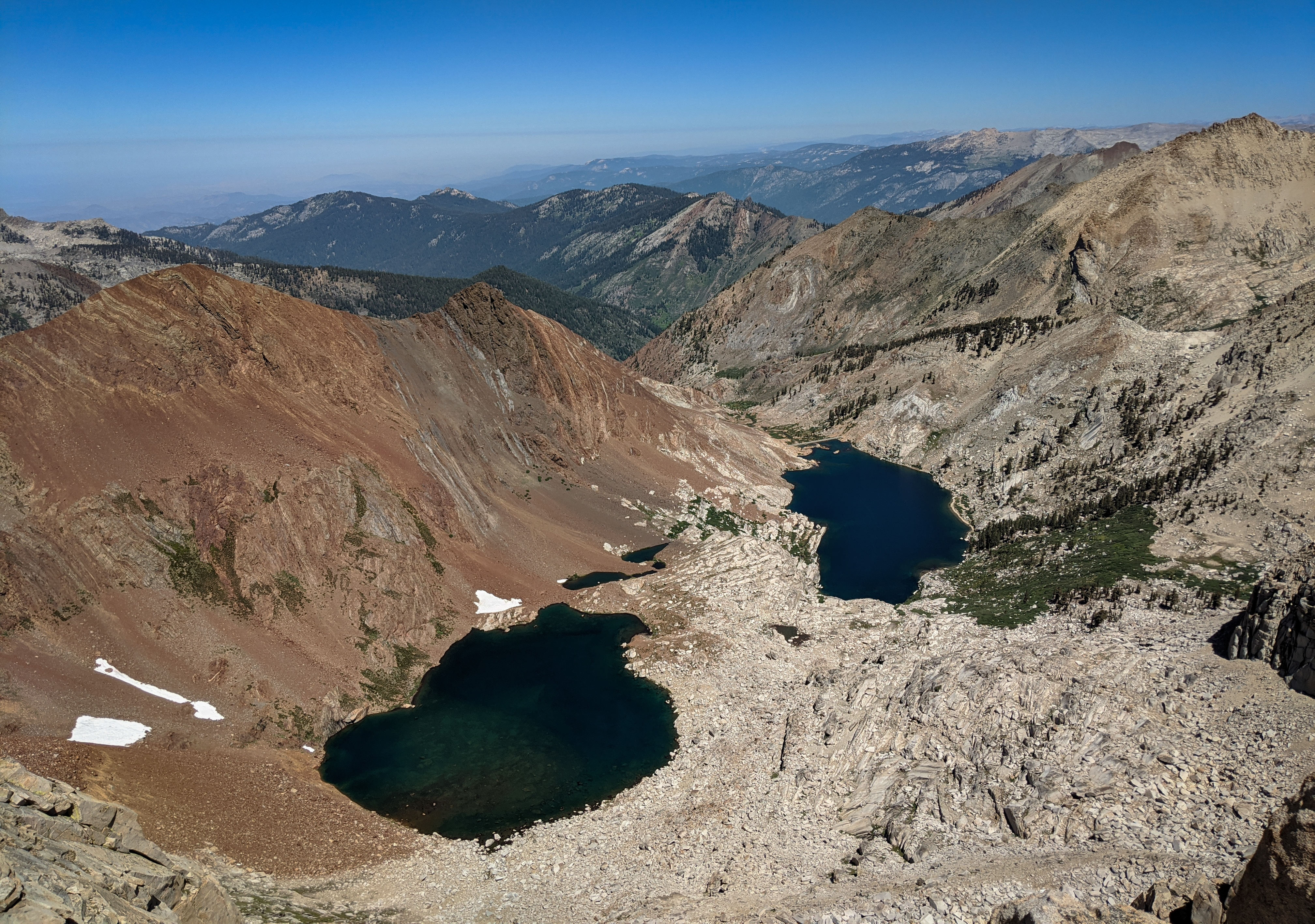
Mount Whitney (middle), Mount Langley (far right), and Mount Williamson (left) and the rest of the Sierra crest from Florence Peak.

The Kaweahs above Needham Mountain from Florence Peak.

Looking back over Franklin Lakes towards Mineral King. After signing into the summit register, we reversed our route back down towards Franklin Pass. Once back at the pass we reconstituted our gear and had a lunch break.
Florence Peak from Franklin Pass. After filling up on peanut butter and jelly wraps, we headed down the trail towards Rattlesnake Canyon. As we dropped lower, the temperate climbed. It was really pretty warm for almost 11,000’ above sea level.

Florence Peak from the east. I was feeling the heat in the exposed upper parts of the trail. Fortunately, we were down into the forest soon and stopped for a drink of water.
We headed down Rattlesnake Canyon about a mile before continuing on the trail towards Forester Lake. At Forester Lake, which is a shallow lake in the forest, we stopped for a snack break and to fill up some water before one final climb to Little Claire Lake. After resting and cooling off again, aided by the lower angle of the sun, we climbed the final 400’ up and over the pass to Little Claire Lake where we set about looking for a campsite. There were some decent options south of the lake, but I thought the view might be better on the north shore. We went around, crossed the creek at the lake’s outlet, and found a good site. There was indeed a great view down the canyon to our east just a short walk from camp.

Looking down Soda Creek towards Mount Kaweah and Mount Whitney.

Looking across Soda Creek to Needham Mountain.

Sunset over the High Sierra.
After setting up camp for the night, I realized I had made a big mistake. I had wrapped a collapsible fishing pole that I had brought inside of my sleeping pad. One of the eyelets of the fishing pole cut a half inch hole in the sleeping pad, meaning it no longer held air. After a couple of attempts to fix it with duct tape and super glue, I gave up and slept on the backpacks. I wasn’t particularly looking forward to several more nights of this.