The next day we went through the same usual morning routine before hiking up Big Arroyo.

Lippincott Mountain high above Big Arroyo.

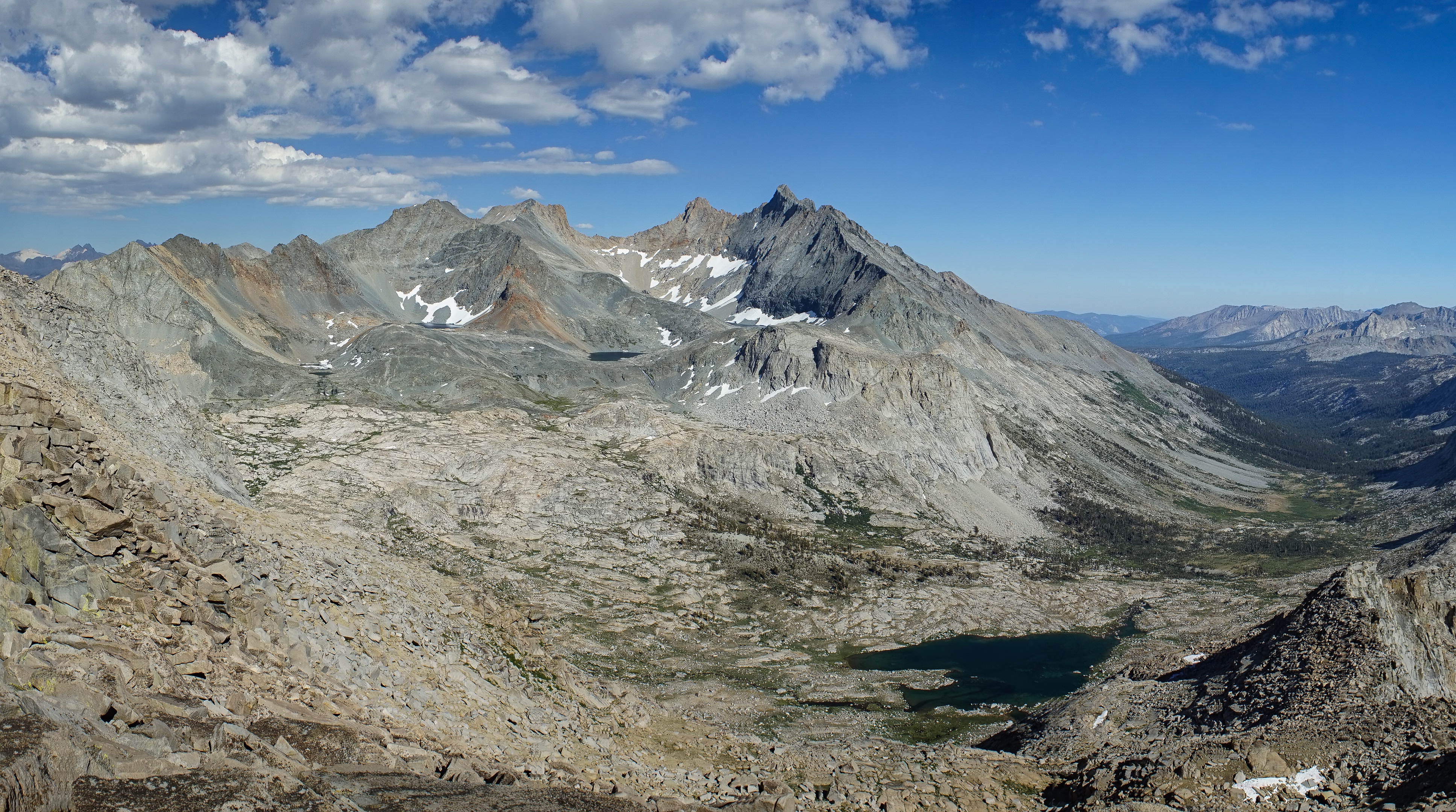
Looking up towards Nine Lakes Basin.

Looking back south the way we came.
Soon, we reached the lowest lake in the basin and continued up to the second lake, Lake 10725. Our plan was to continue up and across Pants Pass and then cross the ridgeline of Picket Guard Peak to Picket Creek or Kaweah Basin. However, Pants Pass looked quite formidable and we were not moving terribly quickly. So, we made the decision to just stick to this side of the pass and climb some of the nearby mountains instead.
We ran into a ranger out hiking, he was the frontcountry ranger from the Lodgepole area out for a few days backpacking. He was headed up to nearby Piss In Your Pants Pass to take a look.

The west side of Pants Pass from below.

Looking out over the lowest lake in the Nine Lakes Basin, with Eagle Scout Peak behind.
We hiked down to the lower lake and found a campsite a bit northeast of the lake where we set up. We talked about a possible plan over lunch and a rest and decided we would try to climb nearby Mount Stewart via the southeast slope, an objective that we thought we’d have enough daylight for.

After lunch we started up the southeast slope of Mount Stewart. It was easy climbing at first up gullies and benches.

Looking towards Piss In Your Pants Pass (left), Pants Pass (right), and Lake 10725.
Near the top of the peak the climbing became a bit trickier. There was a lot of talus to be crossed and we accidentally climbed to the top of the ridgeline about a quarter mile east of the summit and then had to traverse back. But we eventually did reach the summit, just over 2 hours after leaving our campsite at the lake. The final summit block was a very tricky couple of moves climbing from one boulder over to another with a big drop off below. It was definitely more difficult than the class 2 rating would imply. I climbed up to the summit and signed into the summit register and passed it down below to dad.

The panorama view to the south.

Black Kaweah.

The Kaweahs.


The Great Western Divide.
<img>4/14.jpg<img>
Tamarack Lake and Copper Mine Pass to the north.

Far below, on the north face of the peak, we could see the tiny Lilliput Glacier. This is the southernmost named glacier in the United States! It’s at roughly the same latitude as the border between Virginia and North Carolina. The northern part of the Great Western Divide stood out impressively to the north as well.
After a short break we headed down a little bit more directly than we had come up and were back at camp in about 80 minutes. When we got back to camp we had been left a note by the ranger who was hiking nearby asking us to move our camp. We had pitched it on top of a sandy patch among meadows and the ranger claimed we were camping on a meadow. I disagreed but we weren’t interested in getting in an argument with him, so we moved to one of the nearby places he suggested.

Looking across the lake at Eagle Scout Peak.
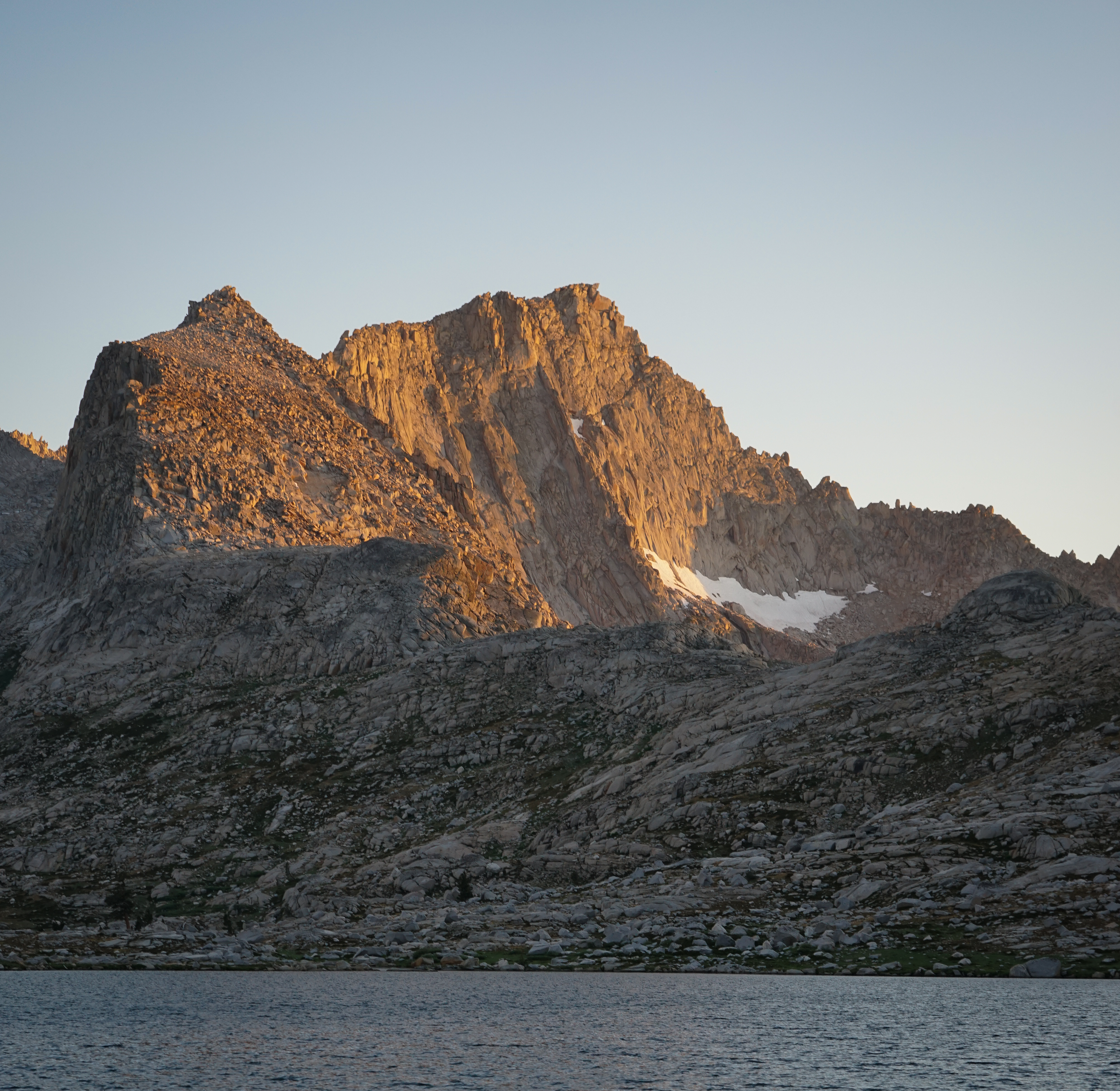
Sunset on Eagle Scout Peak.

I got up in the middle of the night and took a few star photos of the Milky Way over Eagle Scout Peak. This one turned out alright, I thought.