
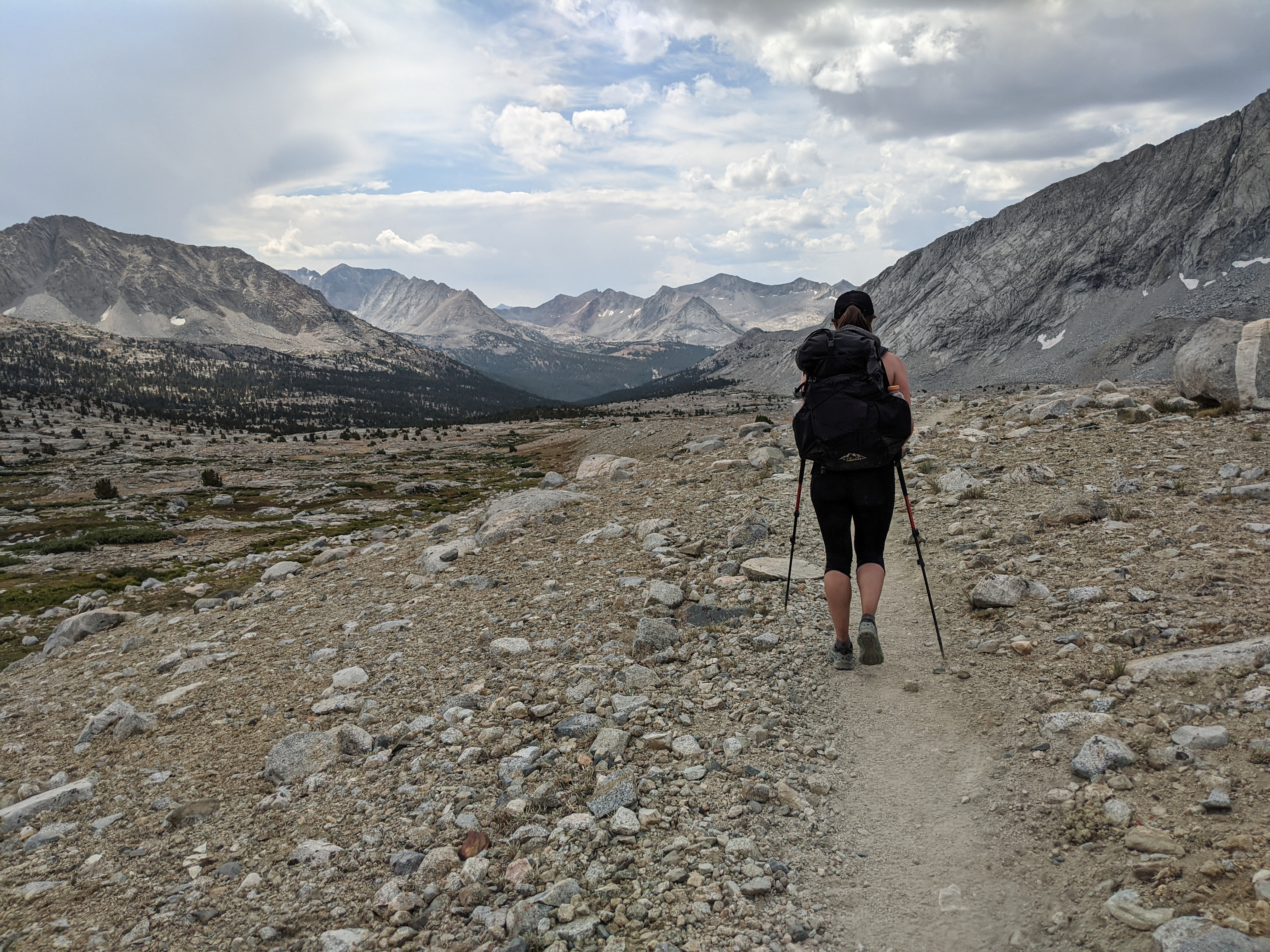
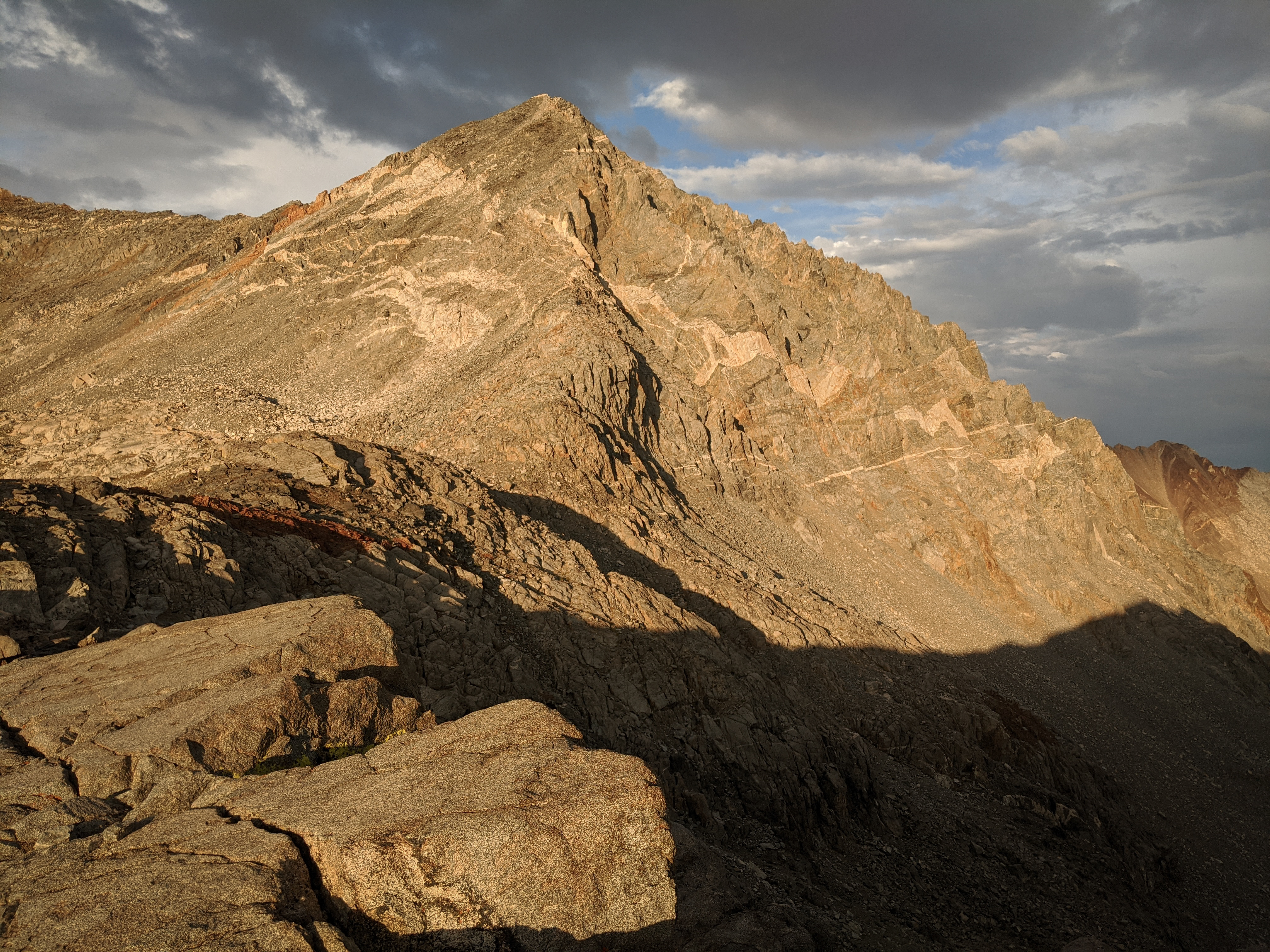
Our first goal for the day, Mather Pass, under some morning clouds -- a likely indicator of another storm today. We were feeling a bit sore this morning from the previous day’s talus hopping adventure.


Views from the climb of Mather Pass. We passed plenty of people headed in both directions on our way up this climb.

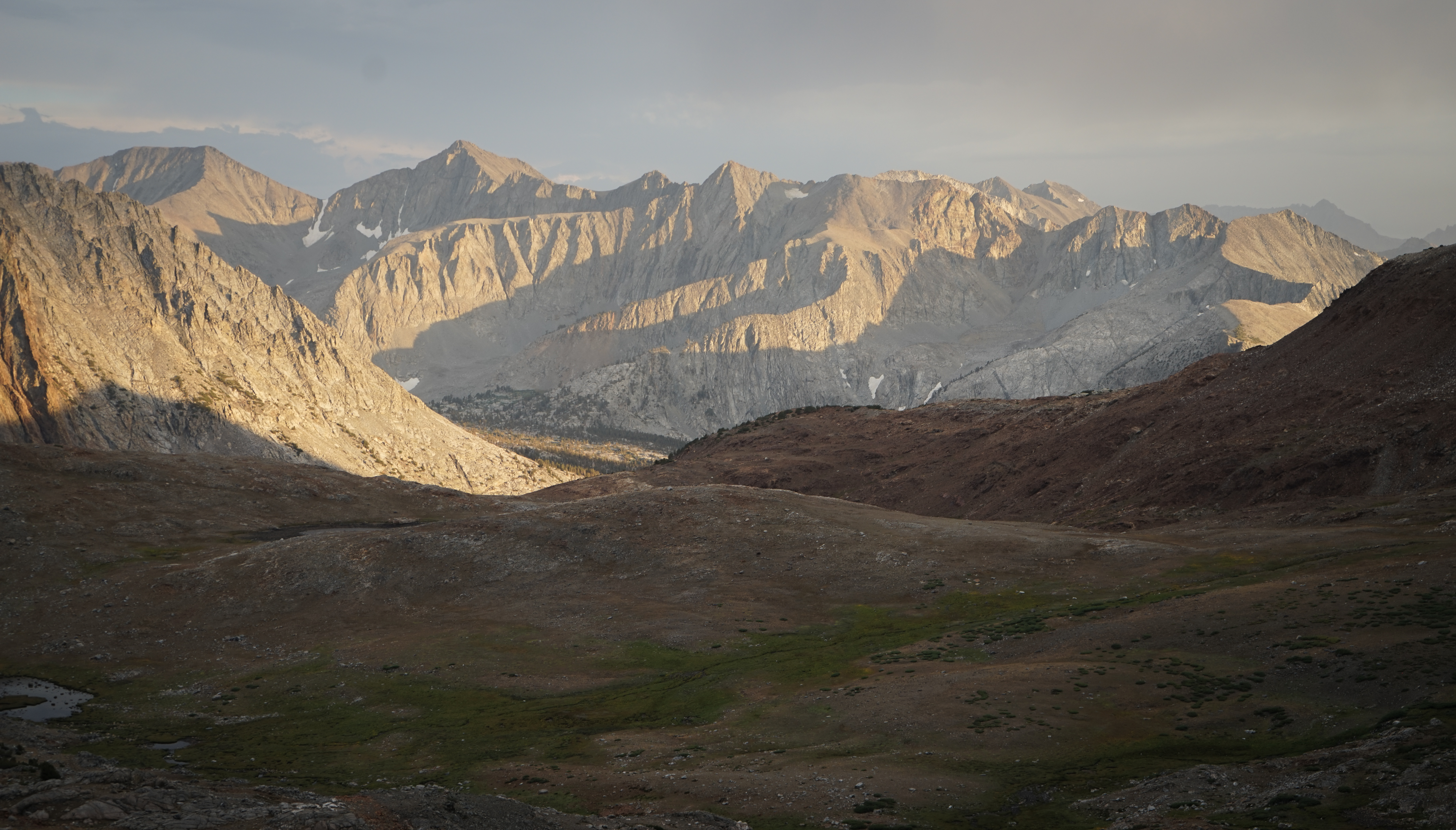
View over the Upper Basin south of Mather Pass. Even though it was still early in the day, the thunderclouds were building nearby.


Heading south through the Upper Basin with great views of Vennacher Needle and the other peaks nearby.
We stopped for a snack break at the crossing of the South Fork of the Kings River. As we snacked and soaked our feet, it started to rain a little bit -- at 12:30 this was pretty early in the day, so we figured we were in for a big thunderstorm. And sure enough, the first thunderclaps rang out soon, not too far away. We figured we could make it to Lake Marjorie safely unless it really picked up, so we donned our raincoats and walked on.
Ten or fifteen minutes later, the storm really picked up. It rained very hard, then hailed for a while. We searched for a cave to hide in, but had to make do huddling under a large tree. It was raining hard enough that it didn’t make sense to set up the tent, as it would have just gotten soaking wet in the process. So, we stood under the tree for another fifteen minutes or so, waiting for the rain to stop.
As quickly as the storm moved in, it shifted north and we headed off again to climb the steep trail towards Pinchot Pass in intermittent sunshine.

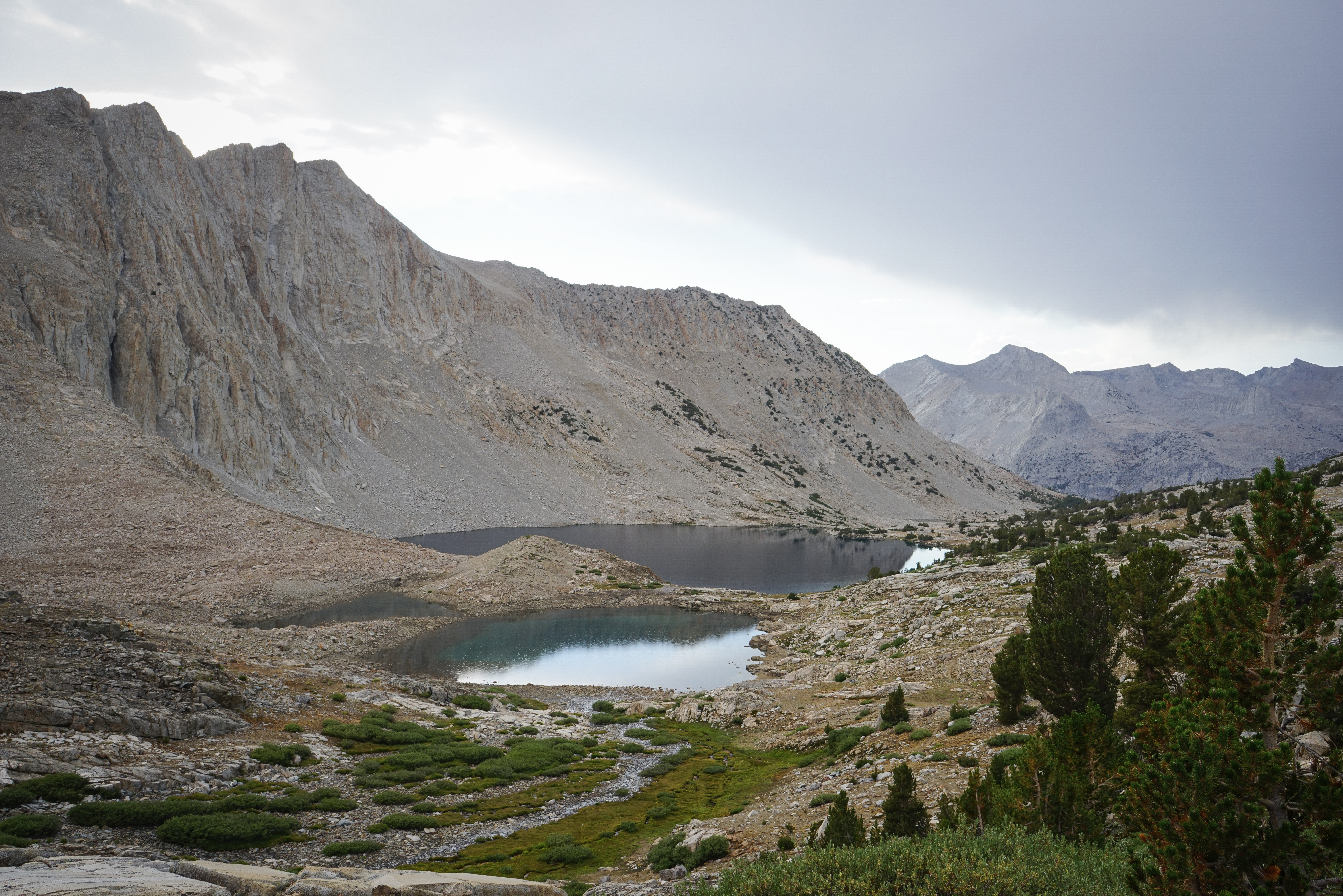
The view of Mather Pass and the Palisades through a gap in the trees en route to Lake Marjorie. On this climb, we passed a group of folks with very small backpacks, followed by some horsepackers.
When we reached Lake Marjorie, the clouds were still swirling around, so we decided to set up the tent and wait it out for a while. We waited a couple hours until it was clear enough that we figured we could get over Pinchot Pass safely and comfortably - we were trying to have fun after all.
The view back over Lake Marjorie, with Mount Ruskin in the background.
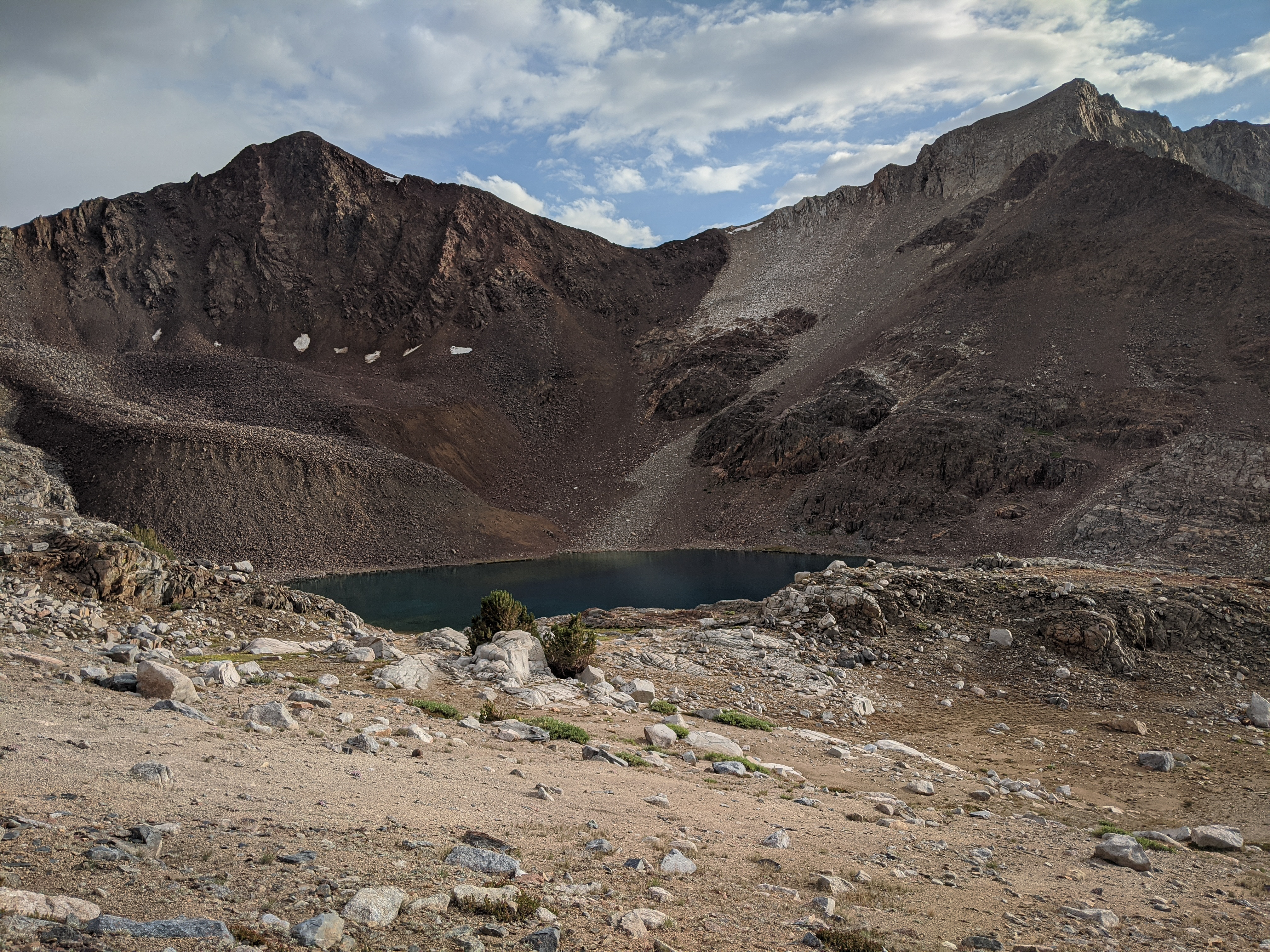


The highest lake north of Pinchot Pass is a special treat, a remarkable shade of blue contrasting with the red rocks of the peaks in this area.
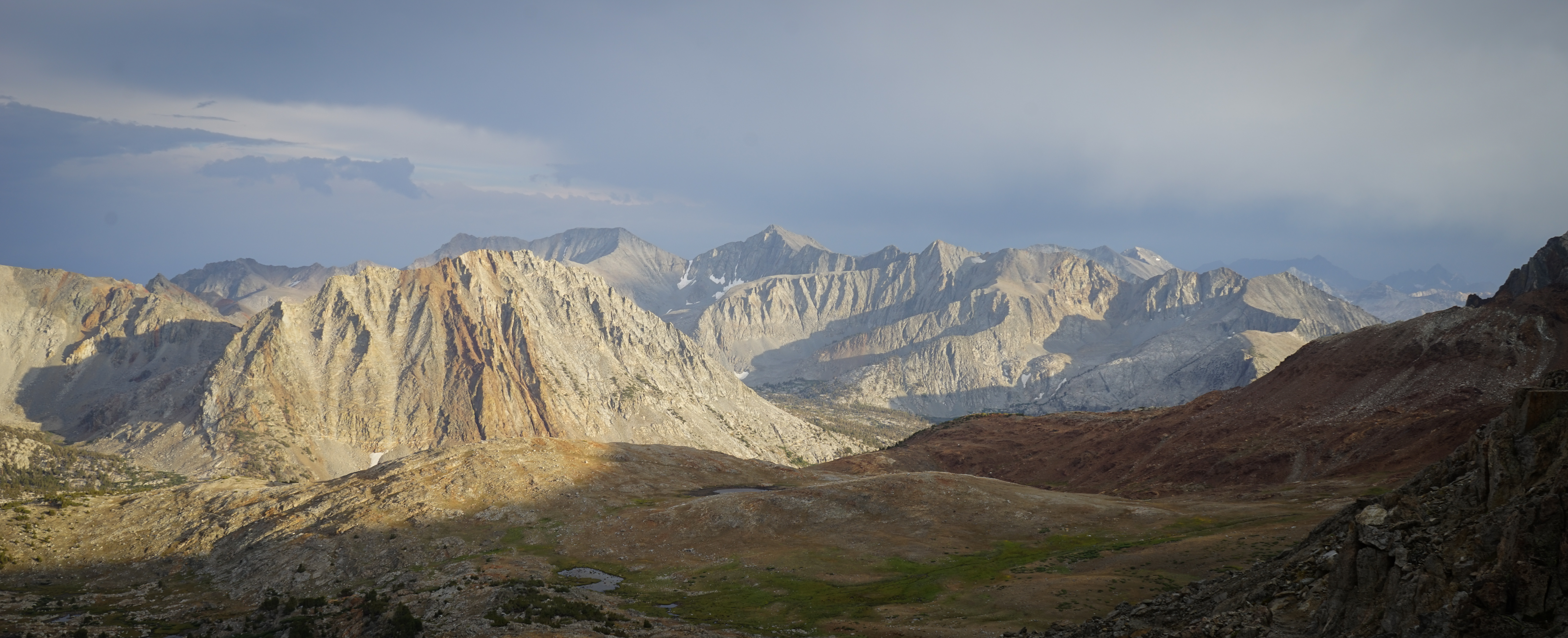
We crested Pinchot Pass and were treated to some more amazing late-afternoon clearing-storm views in both directions. Here you can see the high route option through this section, over Mount Baxter just left of Grasshopper Pass.
Evening light on Mount Wynne above Pinchot Pass.

The view north, with Mount Sill and North Palisade poking out on the horizon.
Another shot of the beautiful golden light over the peaks south of Pinchot Pass.
We hiked down until we found a sheltered campsite near some water and made camp for the night as it got dark.
Tomorrow we would be presented with a choice between following the JMT or the Mount Baxter alternate. The Mount Baxter option was more in the spirit of the high route, but would likely be much slower and more difficult. We figured that because we were a little bit behind schedule and had been hit with bad weather (by California standards) every day so far, making up some miles on the JMT would give us a better chance of completing the high sections in the southern part of the route, which we were really excited for. So, we settled on that plan.