The next day we got up at 4:30 to brew up some coffee and get ready for the big climb. It was dark but not too cold. After the usual morning routine, we set out just before 6, crossed the creek, and followed the footprints in the sand for the huge sand slope up to Russell-Carillon Pass.
The climb up to Russell-Carillon Pass was as shitty as expected, there’s 1,000 vertical feet up a steep sand hill before the grade eases near the top. Despite our previous week’s acclimatization, we weren’t feeling especially strong in the sand. It didn’t take forever though and we reached the open bowl below the pass soon enough.

Looking up at Mount Russell from the top of the sand slope. From here there was some easy walking to the pass.

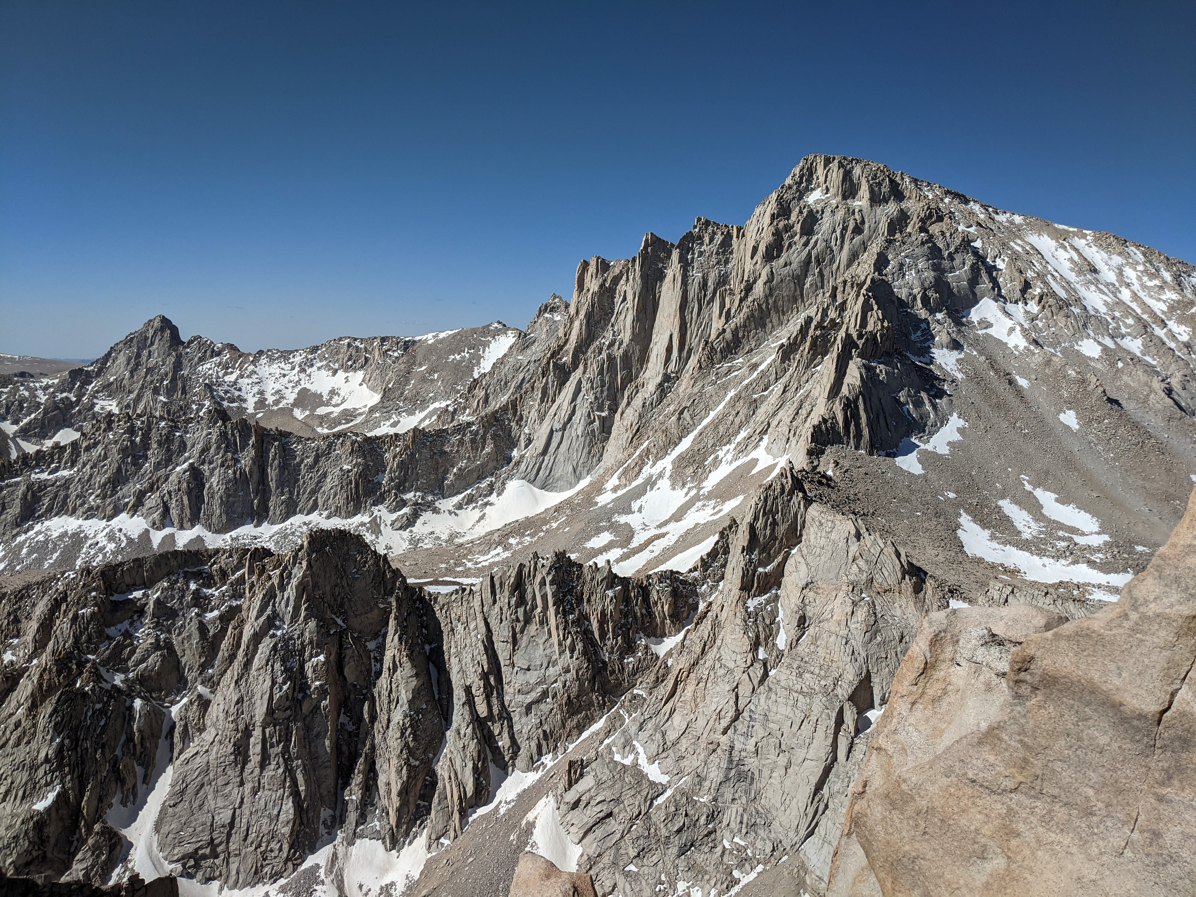
There is an awesome view of Mount Whitney from this area. The summit is so close and the view so direct that you can actually hear people on the summit of Whitney talking from over here.
We cut a little bit left of the pass and were on the east ridge of Mount Russell soon, climbing up. Before long, the ridge narrowed to only a few feet wide. While the rock was solid, the exposure made us think twice.

Mount Whitney and beyond from the east ridge of Mount Russell.

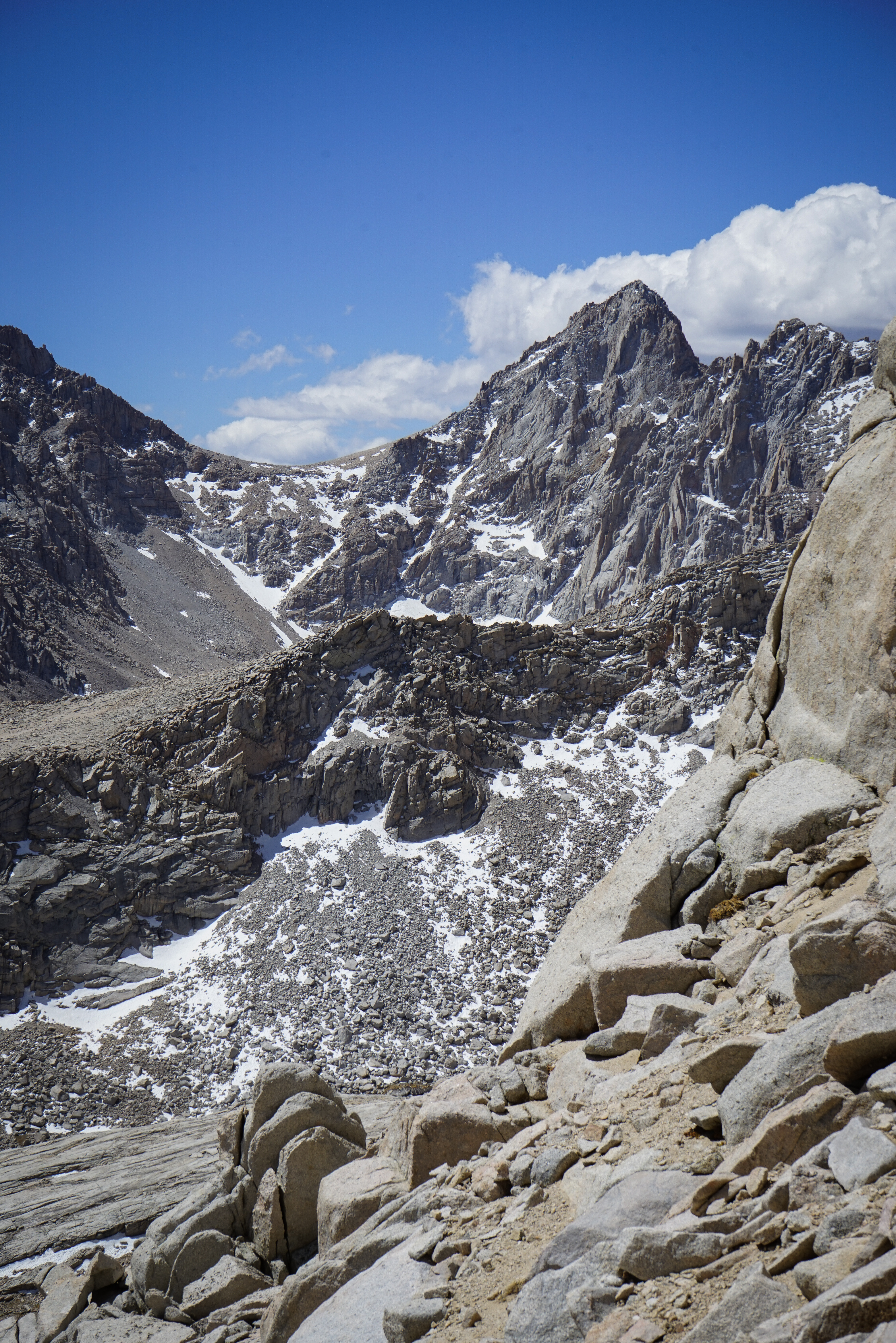
Tulainyo Lake from the east ridge of Mount Russell.
Above us, we spied a snowfield filling a crack that appeared to be the only route. I had read the this route is actually not too bad and there’s a sort of use trail just north of the ridge. Unfortunately, that’s exactly where the small snowfield appeared to be, filling the only break in an otherwise smooth rock face. After some discussion or our current position and what appeared to be ahead, we decided to turn around, concluding that the snowfield would be impassable. I’m not certain that this was the case, but it was the right decision for us as the climb was already close to our comfort limit. We’ll have to return in snow-free conditions for this mountain.
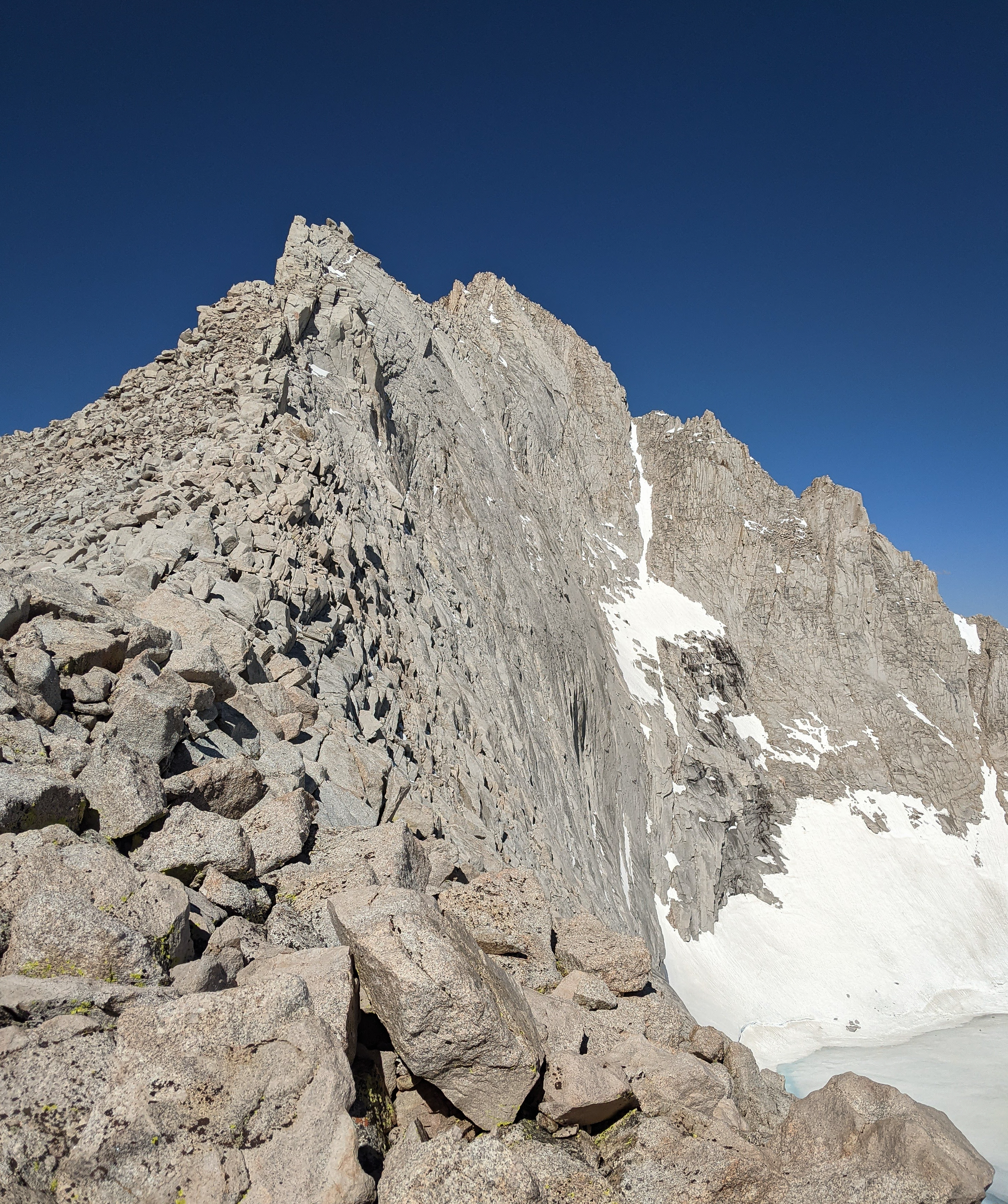

The east ridge of Mount Russell. The snowfield that caused us to turn around is in the crack just below the false summit at the left.

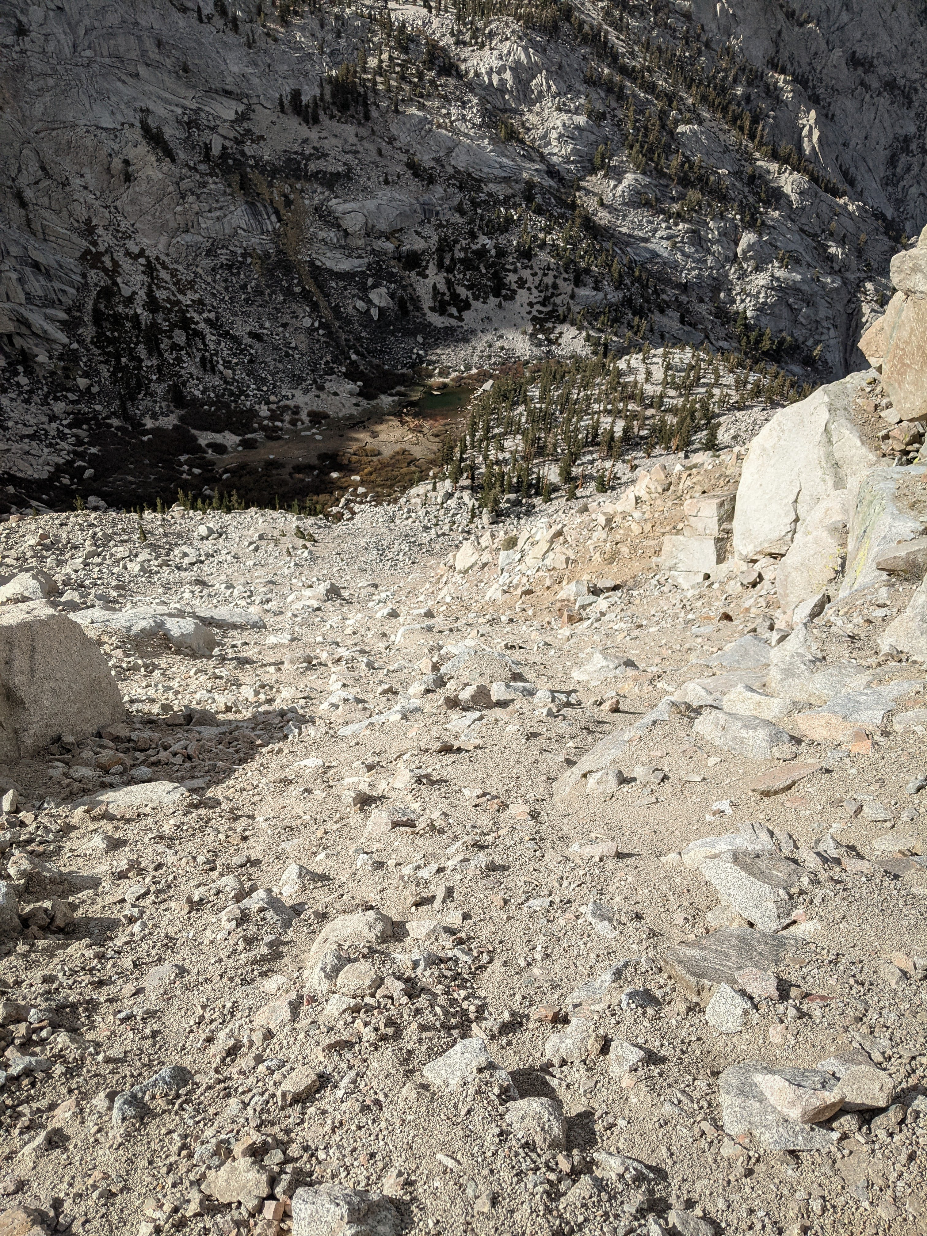
Mount McAdie and Arc Pass from the sand slope descending back to Upper Boy Scout Lake. It was much easier to descend the great sand slope and we were back at camp around 11.

Mount Russell from Upper Boy Scout Lake.
We rested for a little while and talked through our options for the afternoon. We were not too happy to be 0 for 2 on this trip and had the full afternoon remaining, so we decided on another attempt on Thor Peak, this time by heading down the trail and up the obvious sand slope we had seen from Mount Russell.
We headed off at 2, down the trail next to the North Fork of Lone Pine Creek, and then across talus below some cliffs and up a sand slope to a notch that would deposit us on the east slope of Thor Peak. The sand slope was even looser than the one we had climbed this morning and we sent little avalanches of sand and rock down with each step. After a very careful few hundred feet, we crossed the notch and started climbing directly west towards Thor Peak.
Up above us we saw a party of three who had separated due to different paces. Climbing over sand and boulders we passed the first member of their party and met the other two on the summit rocks of Thor Peak.


Mount Whitney from Thor Peak.


Mount Russell from Thor Peak.

Mount McAdie from Thor Peak.
We talked with the other party a bit. They were a group of three from the Bay Area and planning to climb Mount Russell the next day from their camp at Lower Boy Scout Lake. We told what we had found on our outing and showed them some of the pictures we had taken, but tried not to tell them what to do one way or the other. After a little while we all headed down, and naturally separated as Shannon and I were moving a bit quicker. We made it back to the notch easily and started down the loose, sandy slope to Lower Boy Scout Lake.
The sand slope to Lower Boy Scout Lake from above. It proved to be almost as difficult to descend as it had been to come up. We headed down a little bit farther than we had cut across on our ascent, not seeing an easy way to traverse, and then wandered through the talus searching for the use trail before relocating it. Then we had to climb back up 700 or so feet to Upper Boy Scout Lake, not an easy feat on tired legs. But we managed, motivated by our rice and beans dinner and encouraged by the fact that we had managed to climb a mountain today even if it wasn’t the one we originally intended.

Another beautiful sunset over Thor Peak.