Shannon and I had planned a backpacking trip to take advantage of the lighter winter in the Southern Sierra and try to climb a couple of the peaks in the Mount Whitney area. First on our list of priorities was 14,094’ Mount Russell, “the finest peak in the Mount Whitney region” according to RJ Secor. We had vaguely considered an attempt on this mountain the previous year on our Southern Sierra High Route hike, but the timing hadn’t lined up, so we climbed nearby Mount Carillon instead. We hoped that by making this the priority of our trip we would be successful.
We spent the week before in Mammoth Lakes and I took a couple of days off to go for hikes. So by the time this weekend we were reasonably acclimated and ready for adventure.
Day 1: Upper Boy Scout Lake and Thor Peak Attempt
On Saturday morning, we loaded up the car with our week’s worth of supplies from our AirBnB and drove south on 395, stopping at Looney Bean in Bishop for coffee and breakfast. We arrived at a rather busy Whitney Portal at about 9:30AM. The area was bustling with the usual Mount Whitney crowd, so we wasted no time loading our food into a bear box and starting out up the trail.
Not having visited the lower reaches of the North Fork of Lone Pine Creek and having read up on it on the internet a bit before the trip, I was prepared for a rather adventurous bushwhack up towards the infamous Ebersbacher Ledges. So I was quite surprised to find a sign and what appeared to be a maintained trail branching off up the North Fork. Up we went!
The trail continued in very good condition, though quite eroded up through heavy forest and willows, criss-crossing the creek a couple of times before reaching the E-ledges.
The Ebersbacher Ledges from below. The route up them climbs up to the pine tree at left-middle, traverses across to the boulder at the right, and then into the bushes above. I had read lots of concerning discussion on the internet (“class 3 with death-fall potential” and “worse than Angel’s Landing”) so we were ready for the worst.
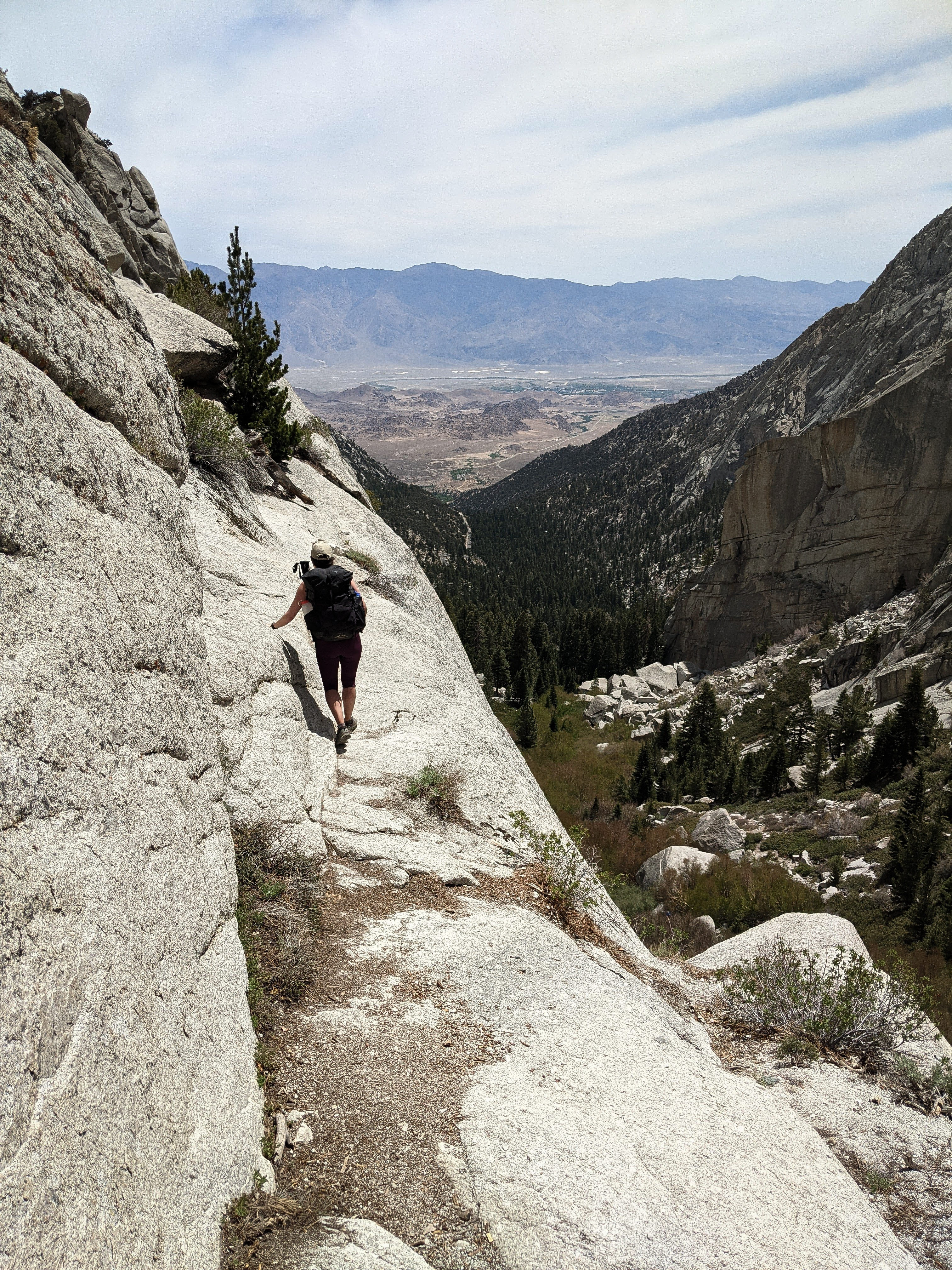
Shannon crossing the most exposed section of the Ebersbacher Ledges. This section was about 4 feet wide with a drop off on the right side. I imagine it would be difficult in snowy conditions, but in summer conditions it’s not worth a second thought. Above here there was some easy class 2 scrambling up to the bushes.
There was a steady stream of people heading in both directions along the North Fork, we probably saw a dozen or so parties between the Whitney Trail and Upper Boy Scout Lake.
At Lower Boy Scout Lake we ran into a couple of hikers and made some chit-chat with them. They were a mother-in-law / son-in-law duo visiting from Florida and hoping to climb the Mountaineer’s Route on Mount Whitney the next day. One of them asked if we had a first aid kit with antacid which we turned over, figuring we probably wouldn’t need it.
After this short break we crossed the creek again and wrapped around the south shore of Lower Boy Scout Lake before following a braided use trail up through talus towards Upper Boy Scout Lake. The route wasn’t very straightforward, but it wasn’t difficult either. All of the different braids of the trail weaved in and out, meeting up before splitting again, so there wasn’t really any consequence to following the “wrong” one. At about 1 o’clock we reached Upper Boy Scout Lake and selected the most private campsite we could find, between a boulder and some willows. There were maybe a dozen other parties at the lake. We set up camp and had lunch.
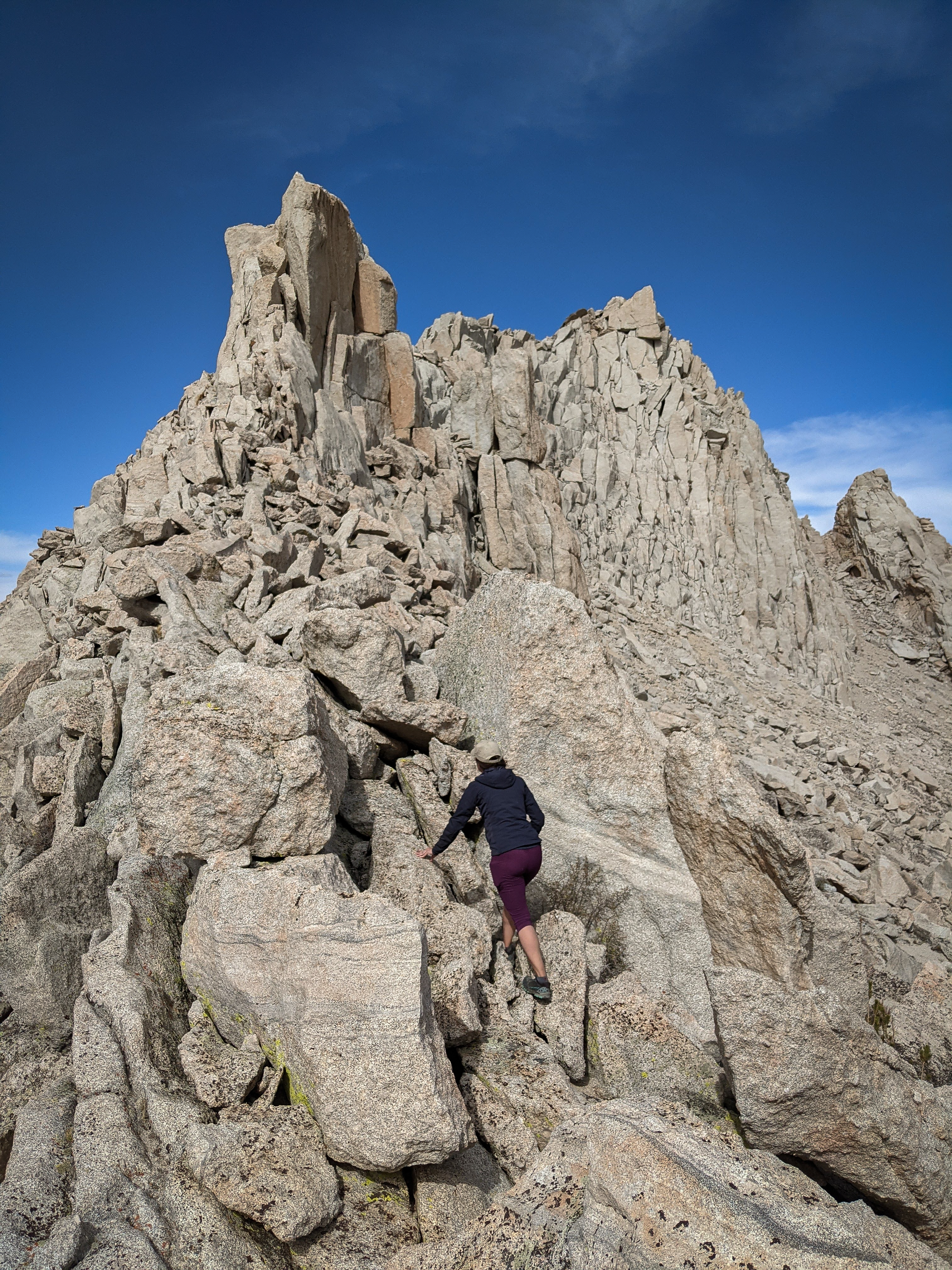
After an extended break, we set out for a warm up climb up nearby Thor Peak. This peak, which stands high on the ridgeline that divides the North and South Forks of Lone Pine Creek is on the SPS list. We suspected it would be a quick climb with a great view of Mount Whitney from the summit. We planned to climb to Pinnacle Pass, west of Thor Peak, and then traverse back east to the West Arete of Thor Peak, a straightforward outing as described in Secor.
We climbed up the North Fork Trail for a bit, then crossed easy slabs to Frog Lake, and then climbed up on the talus, searching for the place where the boulders “rise prominently” against the north face of the ridge. Not having any idea what the fuck this meant, we picked the easiest looking route up to the ridge, which went at class 3 with careful routefinding.
Looking back over Frog Lake.
Soon enough we were on the sandy slopes of the ridgeline west of Thor Peak.
Searching for the West Arete. The climbing along the arete quickly exceeded class 3, so we crossed over to the north face of the peak, hoping to pass around the pinnacles en route to the summit.
Looking back to Mount Whitney. As we got more and more lost on the north face of Thor Peak and were forced down the slope to stick to terrain we felt comfortable climbing, the clouds built up some more and rain threatened. Soon enough we were a few hundred vertical feet below the ridgeline searching for terrain we could safely descent. There was only difficult climbing between us and the peak. So we decided to retreat back to our tent. Looking back at the photos, I think there may have been an easier way from the west by traversing to the notch just southeast of the summit and then wrapping around and up the other side of the peak. I assume the West Arete is climbable as well, but we had trouble finding the way.
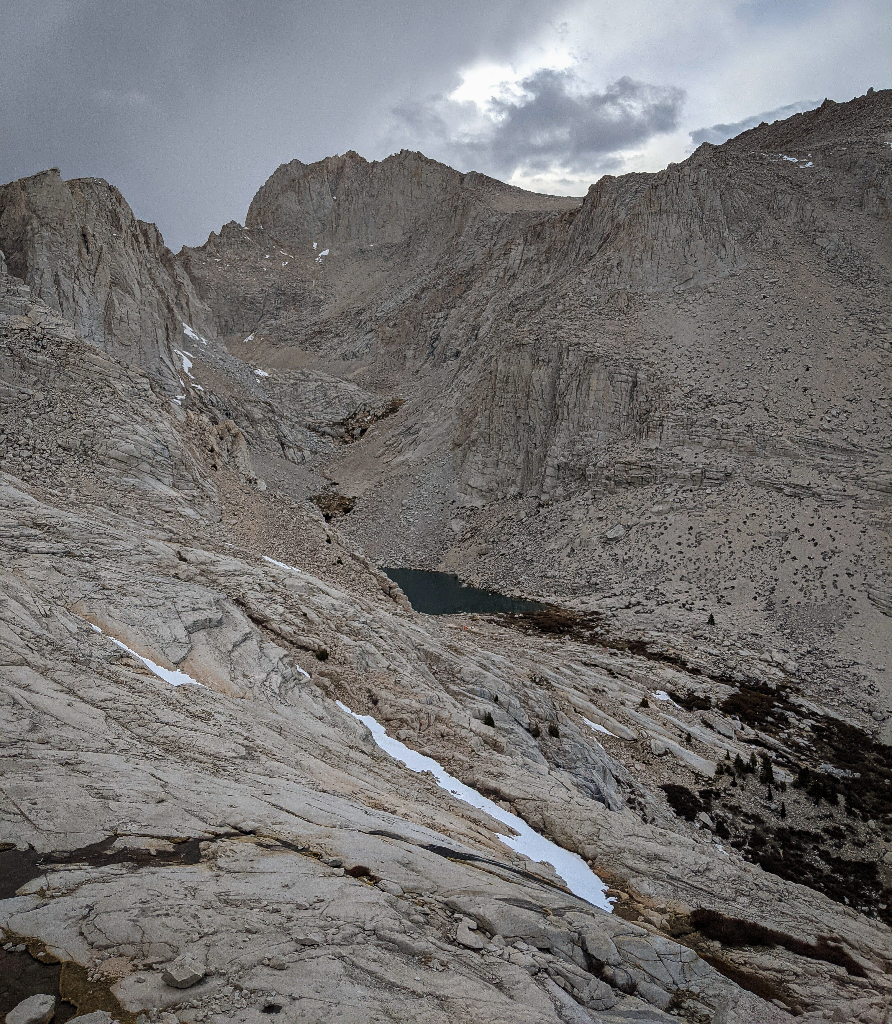
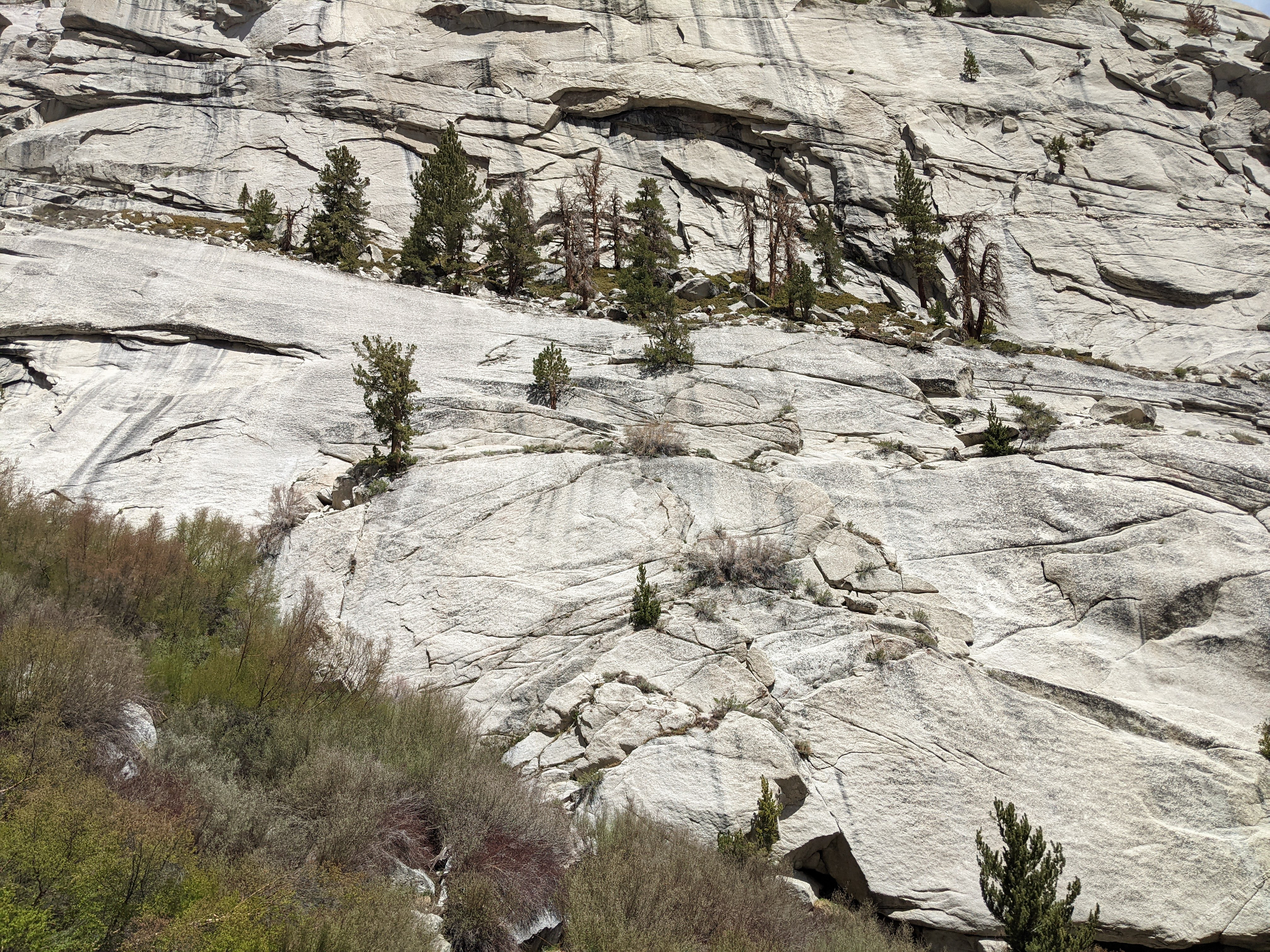
Mount Russell and Upper Boy Scout Lake from just above Frog Lake.
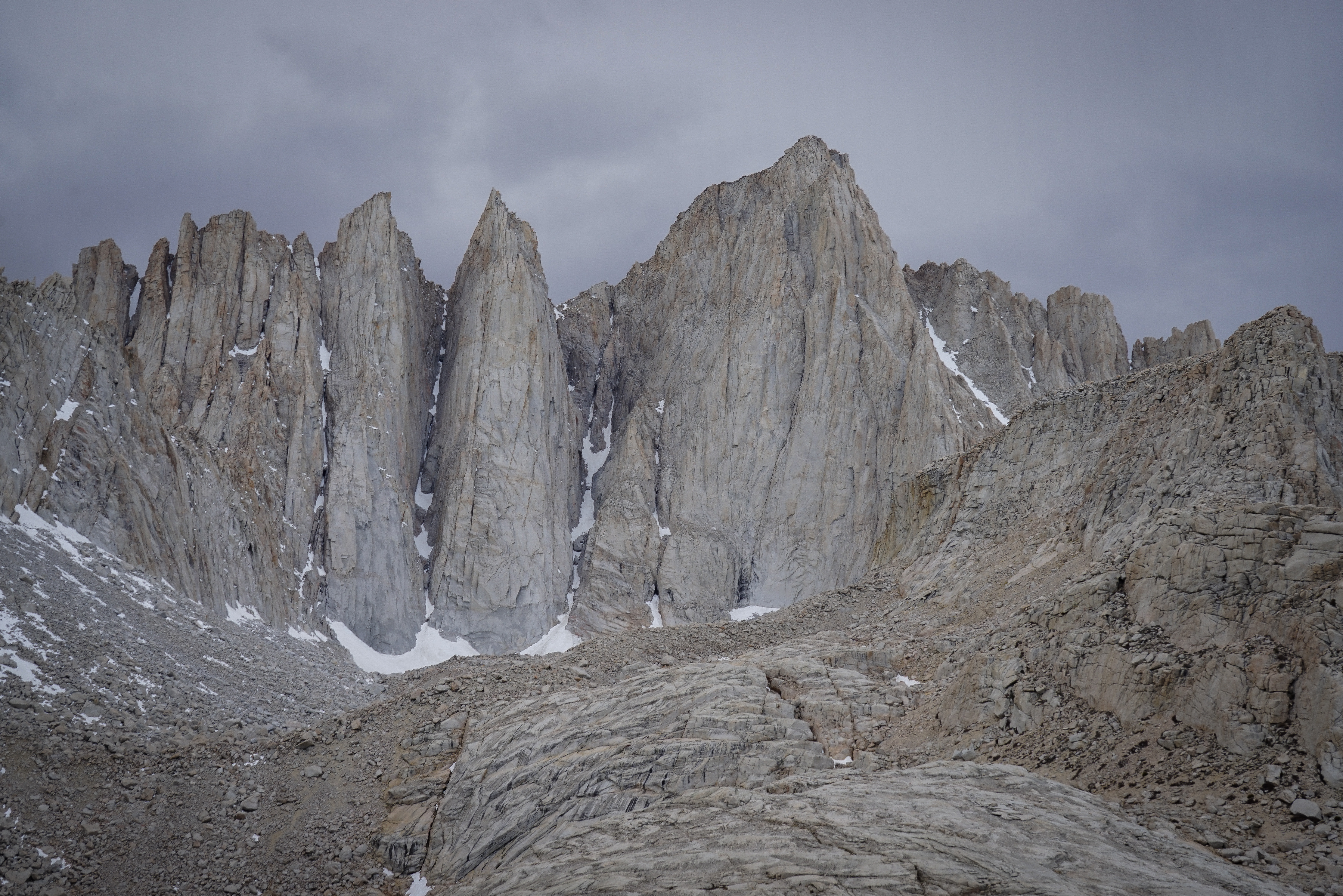
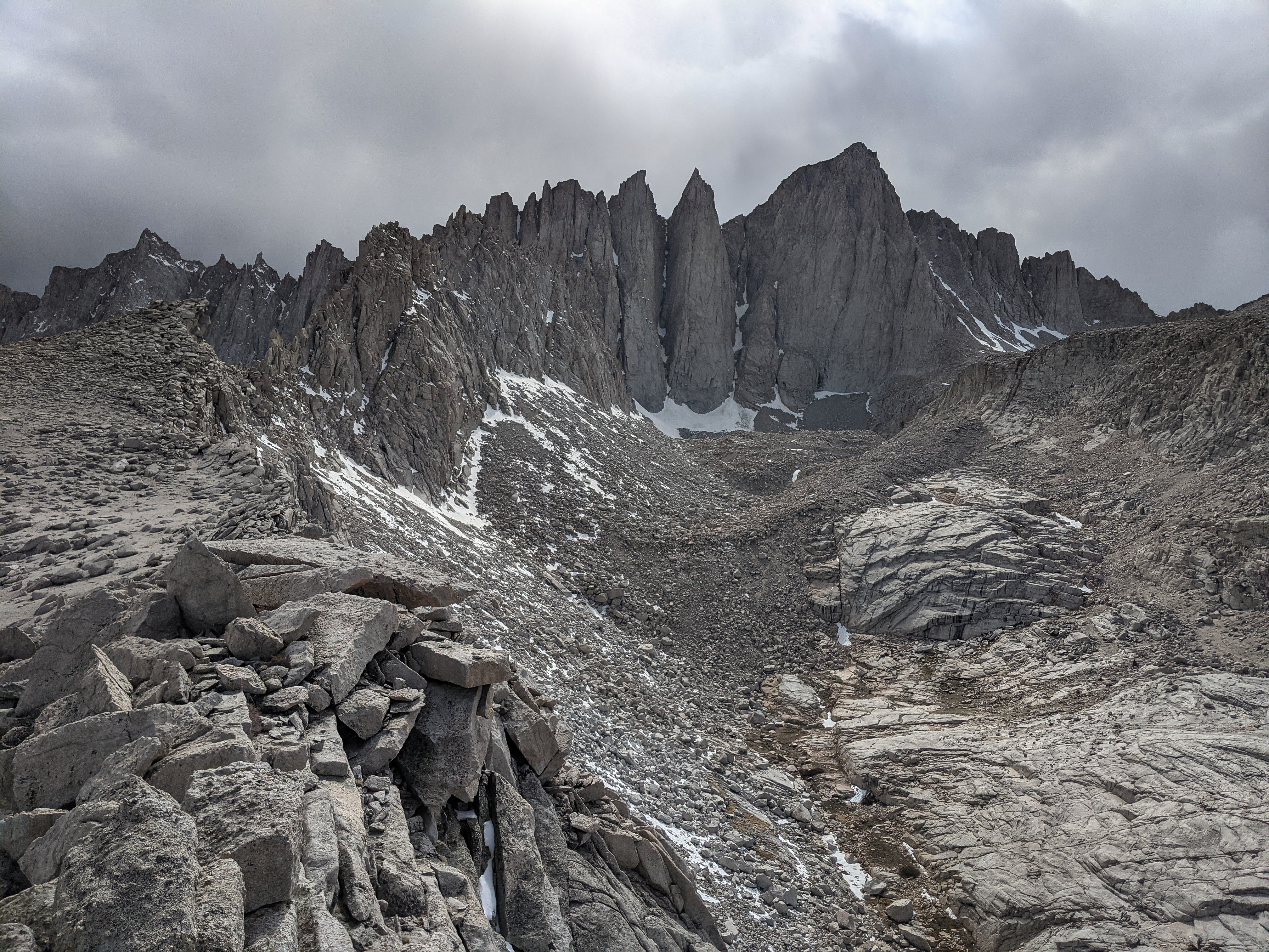
Mount Whitney and the various needles. The snow tongue coming down the Mountaineer’s Route is visible right of the summit.
It didn’t take long to get back to camp after our unsuccessful attempt on Mount Thor. As we headed down, a group of children maybe between the ages of 5 and 10 hiked past, playing on the rocks, accompanied by a dad carrying a planet-sized backpack. They had climbed and ascended the Mountaineer’s Route. We were astounded and took to privately calling him “superdad.” We had lots of other questions about… his life and why the kids were so well behaved, but he explained that he had to go and cook dinner ASAP to keep their spirits up. Understandable.
We did the same, after all we had to keep our spirits up too. Some time in the evening the pair from Florida came over to ask some advice. We had mentioned that we had climbed Mount Whitney multiple times including the Mountaineer’s Route which I guess lent us a certain credibility in their minds. They were curious if we thought they’d need ice axes at this time of year as they had left theirs in the car after a descending hiker said they were unnecessary. A regrettable mistake! After enough trips into the great outdoors, you learn to pass the advice of others through a filter of your own private judgement of that person. I guessed that the Florida duo had not stopped to ask this other hiker whether they had climbed the sunny, south-aspect Mount Whitney Trail, or the shaded northside gully of the Mountaineer’s Route. Not wanting to be the bearers of bad news we told them that they probably would, but we couldn’t say for certain as we hadn’t seen it directly. We advised them that superdad, who was camped nearby, would be a good first-hand witness, or that they could just go up and see. They asked about Mount Russell as an alternate option, noticing that we didn’t have ice axes. We explained what we knew, but got the sense they were only really interested in Mount Whitney. They headed over to visit superdad who wasn’t camped too far away.
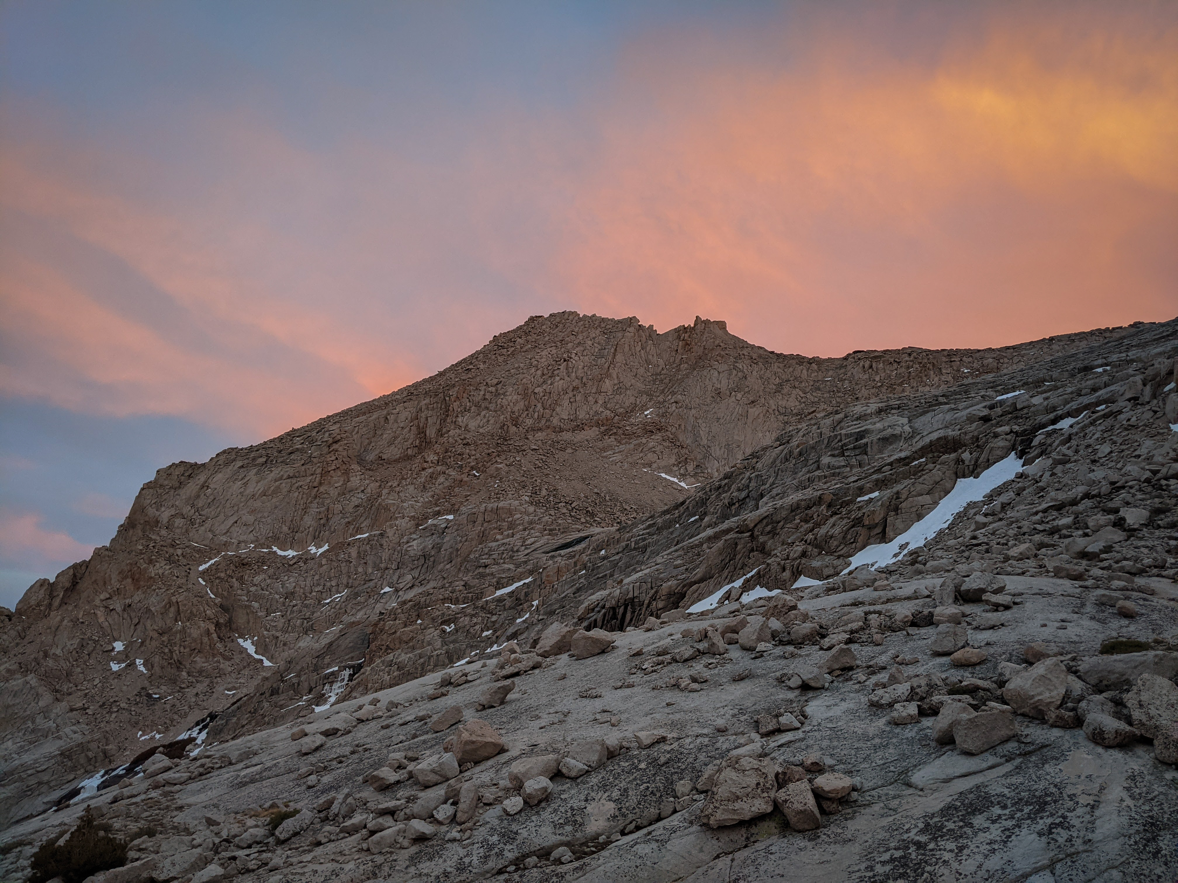
A lovely sunset over Thor Peak. We tucked in for bed, with alarms set for an early start the next morning.