We got up the next day and had a bit of a debate over breakfast about where to go today. I advocated for continuing down the trail for Paradise Valley. You see, I was feeling a bit tired and not so much in the mood for climbing another mountain. Dad wanted to climb nearby Diamond Peak before continuing down. He won the argument, so we stashed our things at camp and set off up the west slope of Diamond Peak for the summit.
Much of the area around Mount Baxter has been closed to off trail travel either seasonally or year round in the past. This was to protect the California Bighorn Sheep, an endangered species. These closures are described in Secor and affect much of Diamond Peak and many of the surrounding mountains. However, a few years ago the Forest Service and National Park Service decided against renewing the closure, concluding that recreational outdoor users in the High Sierra don’t pose much of a threat to or disrupt the sheep very much. However, this good news was not exactly communicated loudly and widely or even at all as far as I can tell. There are murmurs on internet message boards and the rangers will tell you if you ask them directly, but they’re not exactly encouraging people to go and visit these newly reopened places. But that is the current state of things and among other areas this means that access to the west slope of Diamond Peak is now again permitted. So that’s what we planned to climb as it wasn’t really too far out of the way from where we started.


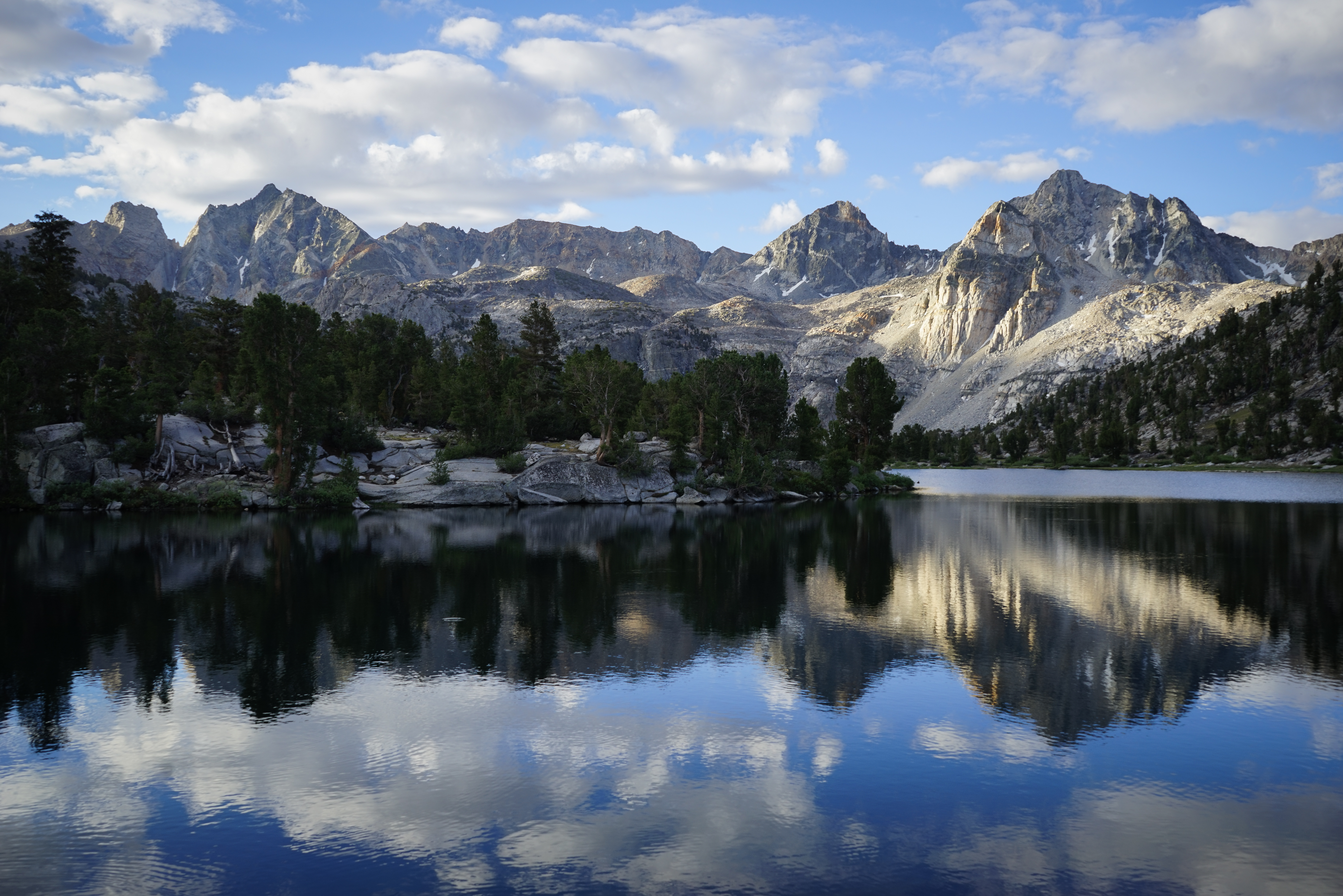
Before all of our debate about which mountain to climb or not climb, we enjoyed a lovely, cloudy sunrise. Usually not an omen of good weather, but we figured we could chance it. We set out at about 7:15, crossed the JMT, and started hiking up through the forest for the very long gully up the west face of Diamond Peak.

Looking out over Mount Rixford and co from above the small lake east of the JMT.
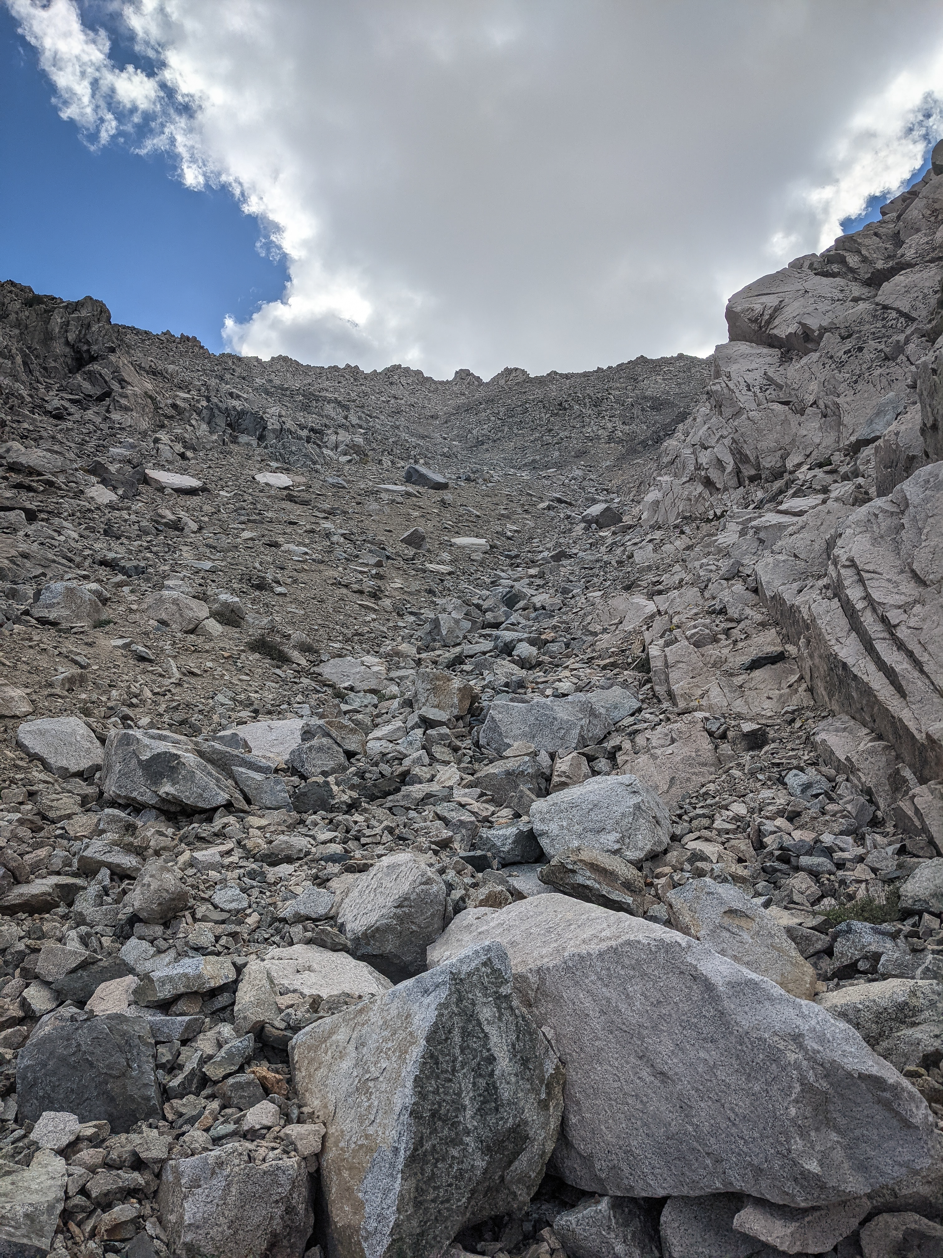
Looking directly up the 2,000’ gully. We started climbing up, hopping over boulders and climbing sand. It was quite loose and while it wasn’t steep enough to be very dangerous, the looseness coupled with the high altitude made for tough climbing. I stuck to the more solid rock outcroppings where possible, which helped a bit.

Mount Clarence King to the west.
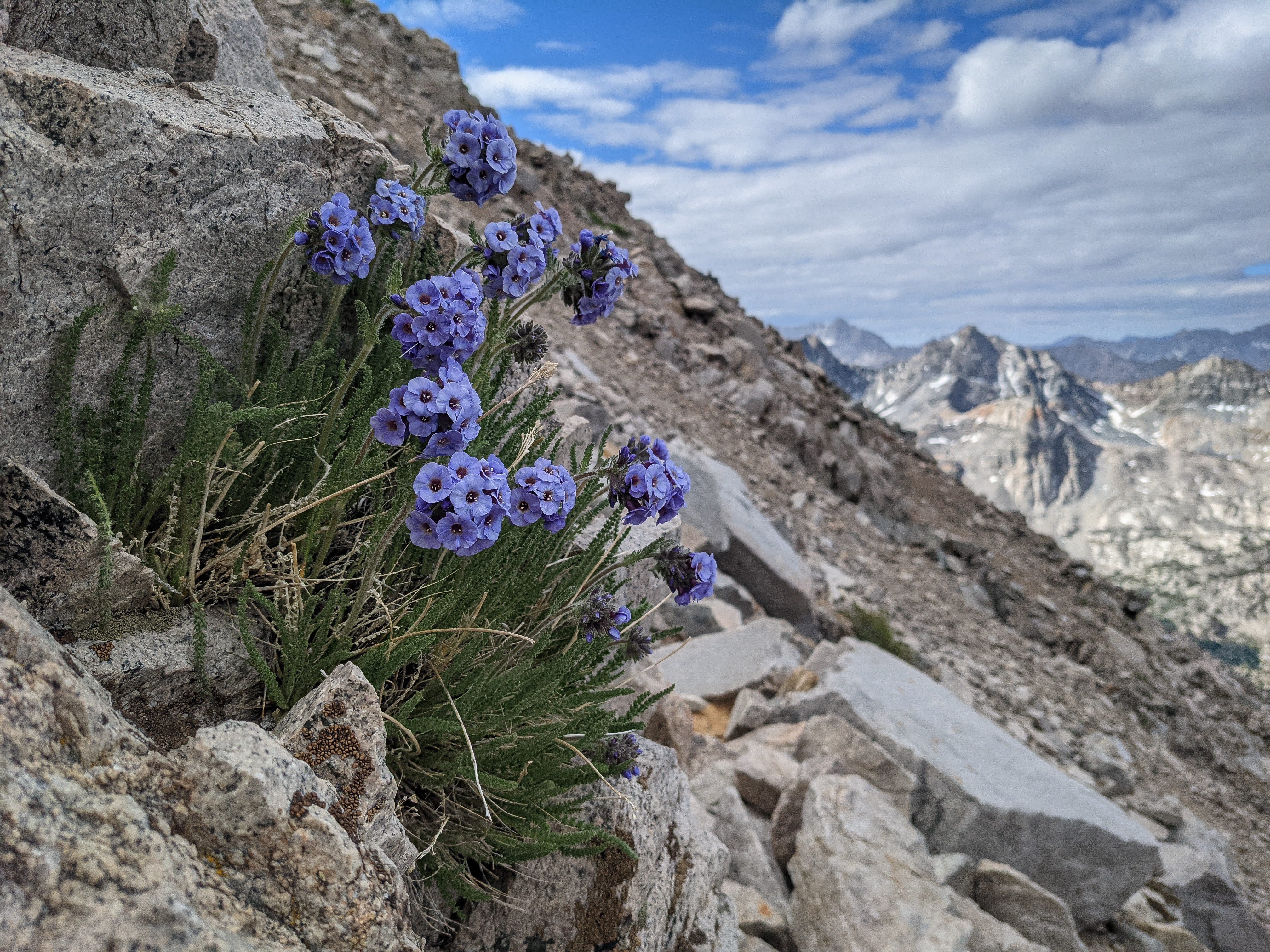

Some Sky Pilot somewhere along the slope.
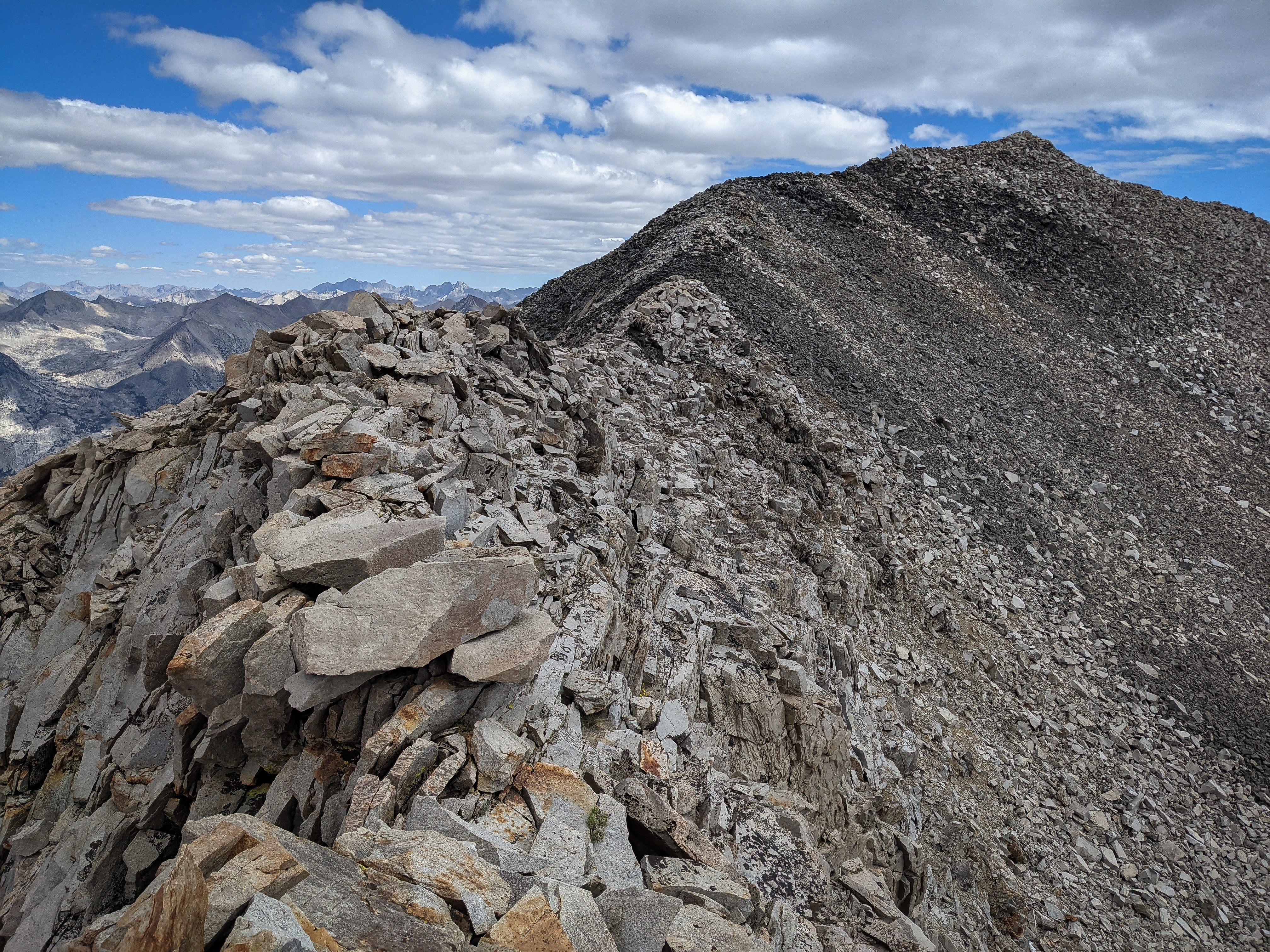
After much struggling, we reached the Sierra Crest by way of some class 3 blocks. Here there was a beautiful sidewalk of talus stretching about a quarter mile to the summit.


From the talus sidewalk there were incredible views in all directions. Looking north, the Palisades and the Evolution Group loomed on the horizon, and the White Fork (of Woods Creek) was easily visible.
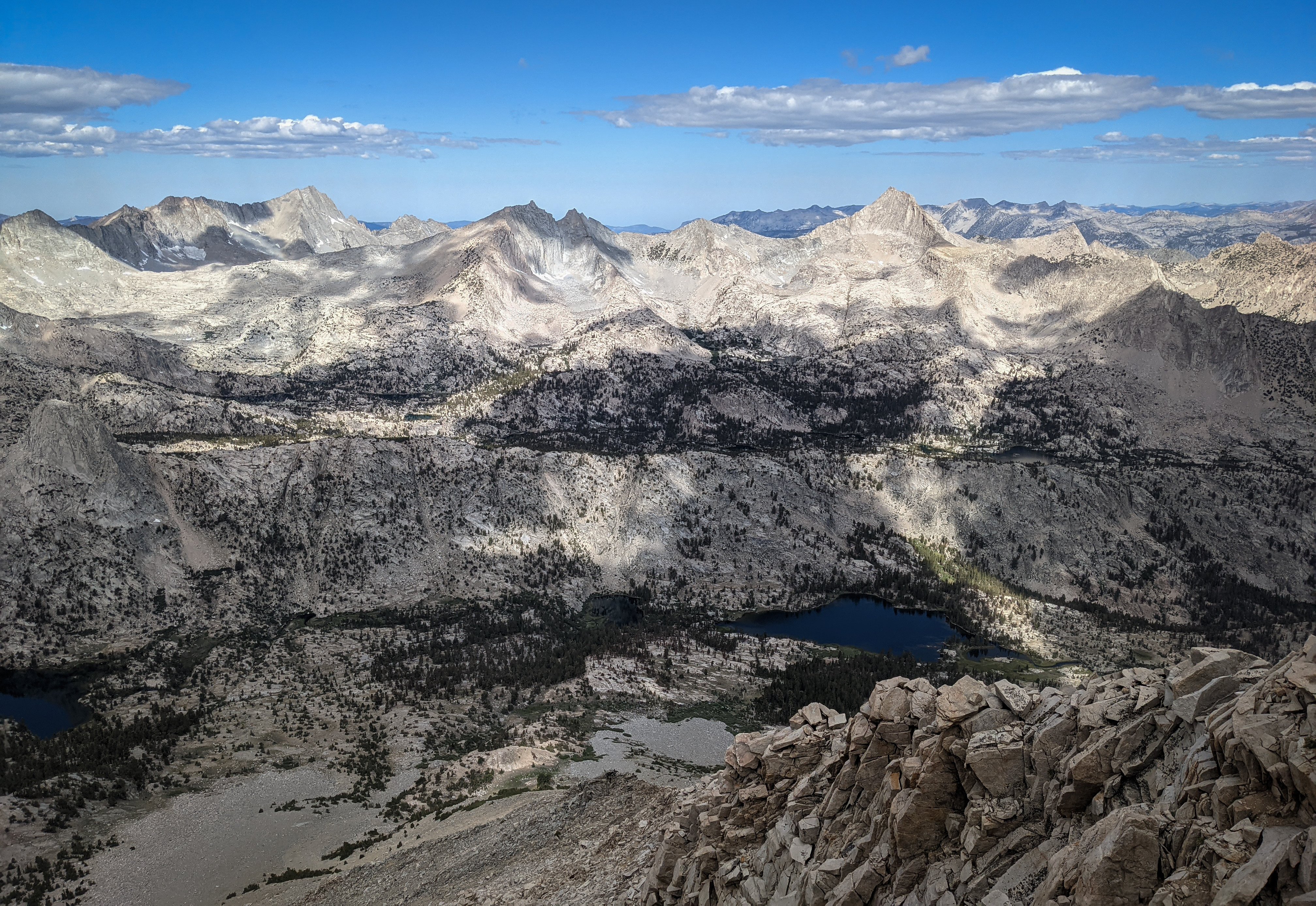
Looking west towards Mount Clarence King, Mount Cotter, and Mount Gardiner.
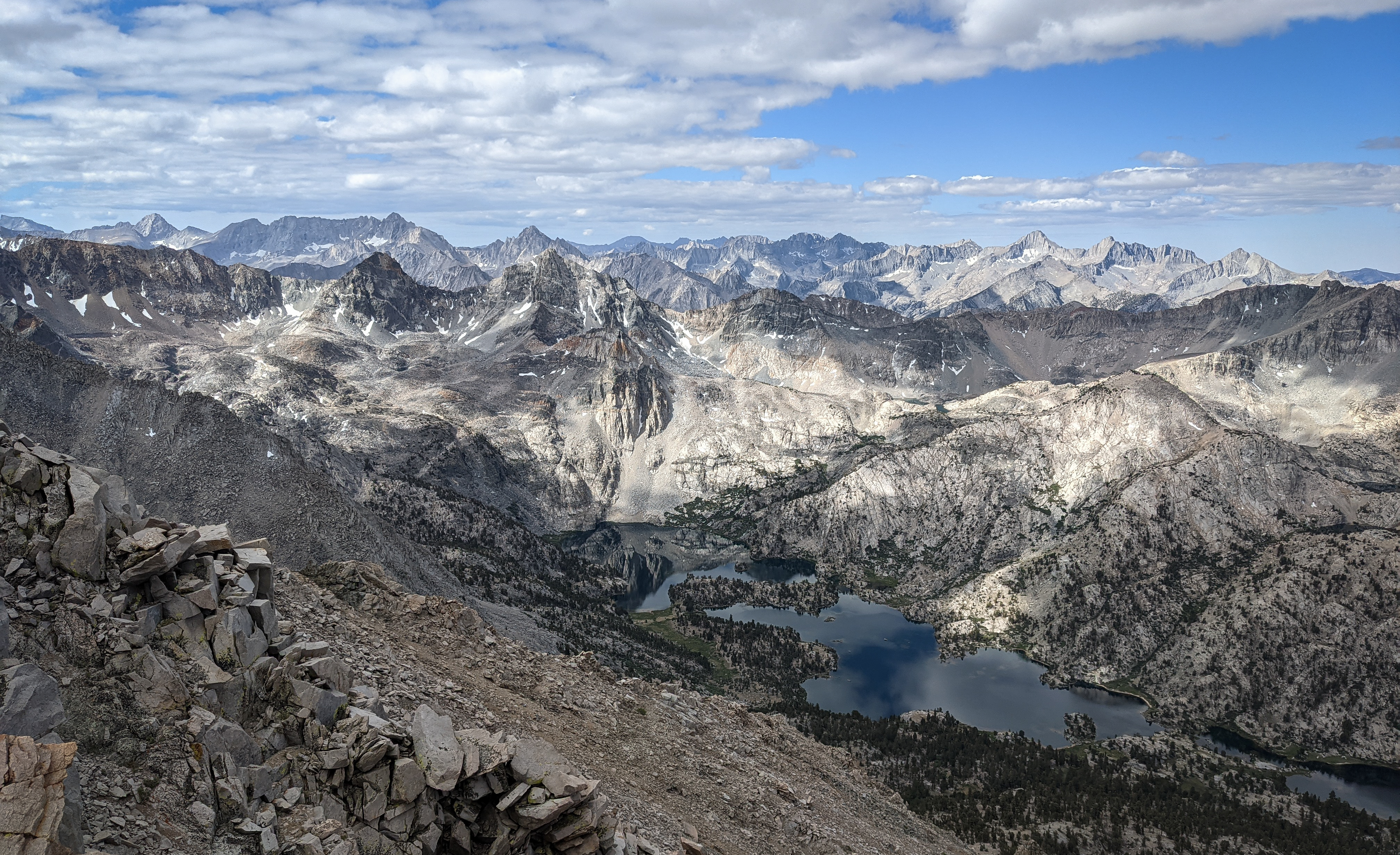
Looking south towards the Great Western Divide and Kings Kern Divide areas.
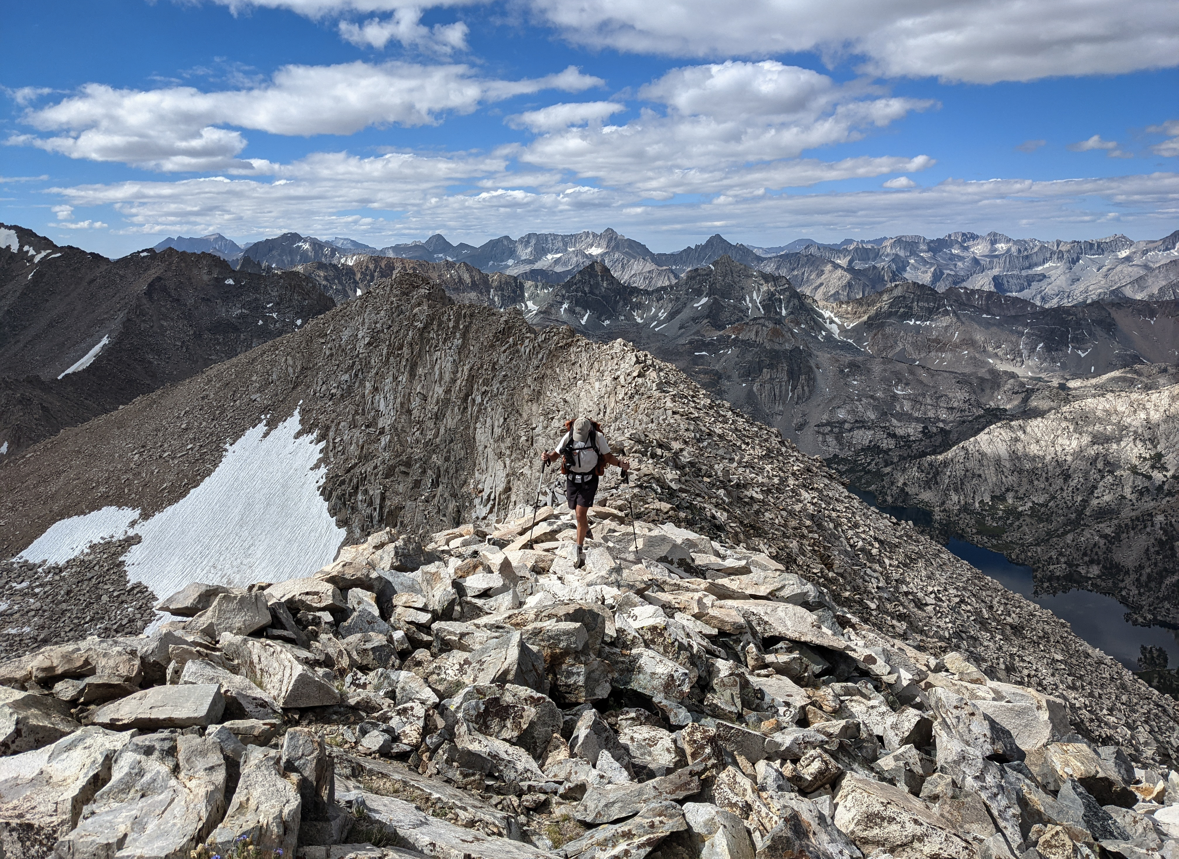
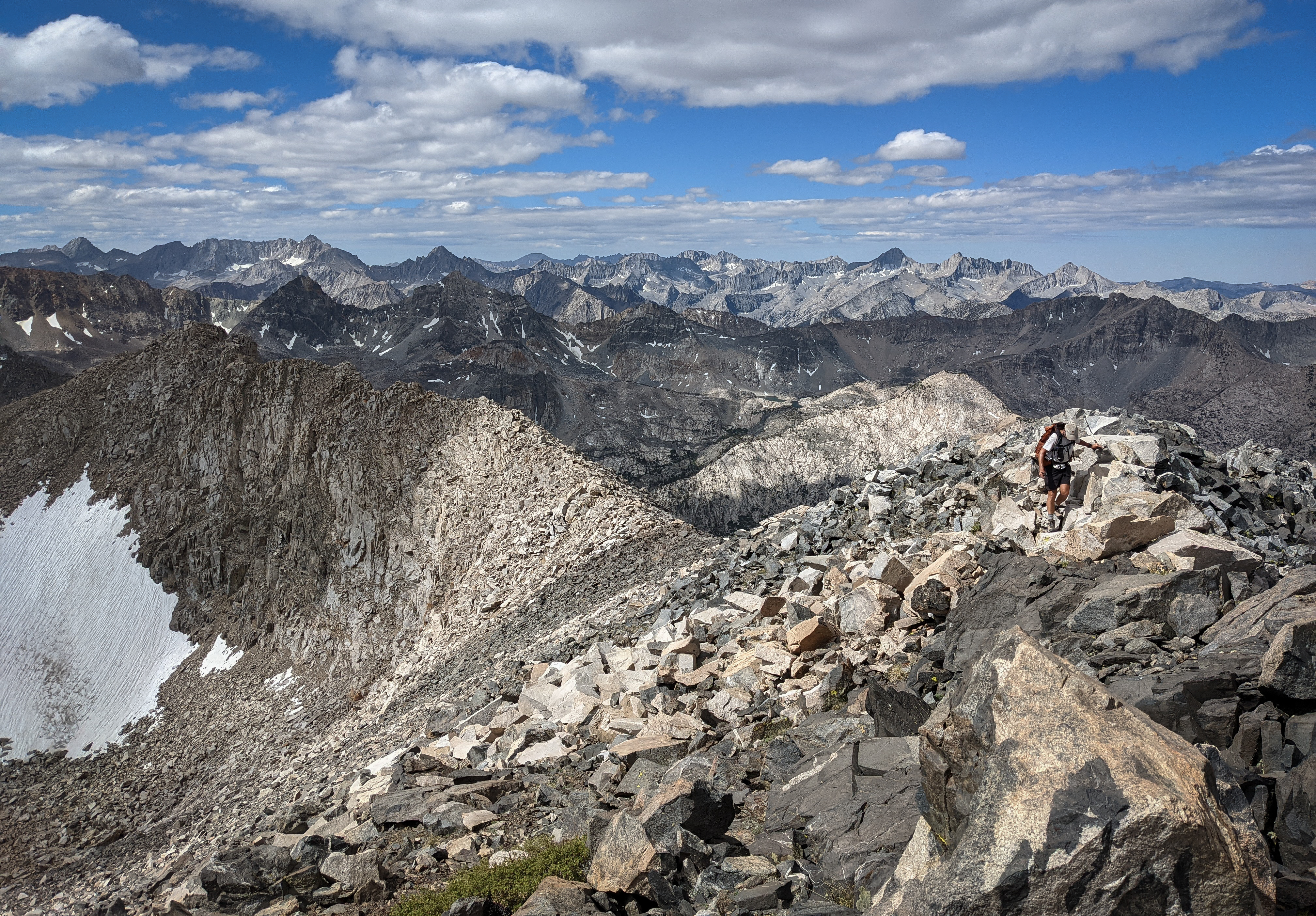
Dad walking along the sidewalk in the sky.

Looking south from near the summit. Soon we reached the summit after about 3 hours of effort.

A panorama looking south.
Mounts Williamson, Whitney, and Tyndal were visible to the south, left of Junction Peak.

Looking down over Middle and Upper Rae Lake and Glen Pass.


Looking north down the U-shaped valley of the South Fork of Woods Creek with the central High Sierra behind.
We both signed into the sparsely-populated summit register. Before the Bighorn Sheep closure was rescinded, one would have had to climb up the rather unpopular Baxter Pass Trail to reach this peak and it seems like not too many folks were keen on doing that. There were maybe 5-10 entries per year, mostly Sierra Club folks. After a summit break, we headed back down the sidewalk in the sky and then ducked down a gully towards Middle Rae Lake. The uppermost 200’ were very tedious climbing down loose class 3 until we got into the main chute again. The descent was quite slow as we knocked a bunch of large rocks down with each step and so to avoid falling we had to proceed very carefully. Eventually we got out of the chute and onto some talus back to the small bench above the trail and started moving faster.

Mount Clarence King and Mount Cotter across the JMT.

Fin Dome. We got back to camp at about 1 and after a short break set about packing up. It was very hot again and after thirty minutes of work shoving things into backpacks we went over to swim in the lake before hiking north towards Woods Creek.

We passed a bunch of hikers going in each direction on the JMT / PCT. We also passed a ranger at Arrowhead Lake who warned of severe thunderstorms to come the next day and for a couple of days after. That wouldn’t be a problem for us as our trip would be over, but some other hikers we saw had to consider their plans a bit more carefully with this information.


The impressive Woods Creek suspension bridge. We crossed the bridge and continued on down Woods Creek.

A grouse in some sagebrush.

Castle Domes, some very impressive formations along the ridge of Window Peak above a beautiful meadow. This would have been a nice place to camp, but we were a bit determined to make it down to Paradise Valley to have a shorter hike the next day.
We made it down to Upper Paradise Valley just before 8, taking our shoes off to cross the unbridged Kings River. All of the campsites near the water were already taken, but we found one tucked back a little ways on the west side of the river. After carefully setting up our crippled tent, we cooked dinner and went to bed.