We woke up at 6 (ish) as planned and enjoyed some coffee and a lovely morning. Breakfast was some cereal that went down a little bit easier than the usual oatmeal. Once our stomachs were full of instant coffee and the most calorically dense breakfast cereal we could find we set out for Mount Winchell at about 7:30.
I had read in Secor or somewhere before our trip the origins of the name of this peak. It seemed that there was a guy with the last name Winchell who was some kind of old-timey Californian. He had done what old timey Californians at the time loved to do and tried to name the peak after himself. However, that wasn’t allowed by the USGS at the time, so he pulled an ace out of his sleeve and very cleverly named the peak after his cousin (also a Winchell) instead. Thus, the peak was named, totally and absolutely not after the man who first applied the name and never climbed it. I’m being a bit facetious as Alexander Winchell (the cousin) was one of the founders of the US Geological Survey. He was also ”unambiguously racist.” Quite the story.


Mount Sill and North Palisade from camp in the morning.
We easily descended back to the trail to Sam Mack Meadow and followed the easy route up to the beautiful little valley. Here, another solo hiker came from below and passed us. He was also going to climb Mount Winchell after having climbed Mount Robinson the day before (I think). His hiking partner had a sore knee and was left exploring camp for the day. This isn’t a particularly popular peak, so we were all surprised to hear that we shared the same objective. In any case, he was moving much faster so we let him pass, thinking he would show us the route.
In Sam Mack Meadow, the trail crosses the creek and heads up into talus towards the much more popular Mount Sill and North Palisade. We followed the creek and climbed a talus-filled gully at the southwest end of the meadow towards the small lake just south of Sam Mack Lake.
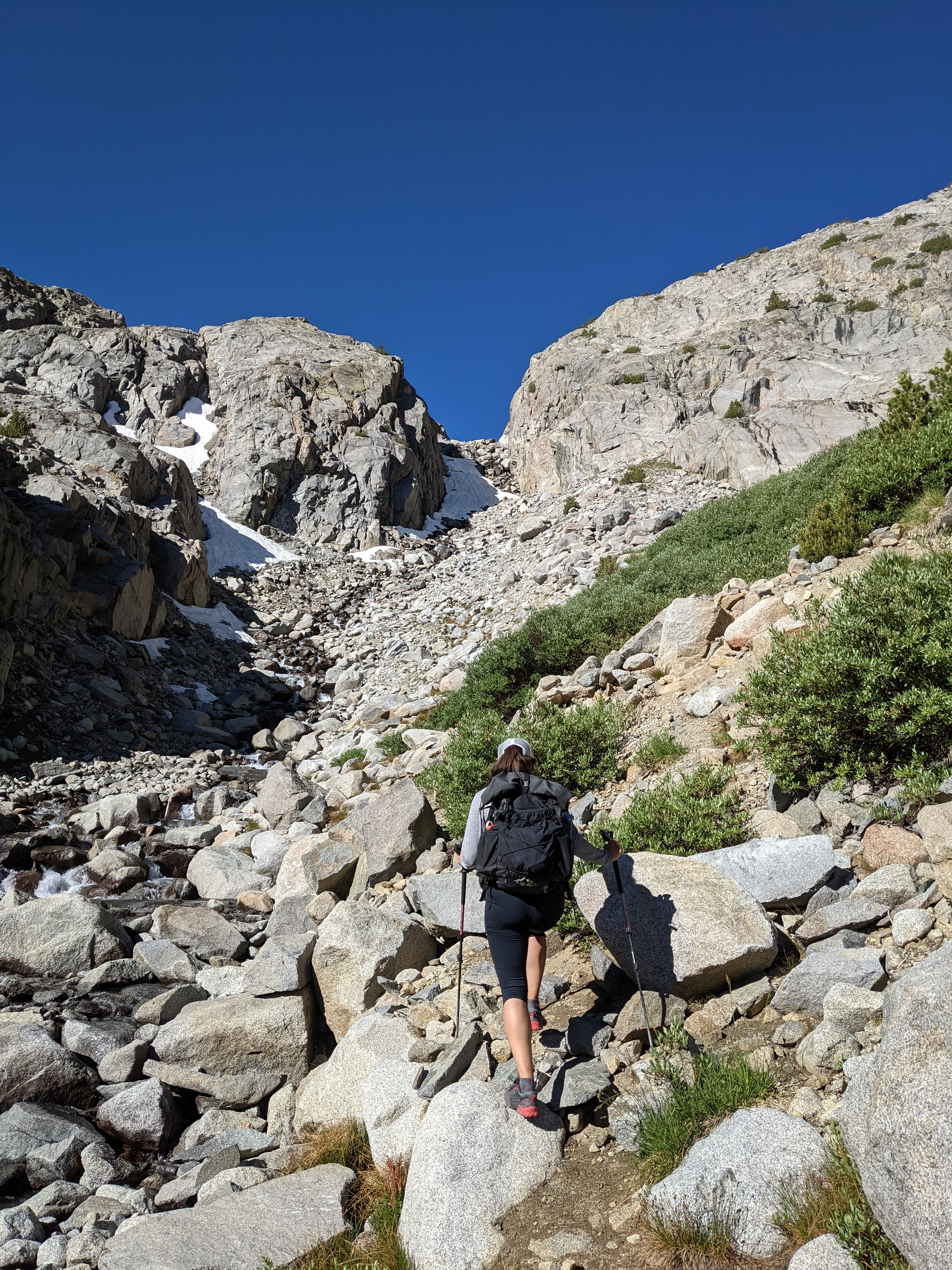
Shannon climbing the gully above Sam Mack Meadow.
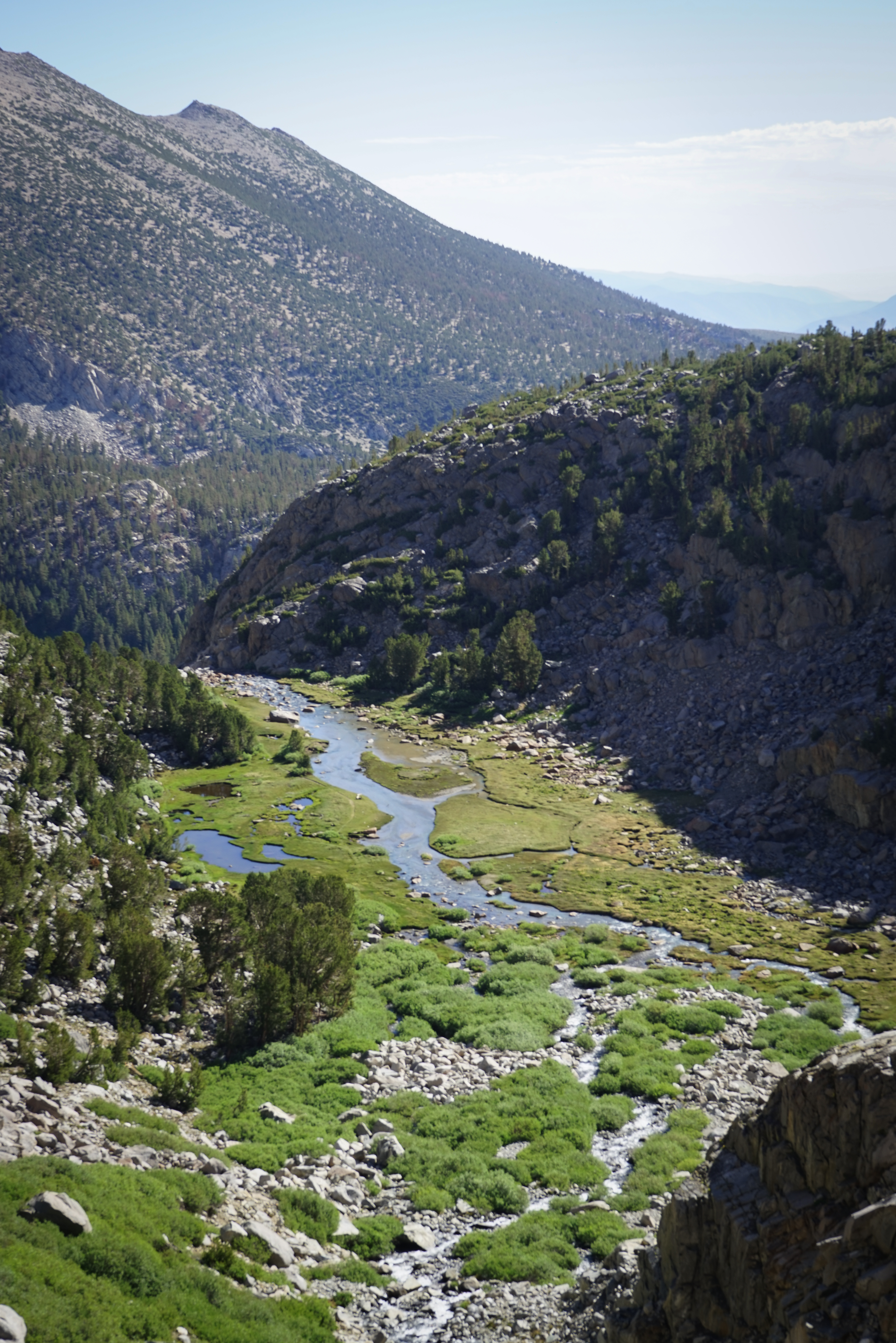
Looking back over beautiful Sam Mack Meadow.
Climbing up the gully was quite an adventure. Near the top, snow nearly completely covered it and we had to traverse across some boulders beneath a small waterfall and then climb up and cross again. It wasn’t too difficult, but with the snow and water and rocks it was quite fun.

First views of the North Palisade massif from above Sam Mack Meadow.

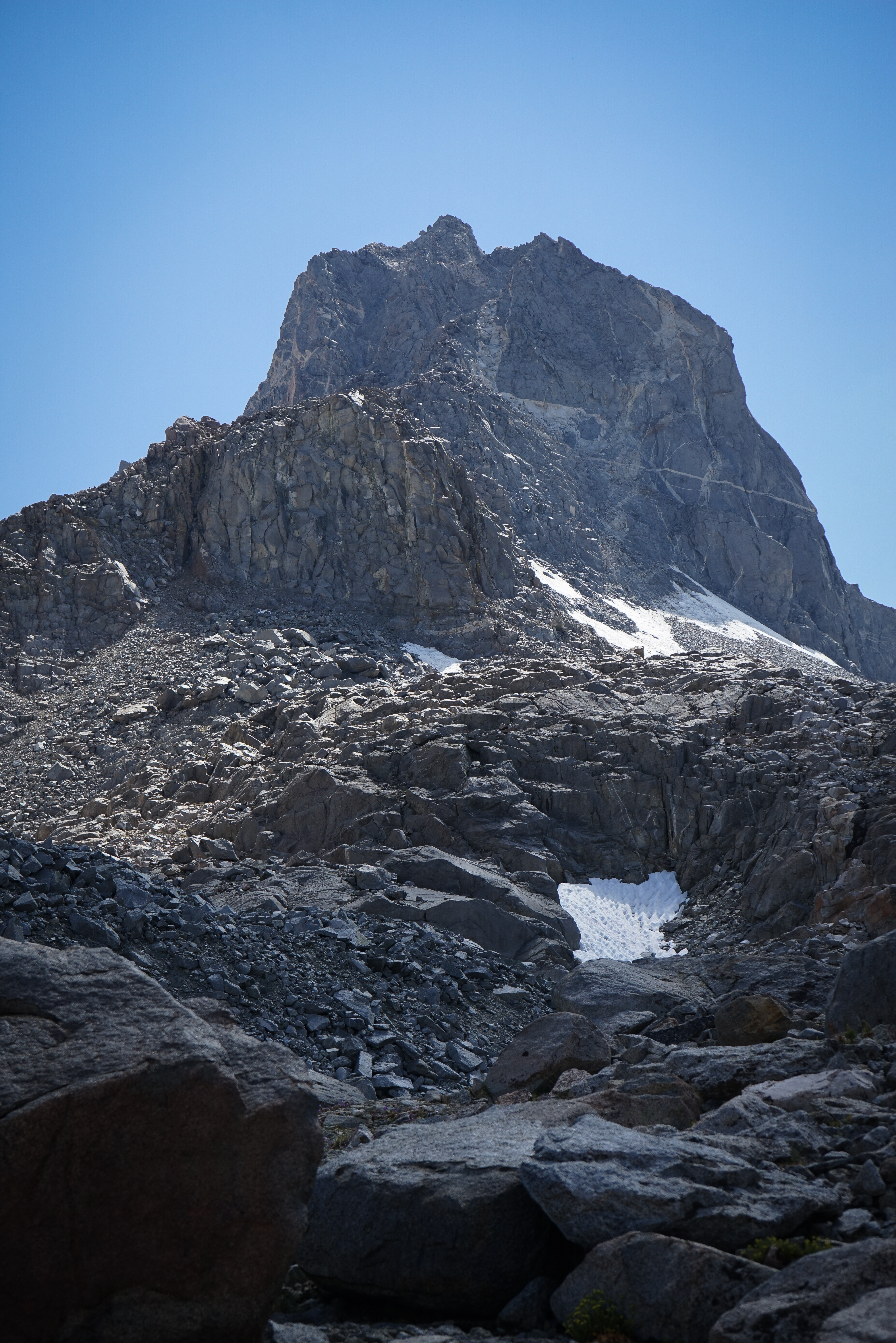
And our objective, Mount Winchell, almost due west.
Above the small lake, we climbed about 50 vertical feet up onto the massive moraine of the Palisade Glacier and continued making very slow progress towards Mount Winchell. I initially wanted to cut off a little bit sooner, aiming for what I thought was the East Arete and the white rocks, but Shannon pointed out that Secor had said to wrap around closer to the Thunderbolt Glacier. She was right and so we continued rock hopping upwards.
Impressive looking Mount Sill to the south.
It was almost 11 by the time we reached the base of the correct route, which we confirmed because we saw the other hiker coming down. Between the altitude and the vast sea of large talus, we were not moving particularly fast today. Fortunately, the weather was holding.

Looking up towards the two chutes. It looks quite steep from this vantage point. We started up, intercepting the other hiker we had run into earlier. We asked for a bit more information about the route and he said he thought it wasn’t too bad, just follow the directions. He assured us that it looked much worse from this angle.

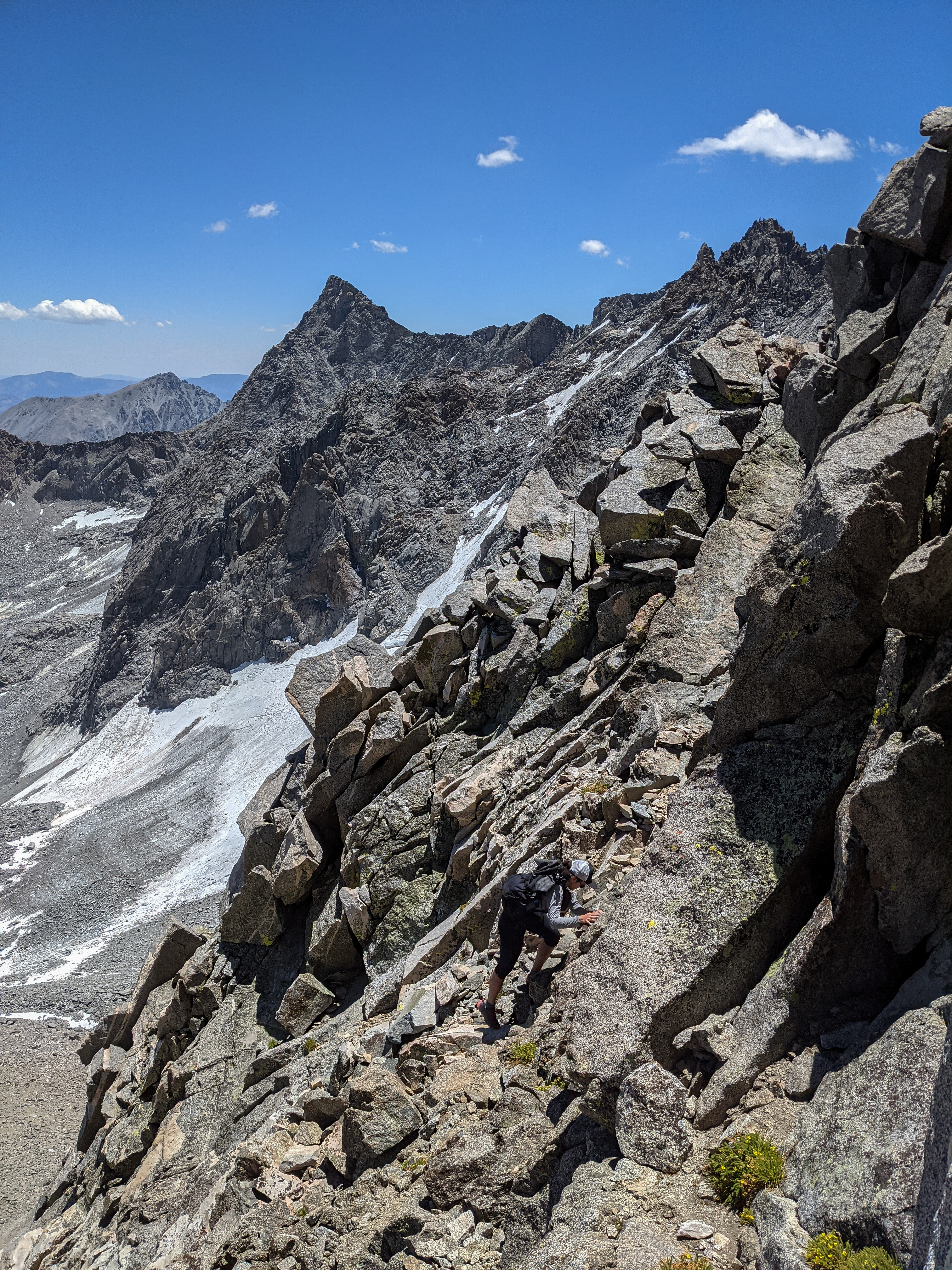
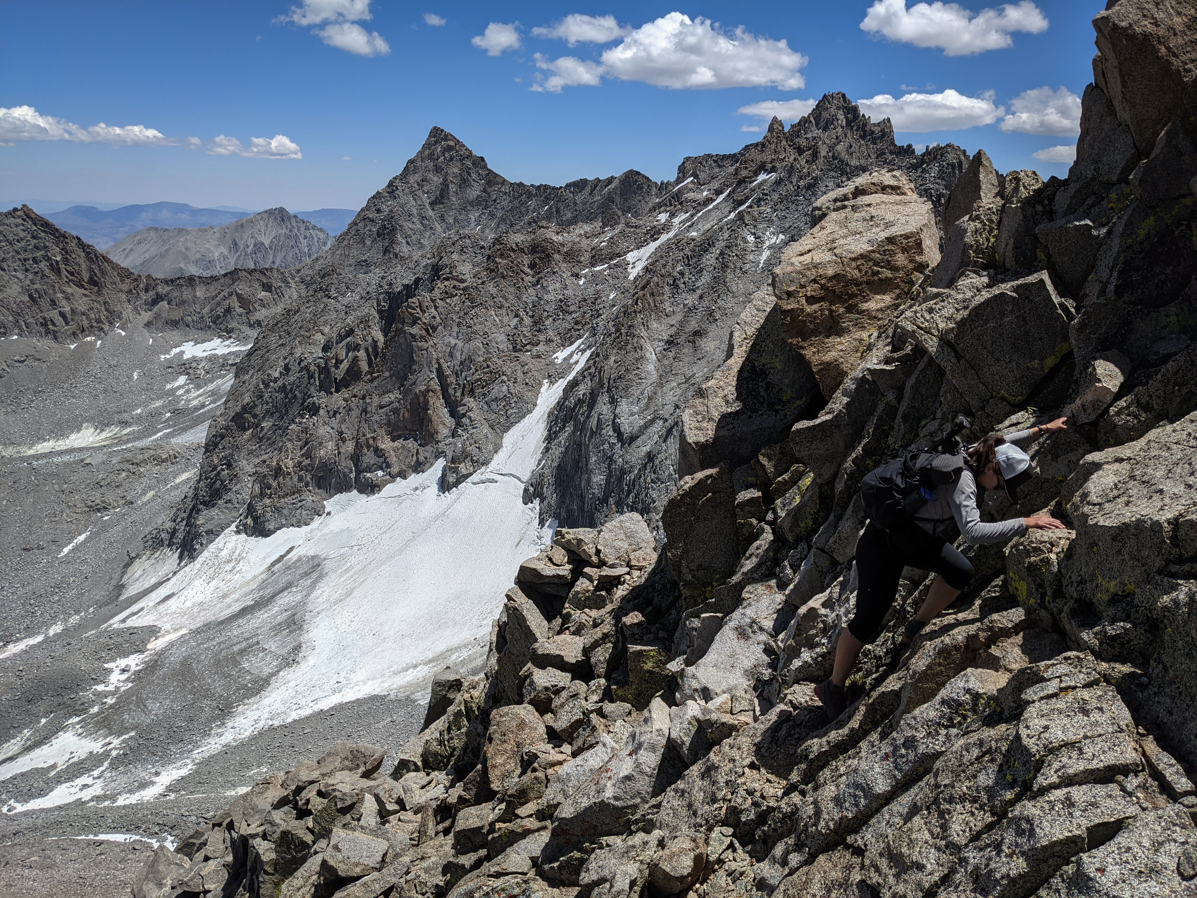
Shannon climbing up the right chute. It was actually not bad at all and quite fun. Once we got most of the way to the top, the band of white rock appeared and we negotiated a tricky 20 foot section to surmount it and cross over to the other chute. Then it was an easy but exposed traverse across the left chute to gain the arete.

Shannon climbing atop the left chute, just before reaching the arete.

Shannon on the arete. It was one of those climbs that’s great for photos because it appears considerably more exposed and steep than it feels, so I stopped and snapped away every 20 feet or so.
Zigging and zagging up towards the summit.
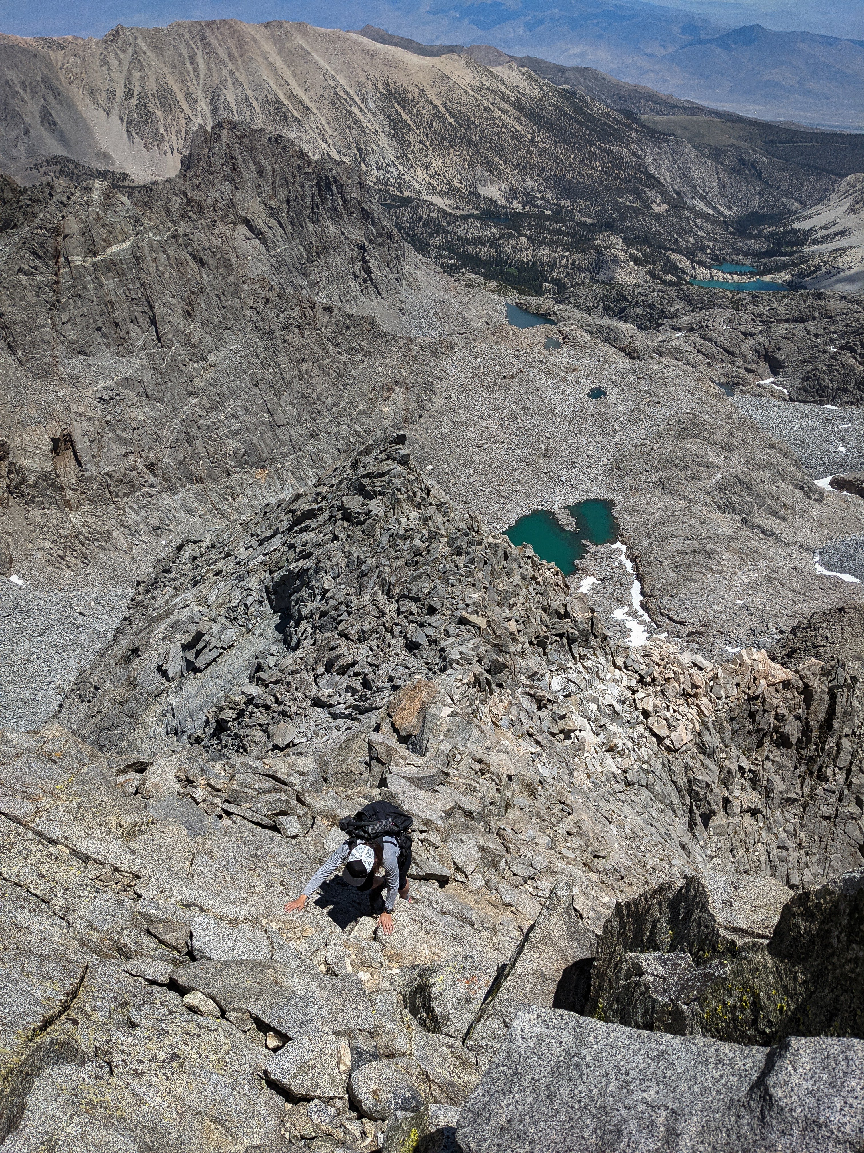
On the arete again, very close to the summit. At about 1 o’clock we reached the summit under beautiful, mostly clear skies. It was a small perch, just big enough for the two of us and with an awesome view.

Mount Sill to the south.


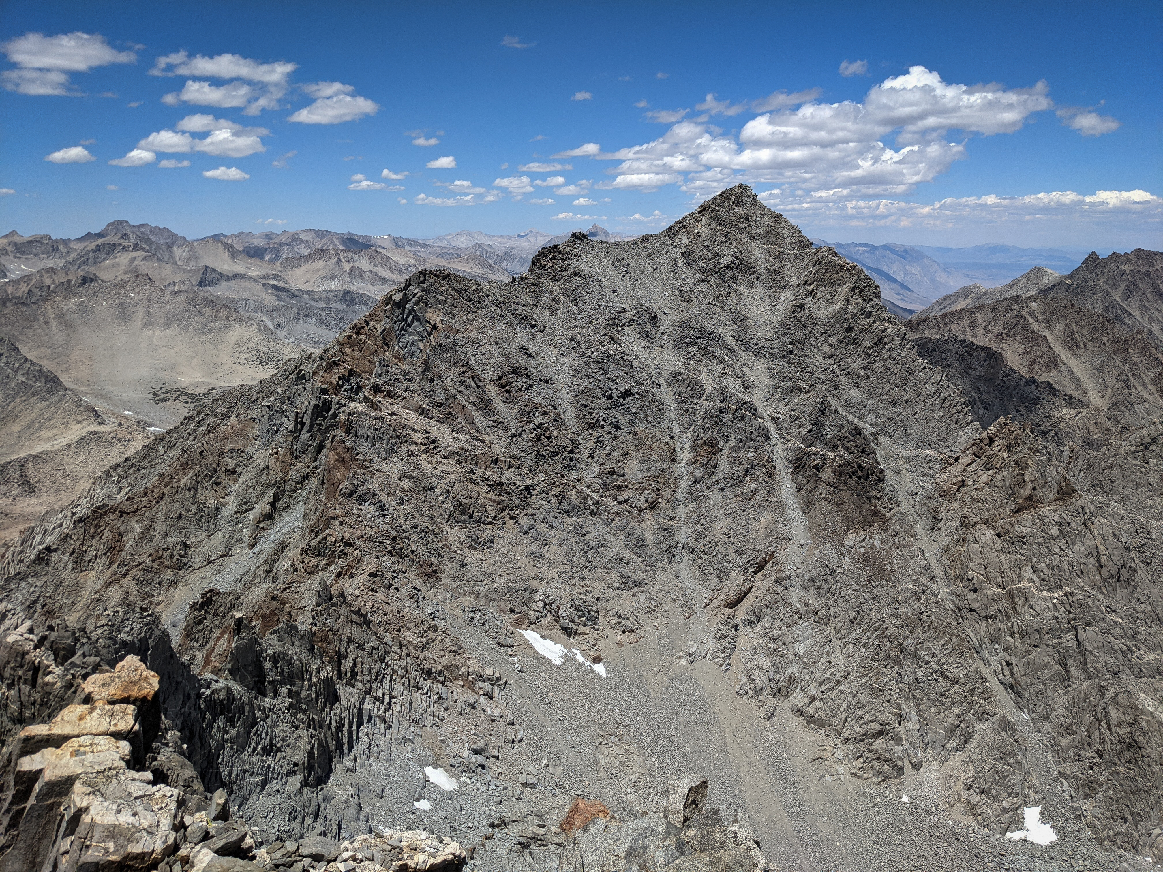
The North Palisade massif to the south.

Looking southwest over the High Sierra.

The Dusy Basin and Black Divide to our west.

A jumble of mountains just north of Bishop Pass, including Mount Darwin.

Mount Agassiz to the north.

Shannon enjoying our fantastic perch.
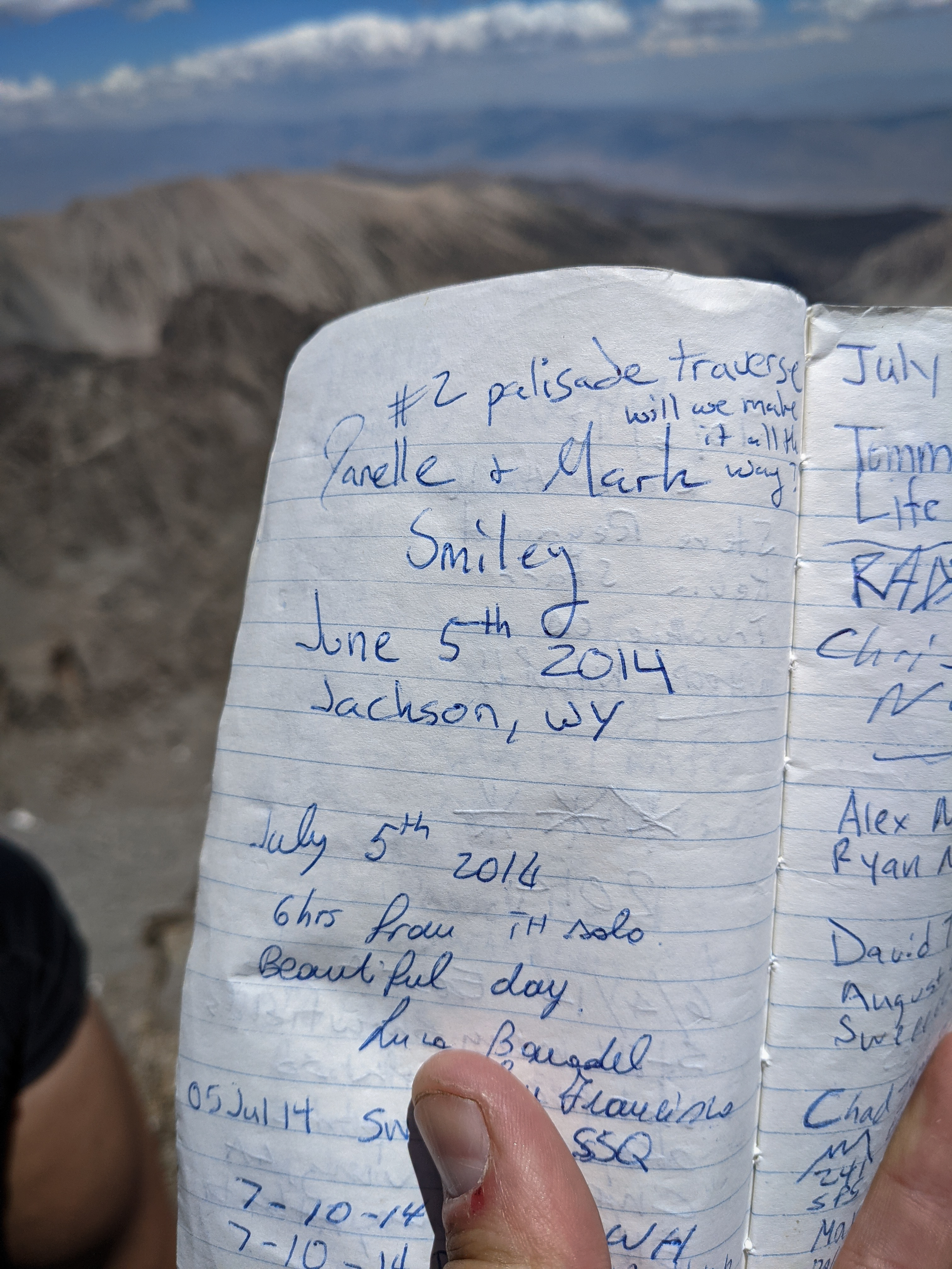
The summit register was not too busy. There were several entries from parties doing a traverse of the Palisades, including the Smileys. After an extended break enjoying the lovely summit, we headed back down.

Looking down the upper part of the east arete.

Shannon leading the way.

Down-climbing and traversing towards the white rocks. It was a little bit more tricky to reverse the climb down the white rocks, but we made it safely into the right hand chute.

Looking through the notch between Mount Winchell and Thunderbolt Peak.

After a fun scramble down, we were back on the talus next to the moraine. Here’s another view of the route from below.

Looking over towards Mount Sill. It was about 3 o’clock by the time we were off of the climbing route, so we definitely wouldn’t have time for Mount Gayley as well. We also didn’t think we could climb it without crossing a snow/ice field, and didn’t have the gear for that.
Looking back up at Mount Winchell. It looked quite impressive from this angle!
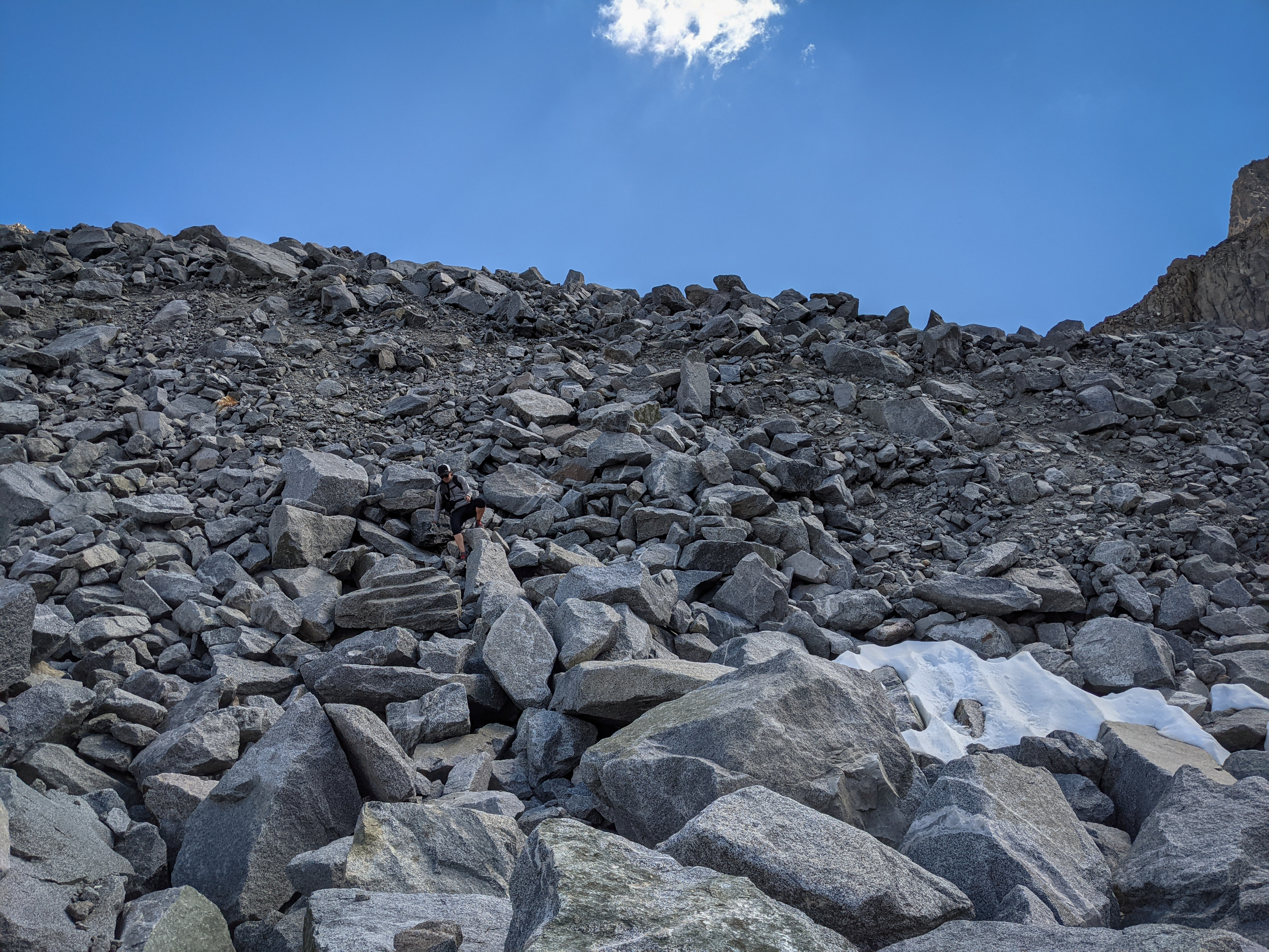
Shannon climbing down off of the moraine. We tried to follow a slightly different path through the boulder, but it didn’t seem to save us any time really. It was just really difficult travel over these large, loose rocks.


The little lake at the end of the moraine.
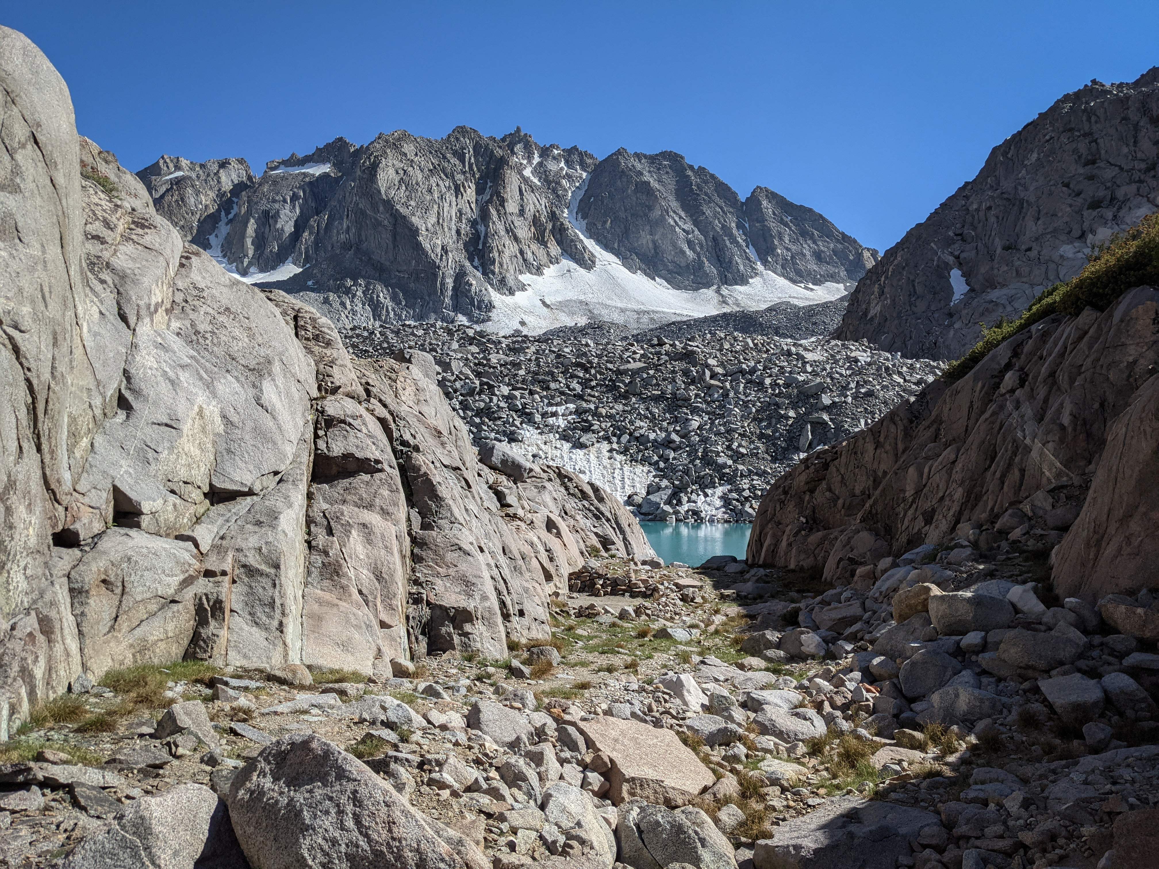
There was a small, semi-protected bivy site next to this lake.

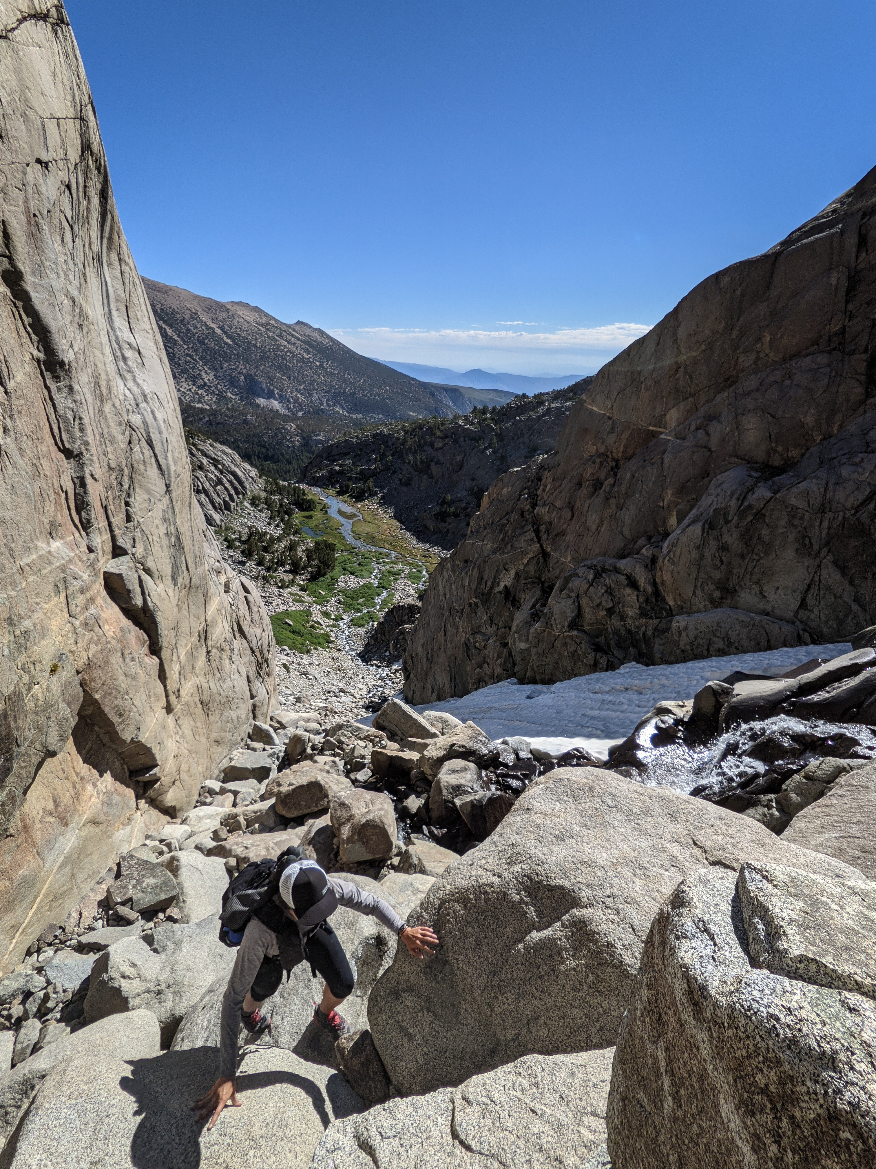
Sam Mack Meadow from above. We were almost back on the trail! We just had to negotiate the bouldery, snowy, waterfall-filled gully.

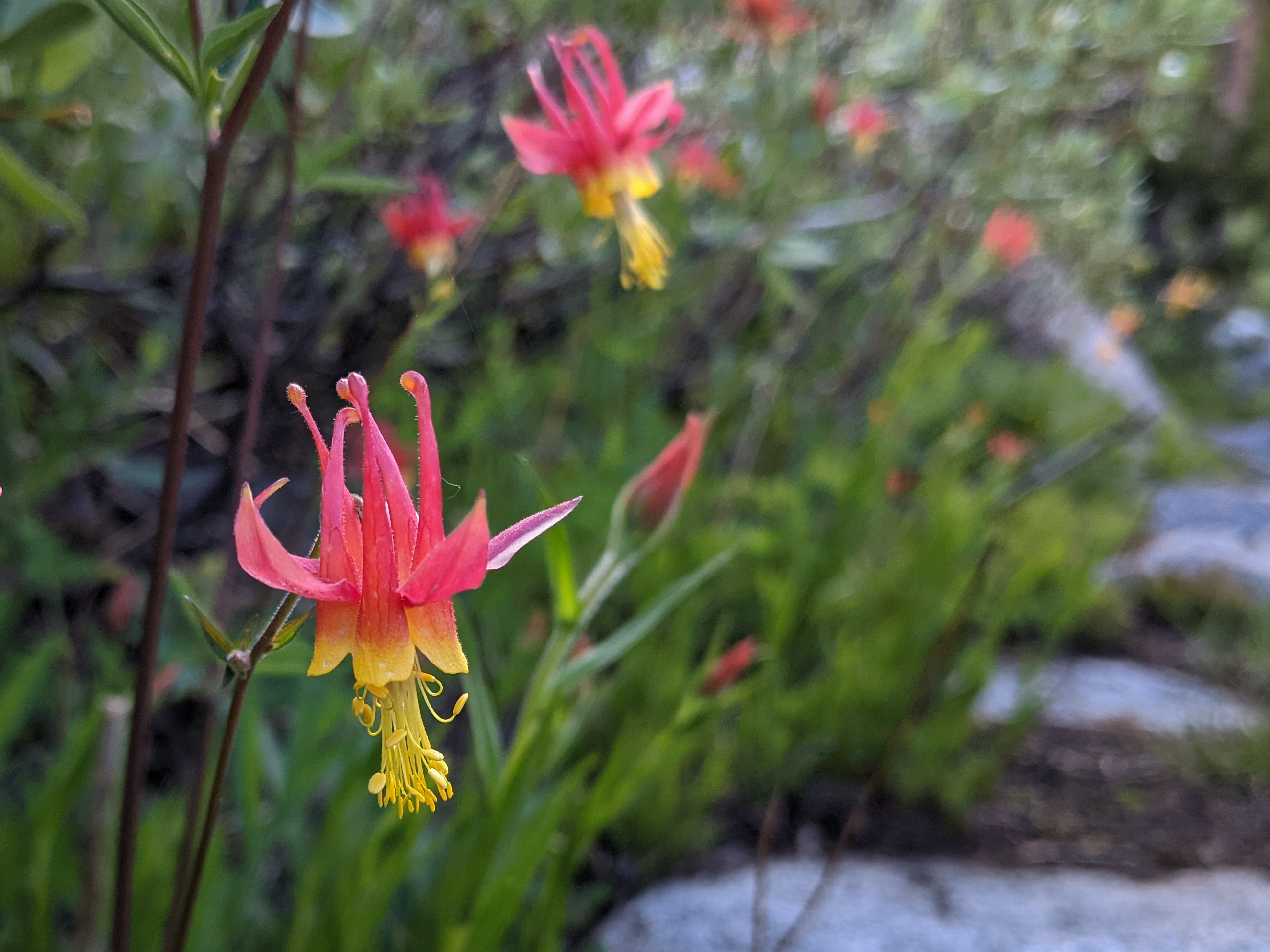
Some wildflowers along the trail near Sam Mack Meadow.

Sky Haven across the basin as we descended along the trail back towards Fifth Lake.
We got back to camp at about 6:30, having taken 11 hours to climb up and down Mount Winchell from Fifth Lake. We both thought it was a great climb, although the difficult travel through the moraine section was somewhat less pleasant. A necessary chore, I guess.
I went down and filtered some water from the lake and then we cooked up some dinner.
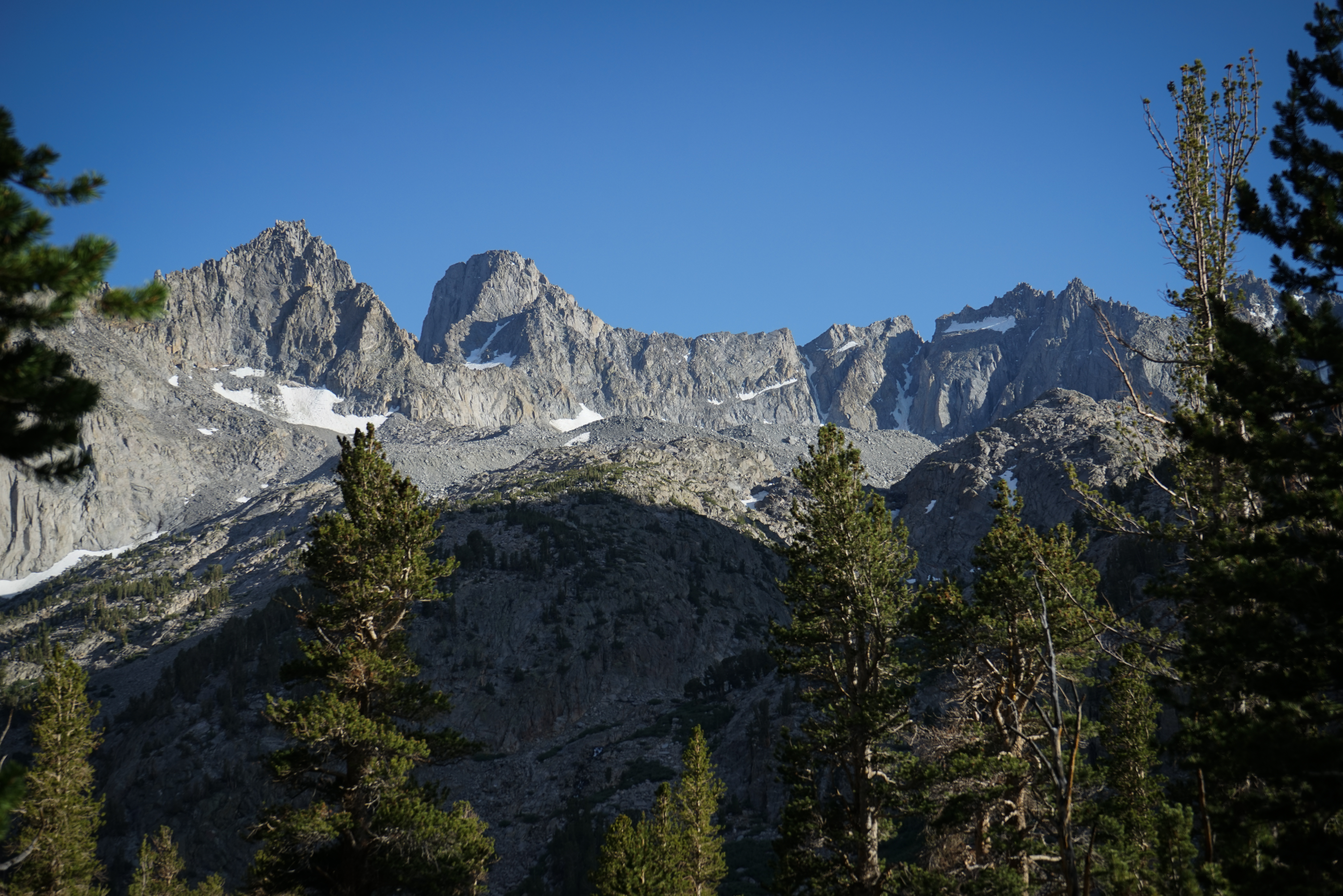

Mount Sill and North Palisade from camp.
We headed to bed with a plan to climb Cloudripper the next day. We figured it must be a bit easier than Mount Winchell, and the weather looked good, and so again we decided in favor of sleep instead of an alpine start.