I got up at 2:45AM the next morning, excited and a bit nervous for our big climb. I brewed up a couple of cups of coffee for the two of us. Shannon was up soon too and we caffeinated and tried to eat some breakfast as our bodies protested the strange hour. We secured the tent and all of our things in case another thunderstorm came through and by four we were ready to go.
The routefinding was not easy in the dark. Fortunately it was very easy travel over large slabs and if we just went up we were mostly heading in the right direction. We zigged and zagged up towards the glacier, looking for the easiest routes that we could see in the limited light. Eventually we made it to about 11,800’ where the easy climbing transitioned to talus and we began hopping from rock to rock in the predawn light.
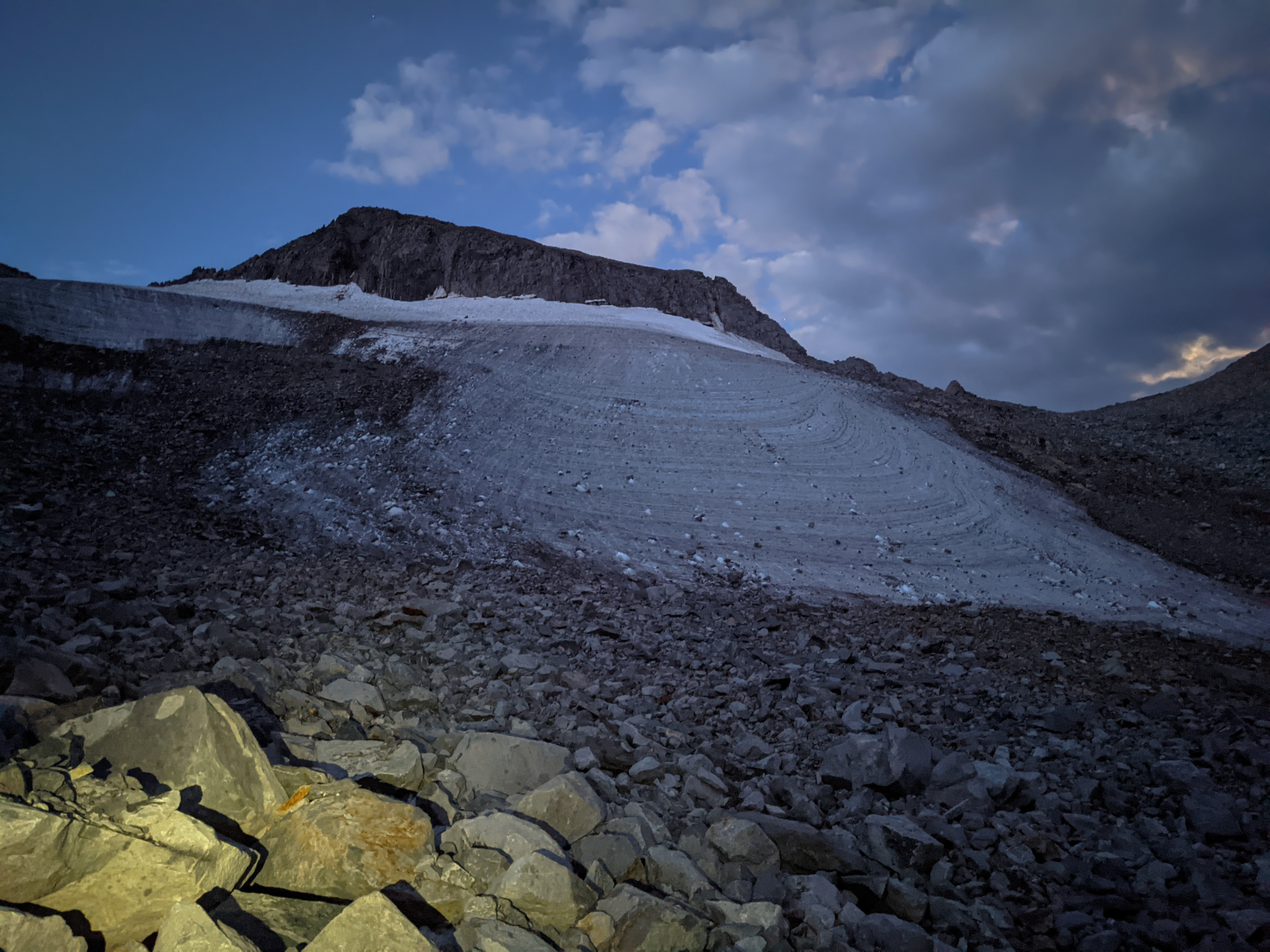
Playing with my phone’s nighttime photography mode just below the end of the glacier.
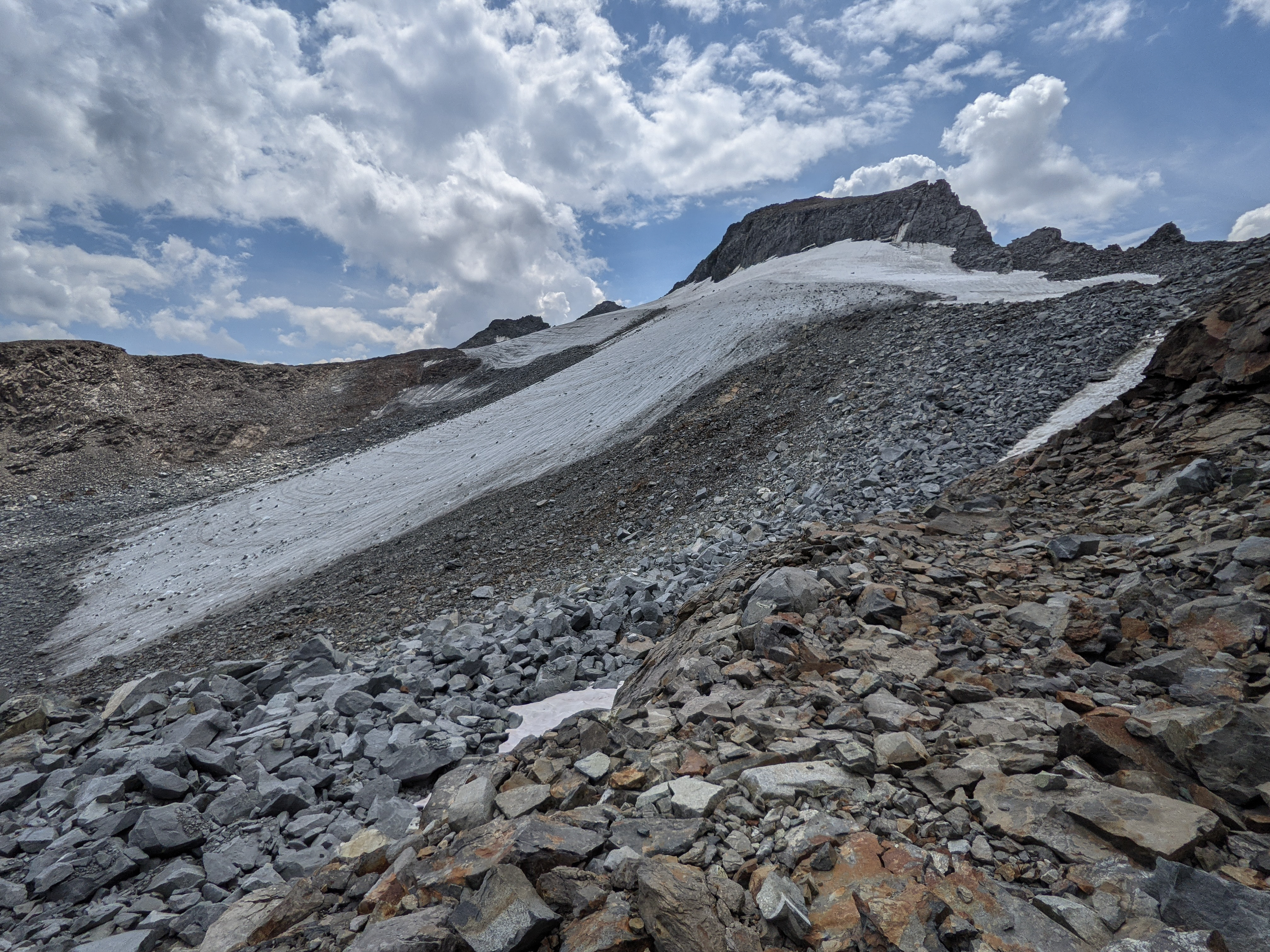
We continued climbing as the sun rose a beautiful pink and purple. It was light enough to switch off the headlamps when we reached the button of the glacier, and light enough for photos when we were maybe 100’ below Lyell-Maclure Col. We had managed to completely avoid the snow and ice, sticking to the rocks. As we climbed up beside the glacier we saw a few large rocks fall down a chute near the middle of the glacier. They would fall down the chute and hit the snow hard, falling several hundred more feet down the glacier. We were glad to not be climbing directly up below the loose gully.


A beautiful sunrise over Lyell Canyon.
As we neared the Col, we faced a decision. We could stick to the rocks, crossing a couple of short sections of snow and climb directly to the col, then take a hard left and scramble up the rocks. Or we could climb up the snow for a little while before climbing onto the rocks. We chose the latter as it was more direct.
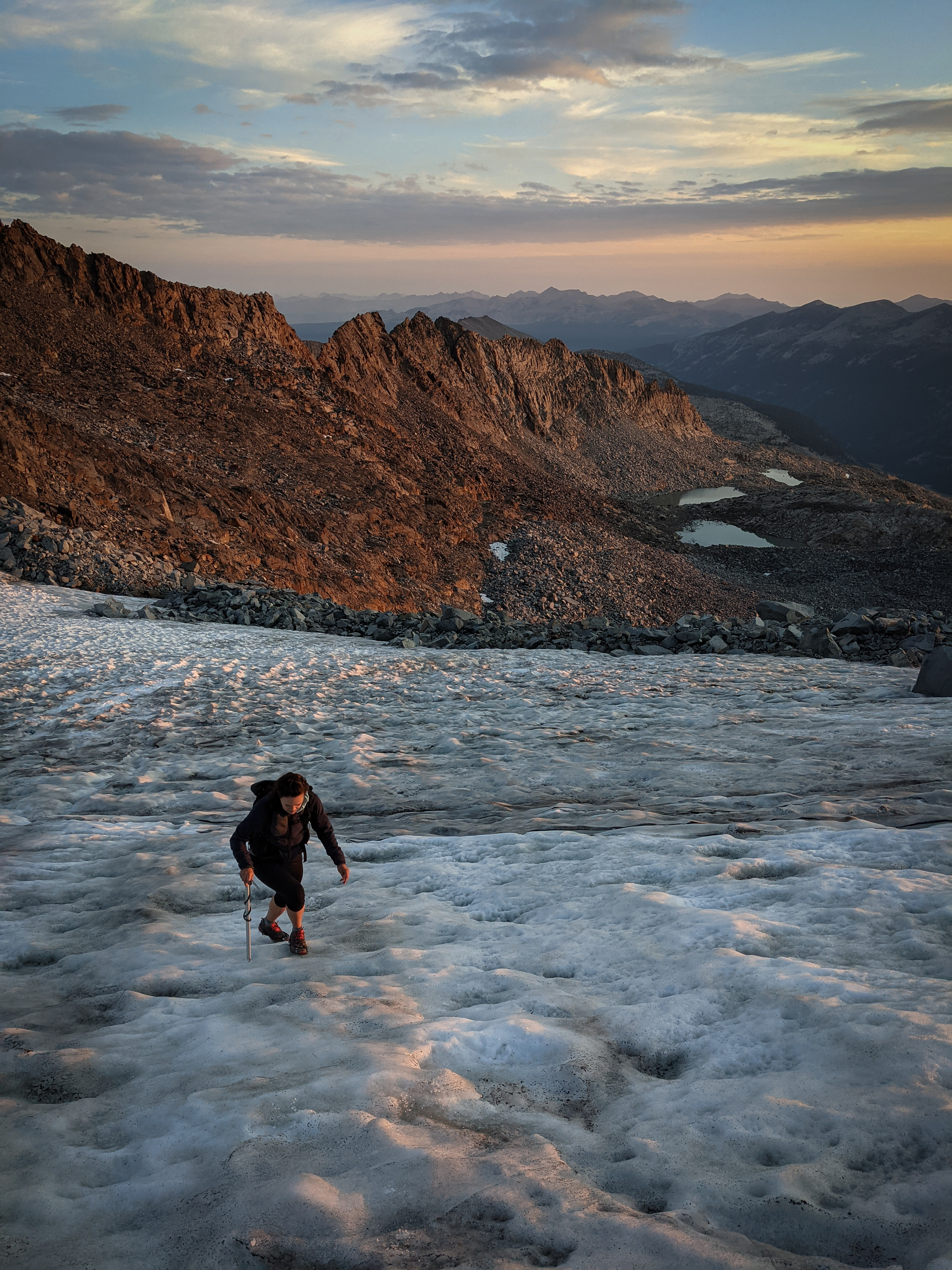
Shannon climbing snow towards the top of the glacier.
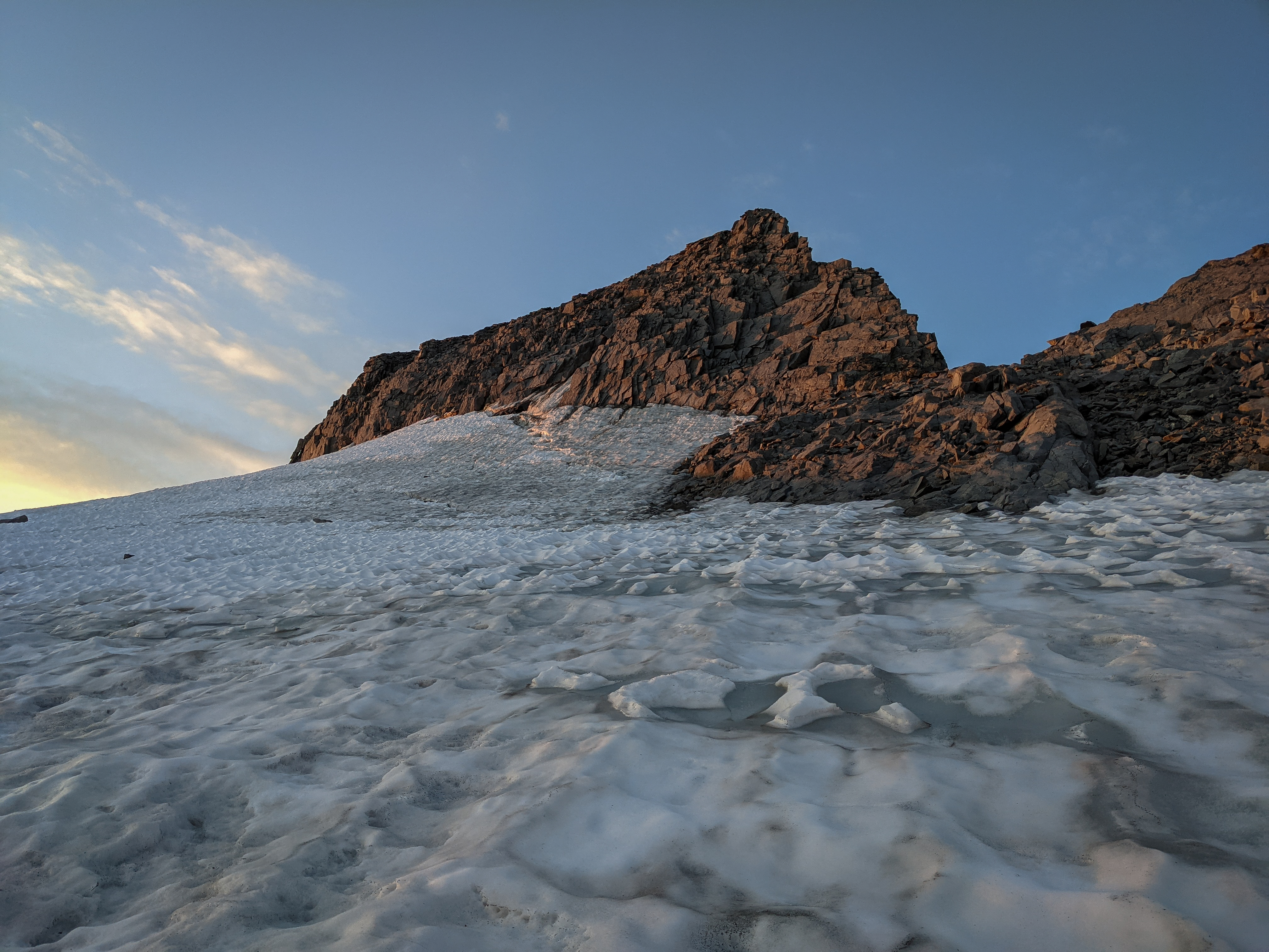
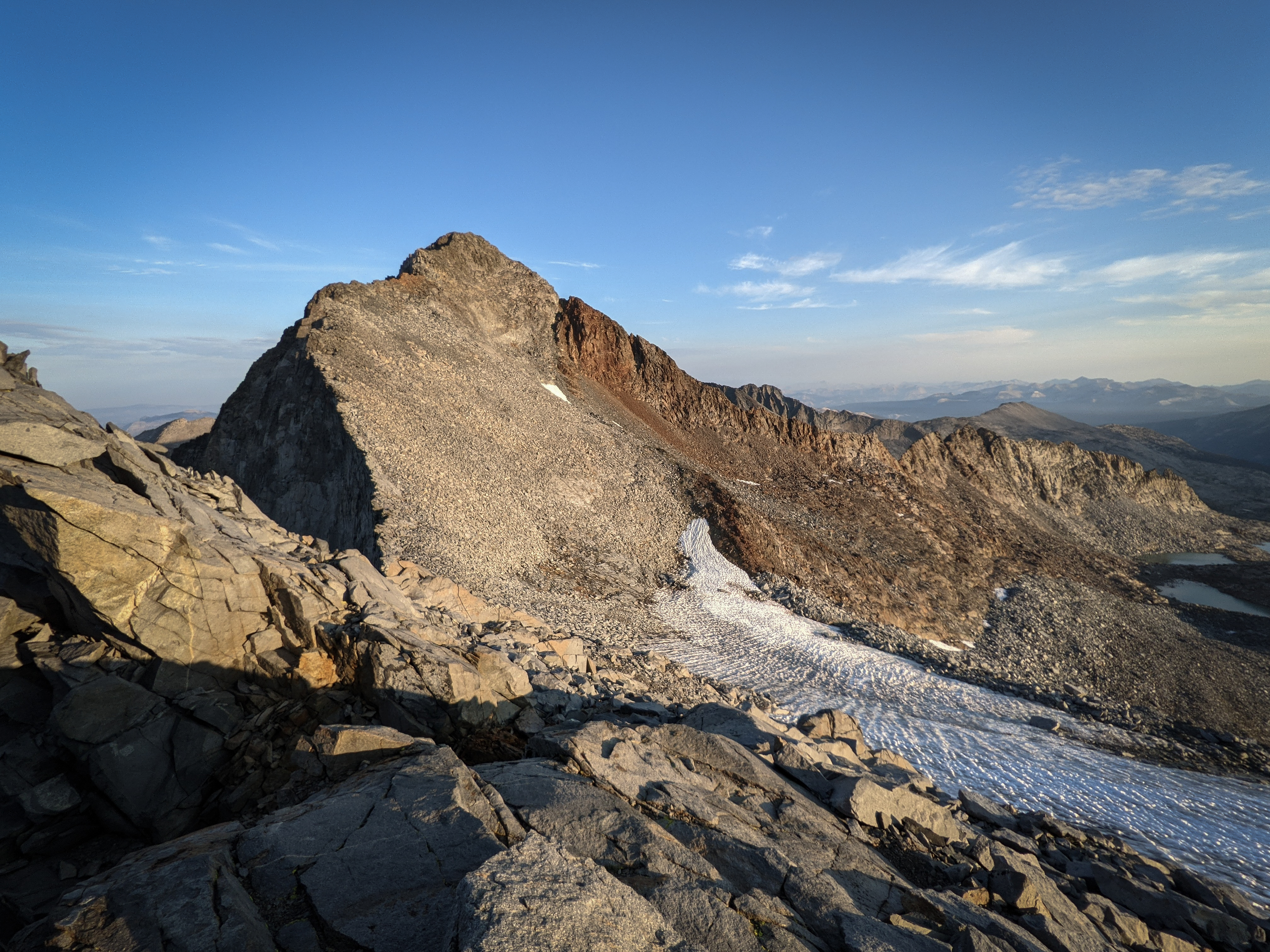
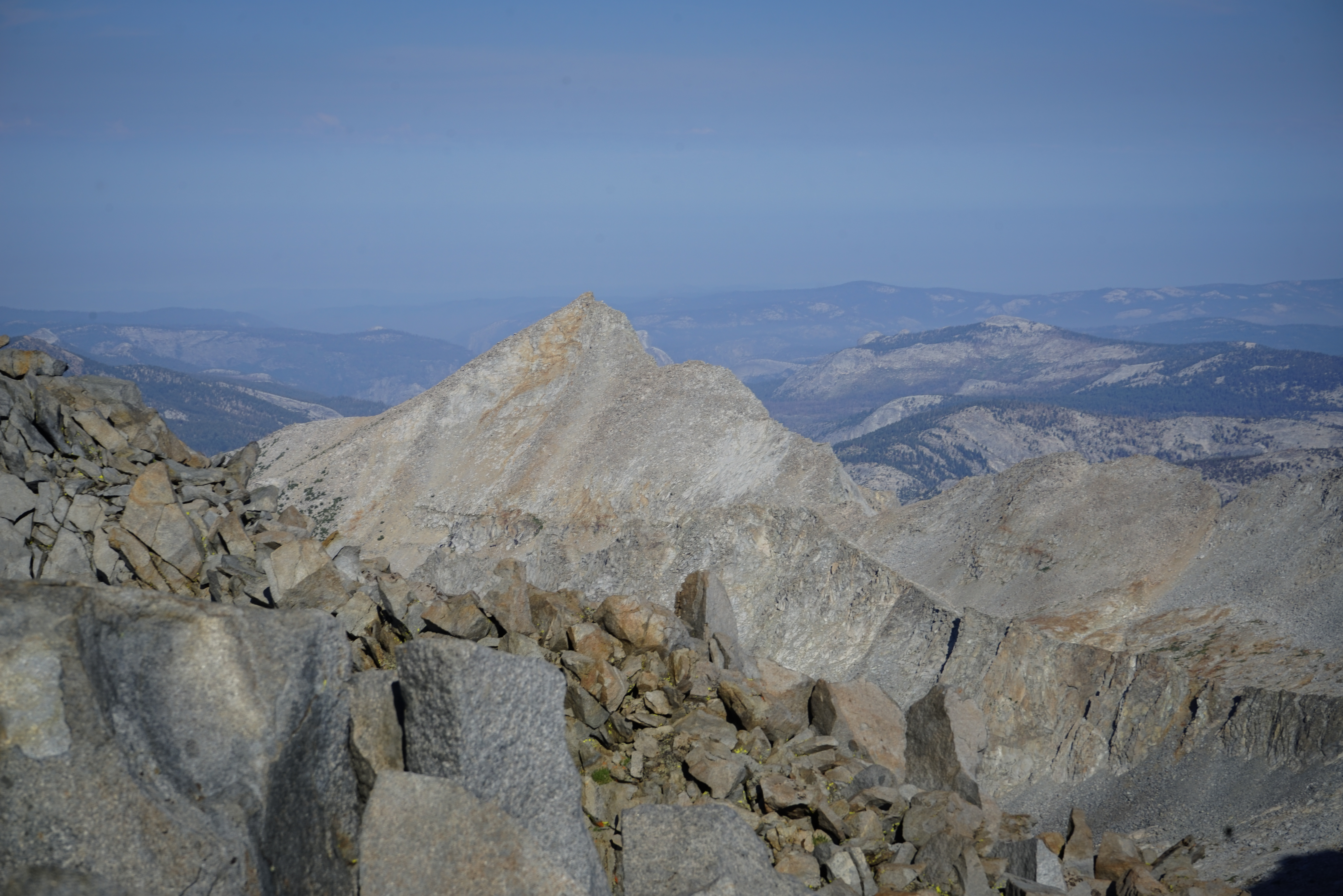
Looking up towards Mount Lyell. We were aiming for the rocks just left of the ridgeline at right.
Looking right towards Mount Maclure.
Unfortunately, right around this time we hit a bit of an impasse. The ice was becoming steeper and harder than our microspikes could be trusted on and we had slipped a couple of times already. We didn’t trust our footing for a short descent. We had accidentally made the rookie mistake of climbing into a position we couldn’t descend from. Classic! We were less than 50 feet horizontally from stable rock, but felt unsafe moving in any direction. After a minute or so of trying to problem solve, I came up with an idea. The problem was that the ice was smooth and very hard and our puny microspikes weren’t biting into it to gain enough traction for the slope. So I pulled a trick I had read about in old mountaineering stories, before crampons were invented, and began chopping steps into the glacier. By chopping up the hard ice so it became more textured and levelling out the foot-holds, we got much better traction. We headed directly right for the rocks, as that was the shortest way out of our predicament, but it took about 20 minutes of bent-over hacking away with my ice axe. Soon enough we reached the rocks and put away all our useless snow gear. We felt quite embarrassed by our silly mistake and glad that no “real” climbers had been around to see us chopping away at the glacier. At least we had realized it while it was still solvable. After a short break to shake off our mistake, we continued up.
Looking over at Mount Maclure from higher up.
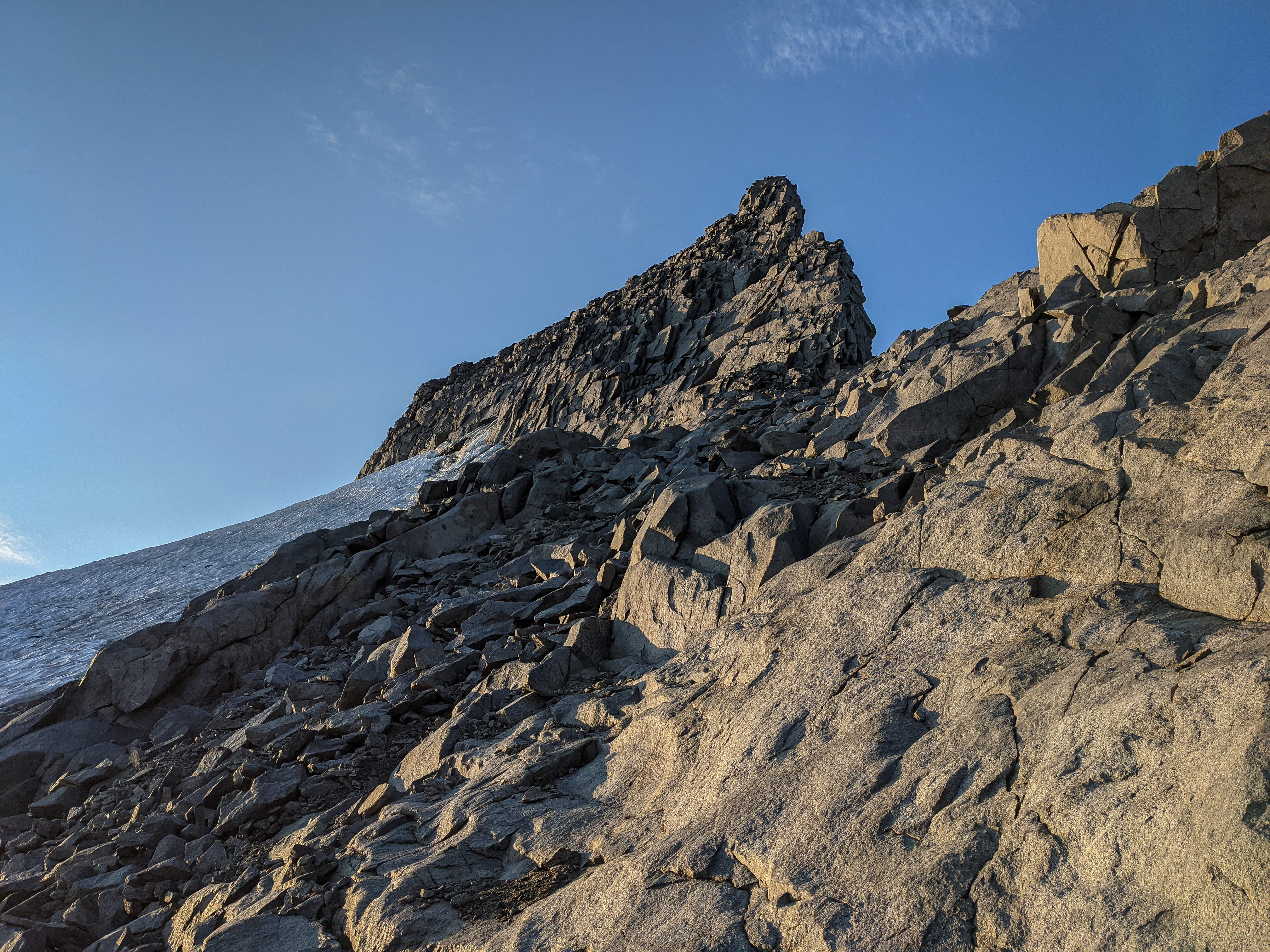
The difficult rock section of the route up Mount Lyell, from below. From here you can clearly see the differences that have appeared in this route in recent years. Old pictures of Mount Lyell show the glacier extending 50-100 feet higher, covering this steep stretch of rock.
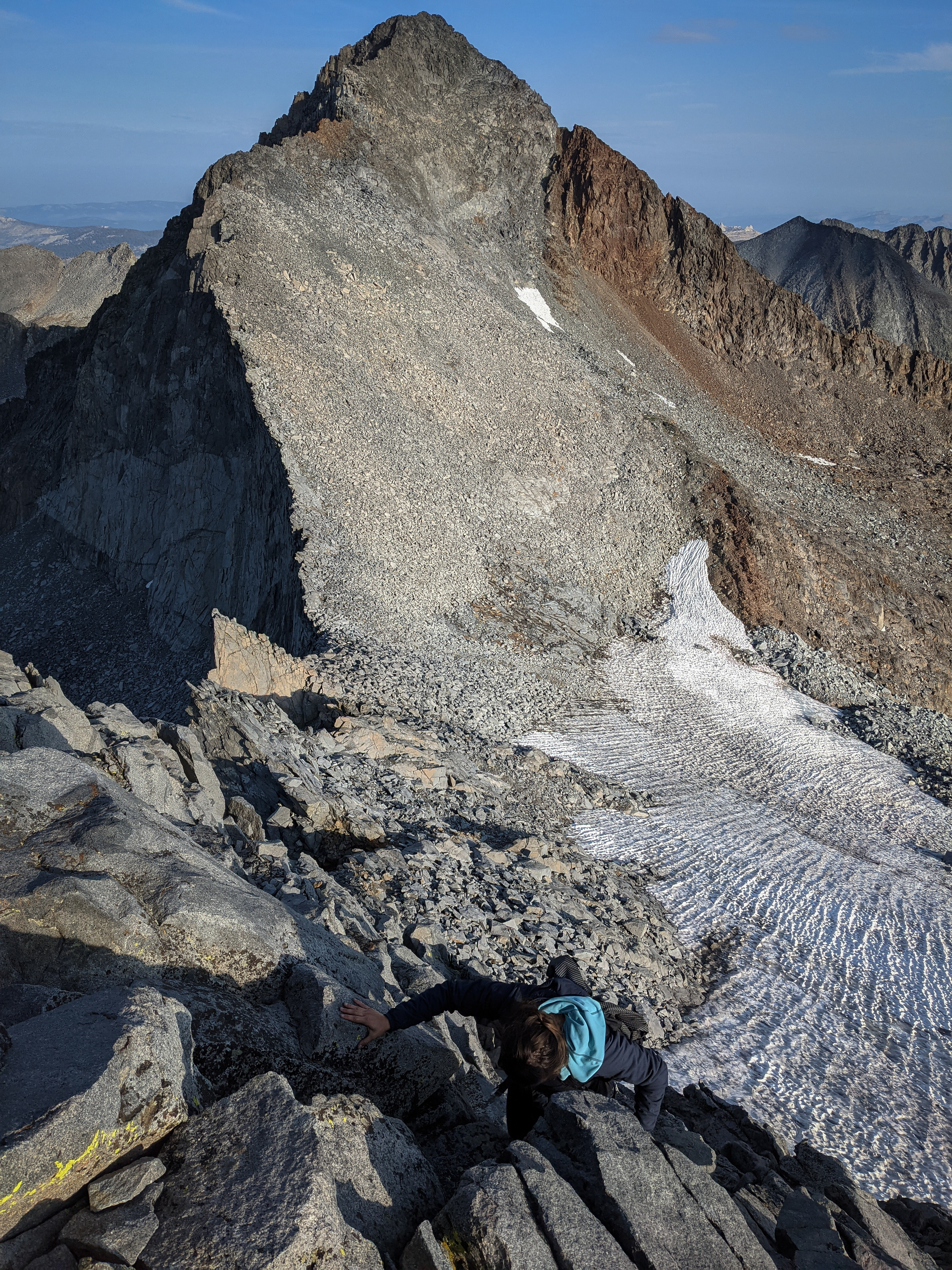
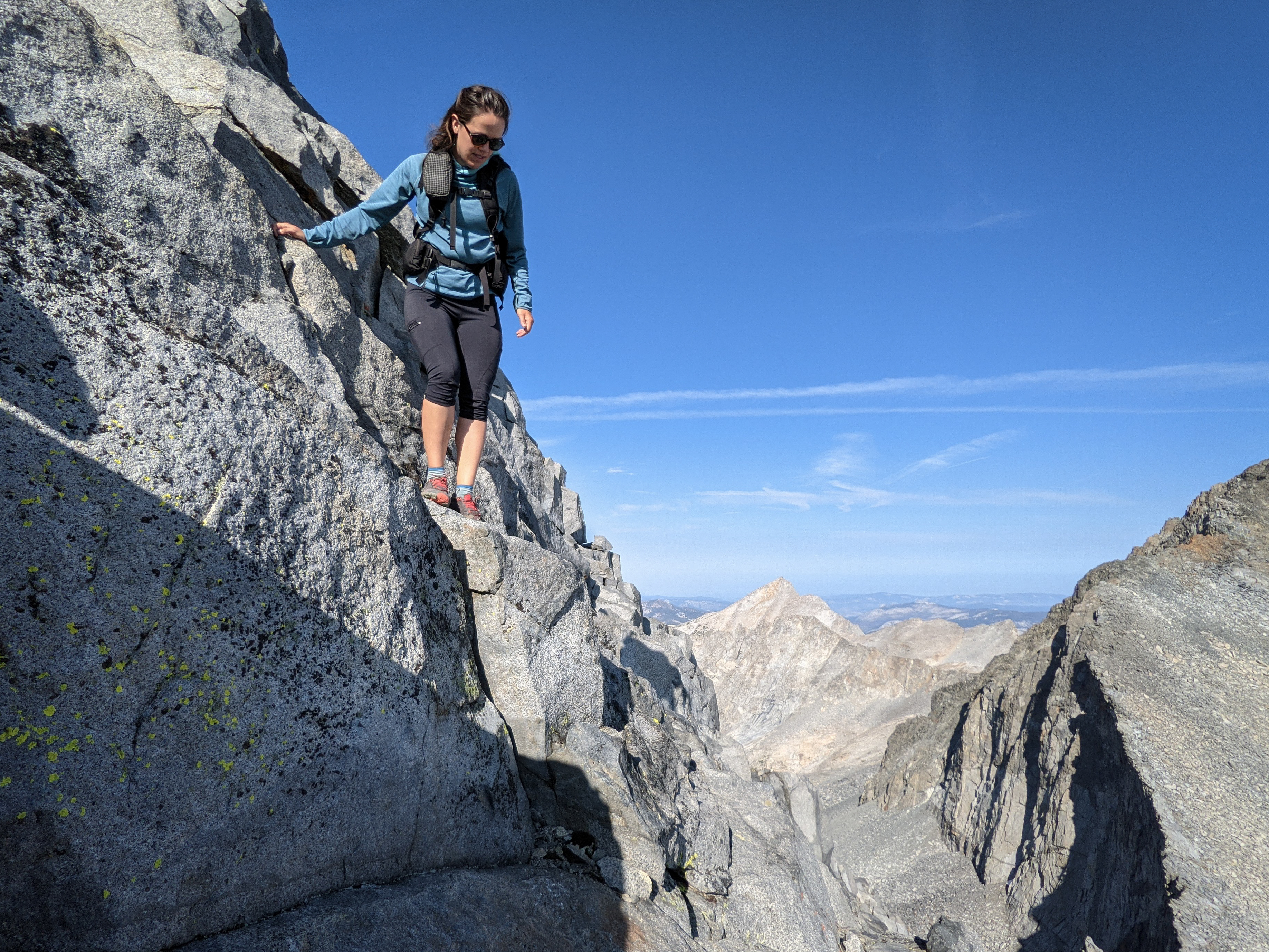
Now we faced our next challenge, how to negotiate this very steep looking 200’ of climbing. We tried several different routes up the face: first I tried sticking to the far right, which was the worst option by far; then we tried a little bit to the left of that (just right of the shadow in the photo), but a 20’ cliff blocked that route; then we tried cutting to the left but that way cliffed out with a 50’ drop off below; our final, successful attempt involved climbing left for a little bit and then going up through some broken rocks before cutting back to the right (mostly in the shadow above the cliff above the snow in the photo). It was definitely the hardest class 3 climbing I’ve done, with a few 10-20’ chimneys that we had to climb up. The holds were all great, but so was the exposure.
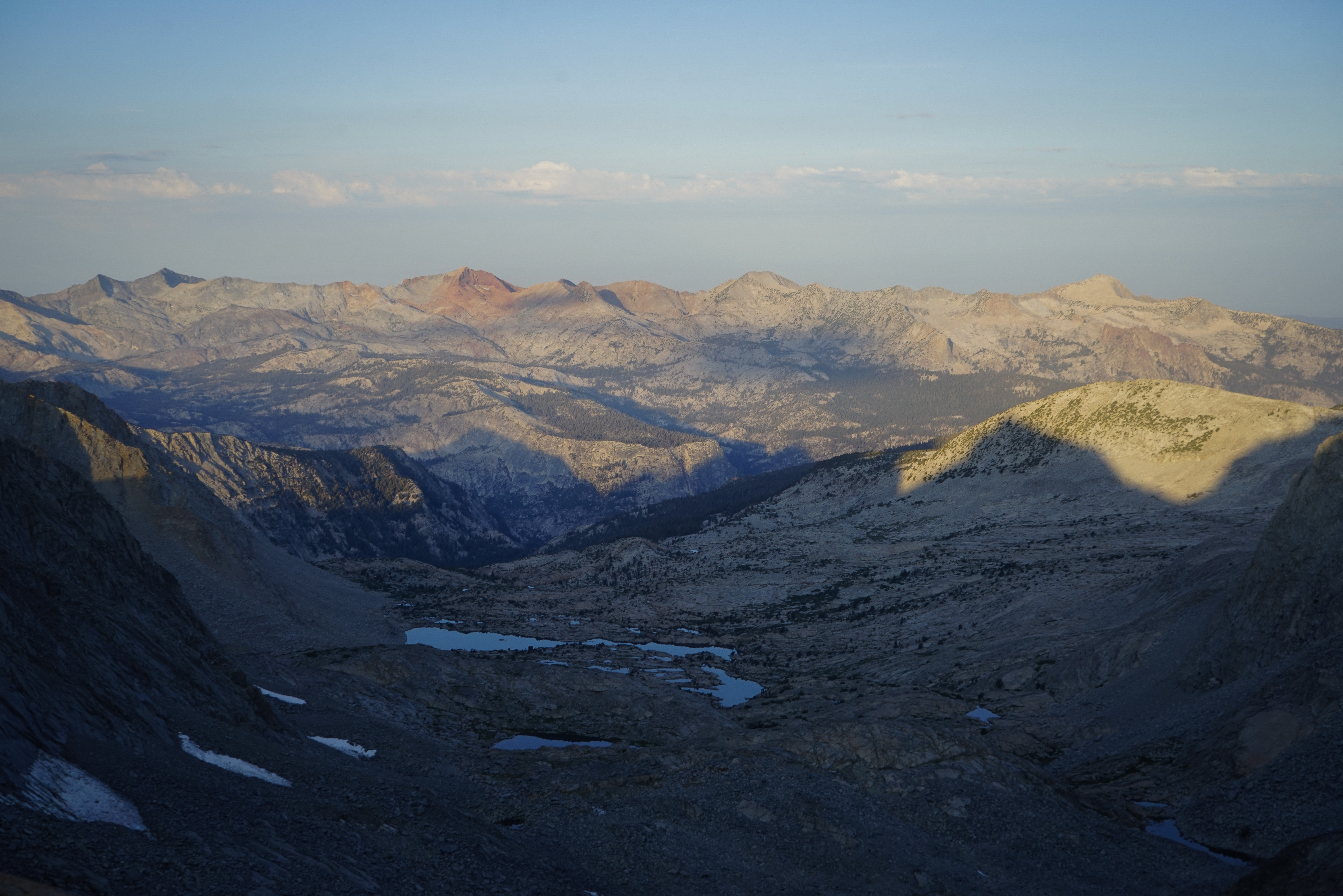
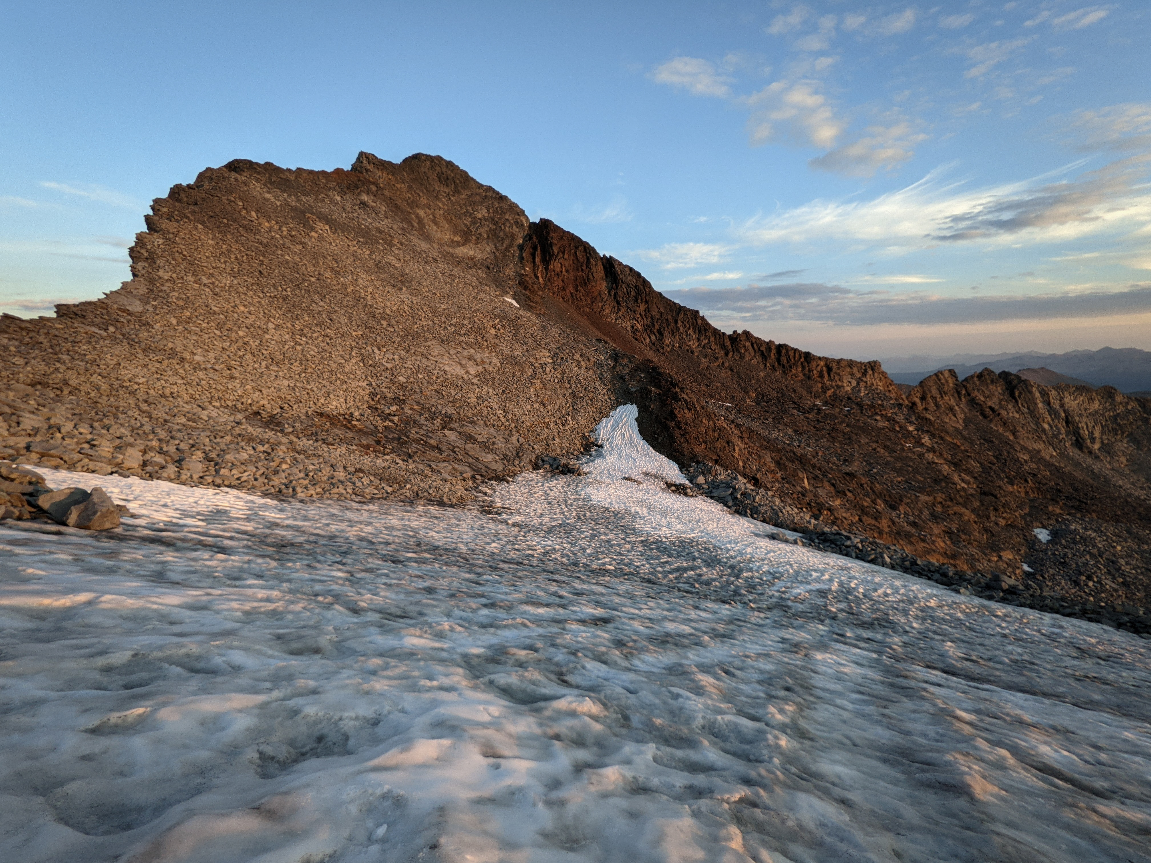
Looking west towards the Clark Range from near Lyell-Maclue Col.
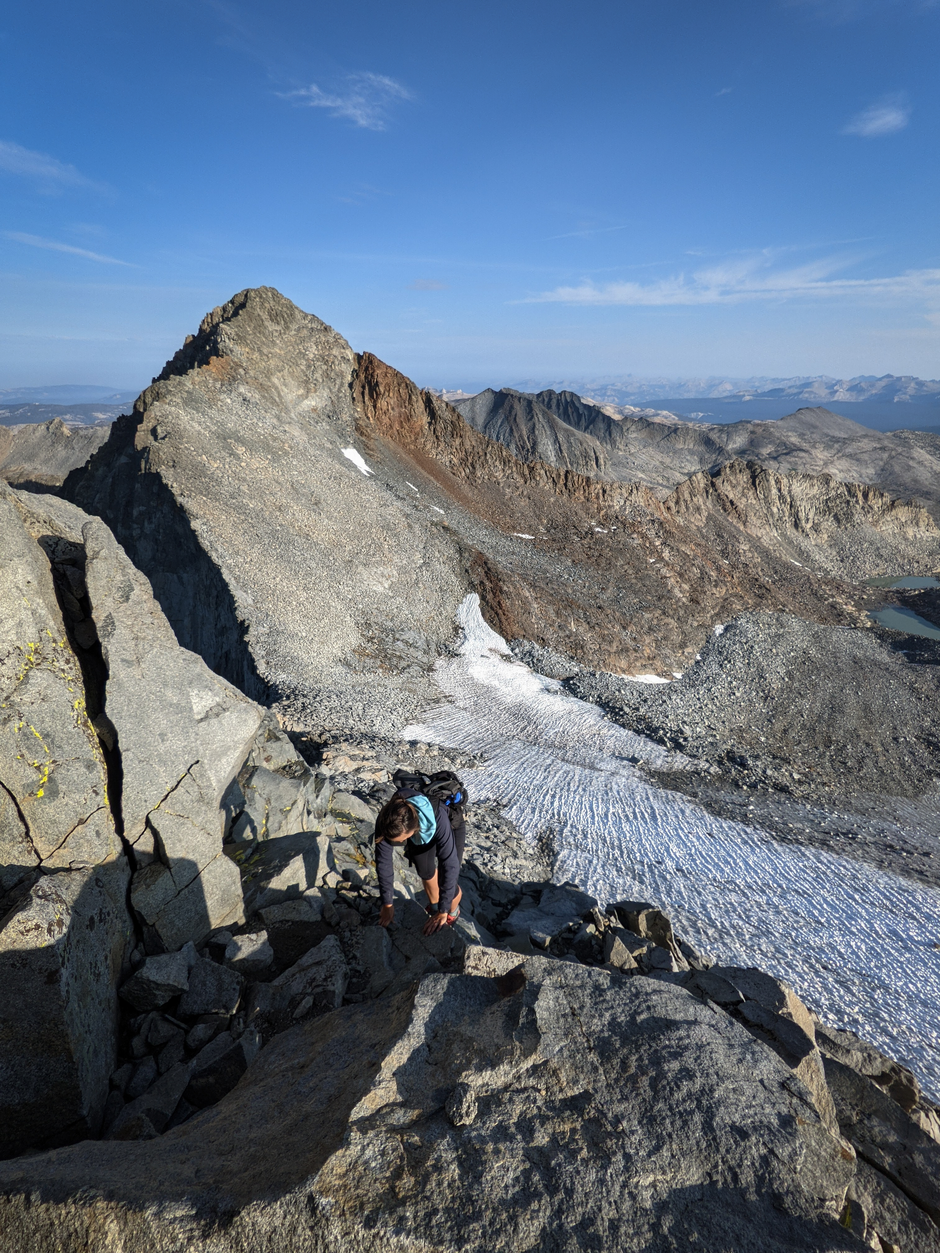
Shannon climbing in one of the easier sections, where I felt comfortable stopping for photos.

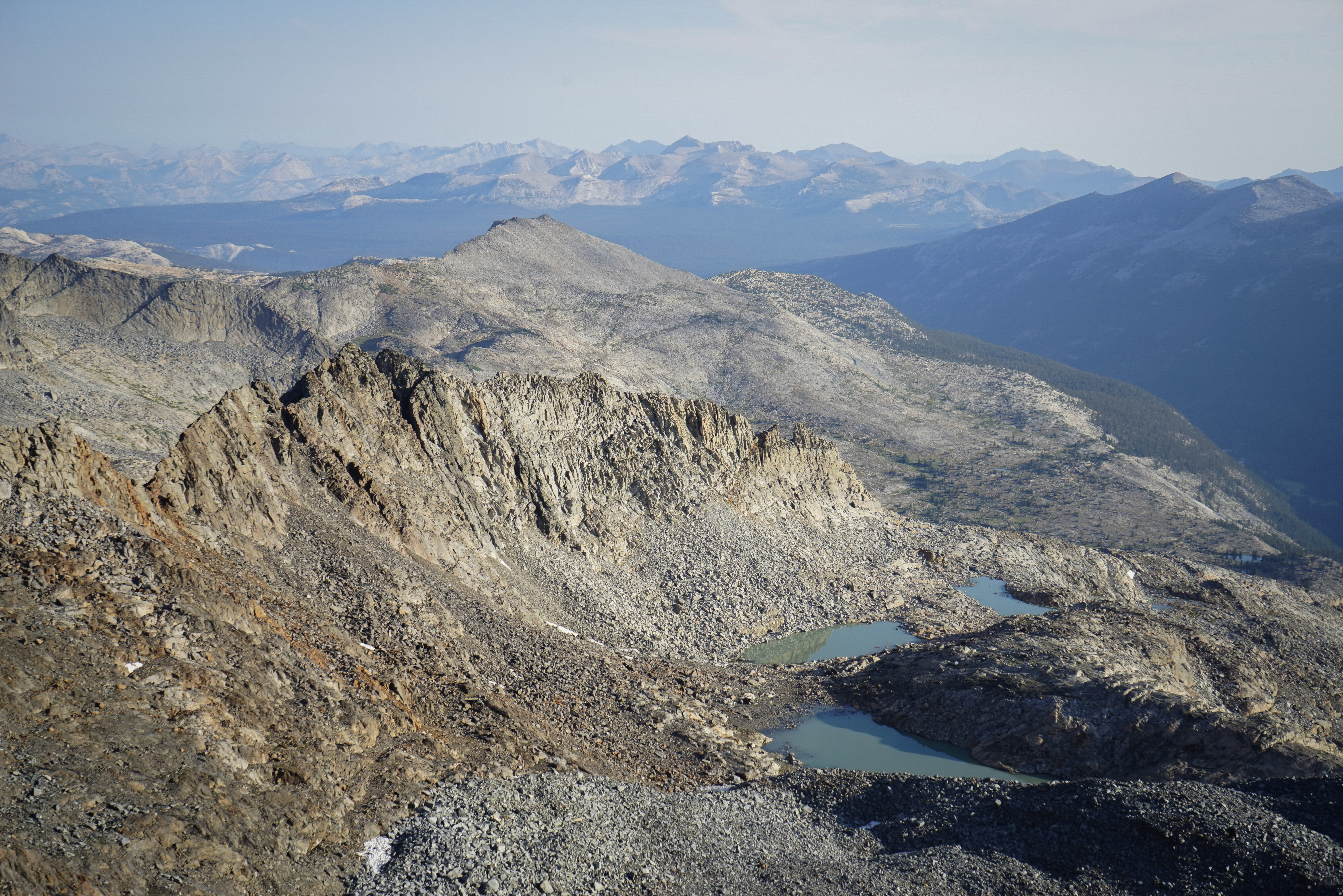
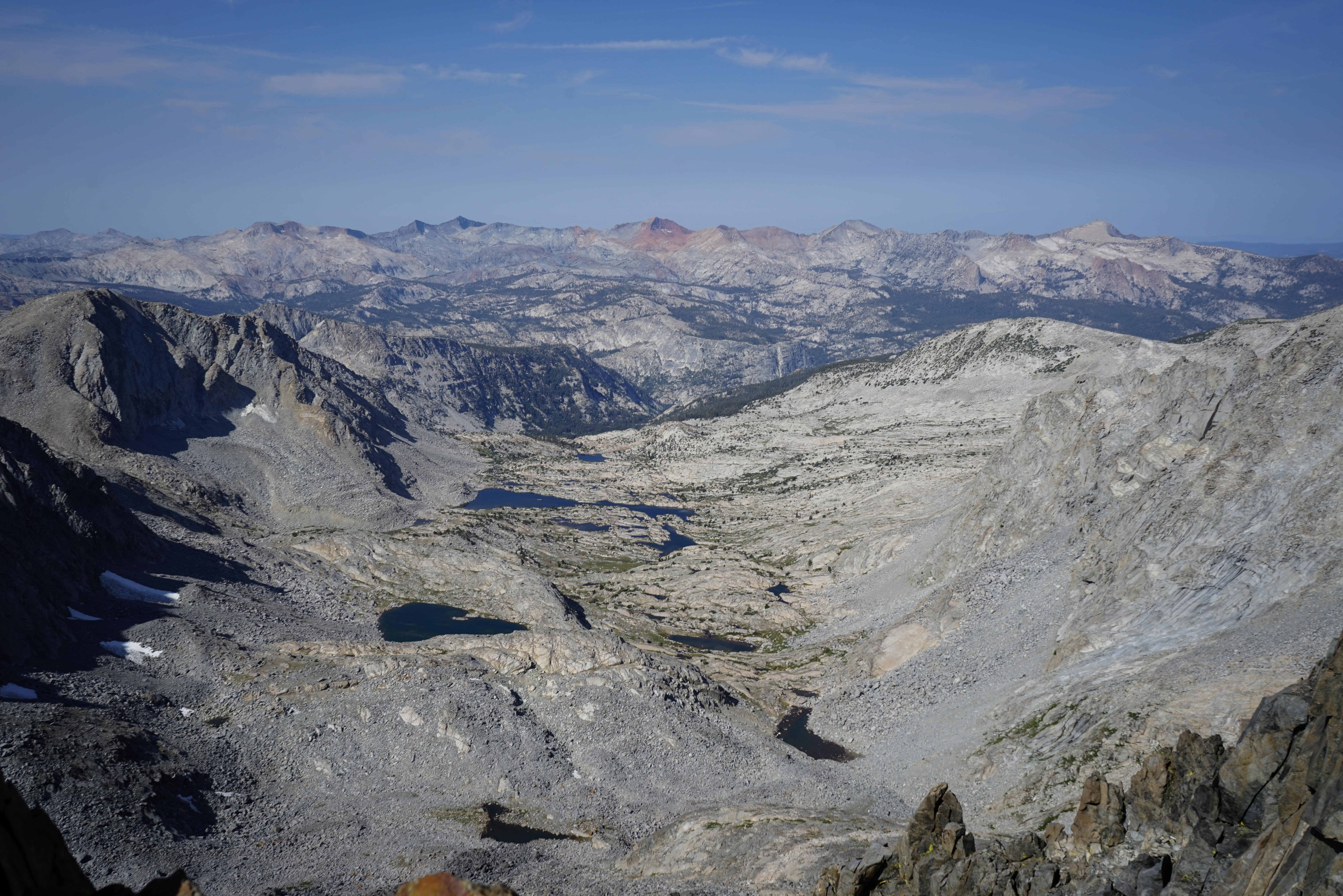
Looking north over Lyell Canyon and towards Mount Conness. After negotiating the difficult rock section, we gained a talus-covered summit plateau and boulder-hopped to the summit where we were treated with an incredible view in all directions.


Looking south towards Rodgers Peak, and the Ritter Range.

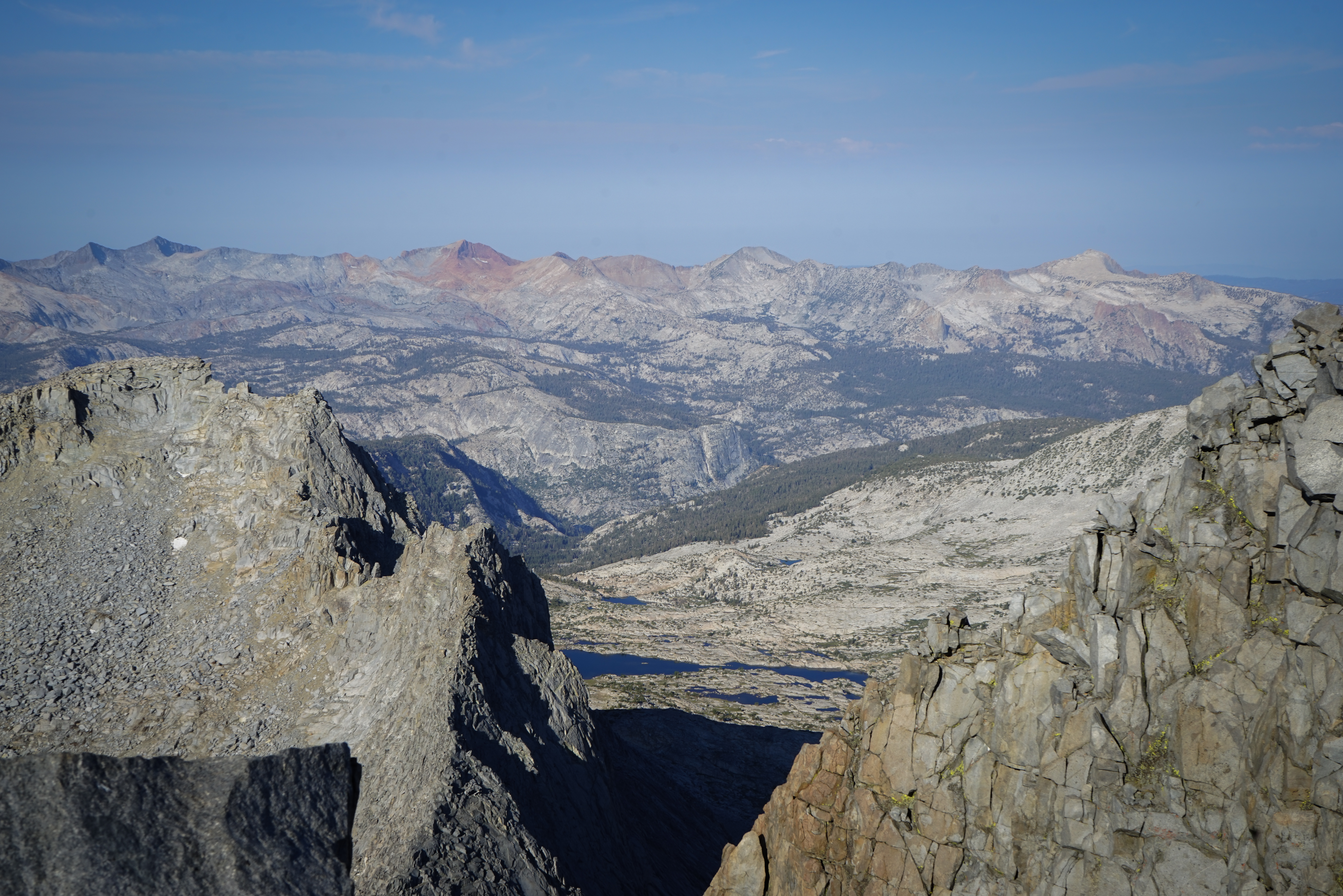
The headwaters of the Lyell Fork of the Merced River, with Electra Peak above. This is a stunning area that I visited a couple of years ago on the south part of the Yosemite High Route.
The Clark Range, with the lakes of Hutchins Creek below.

Mount Maclure and the Cathedral Range to the north.


Lyell Canyon, and the glacially fed lakes near our campsite far below.
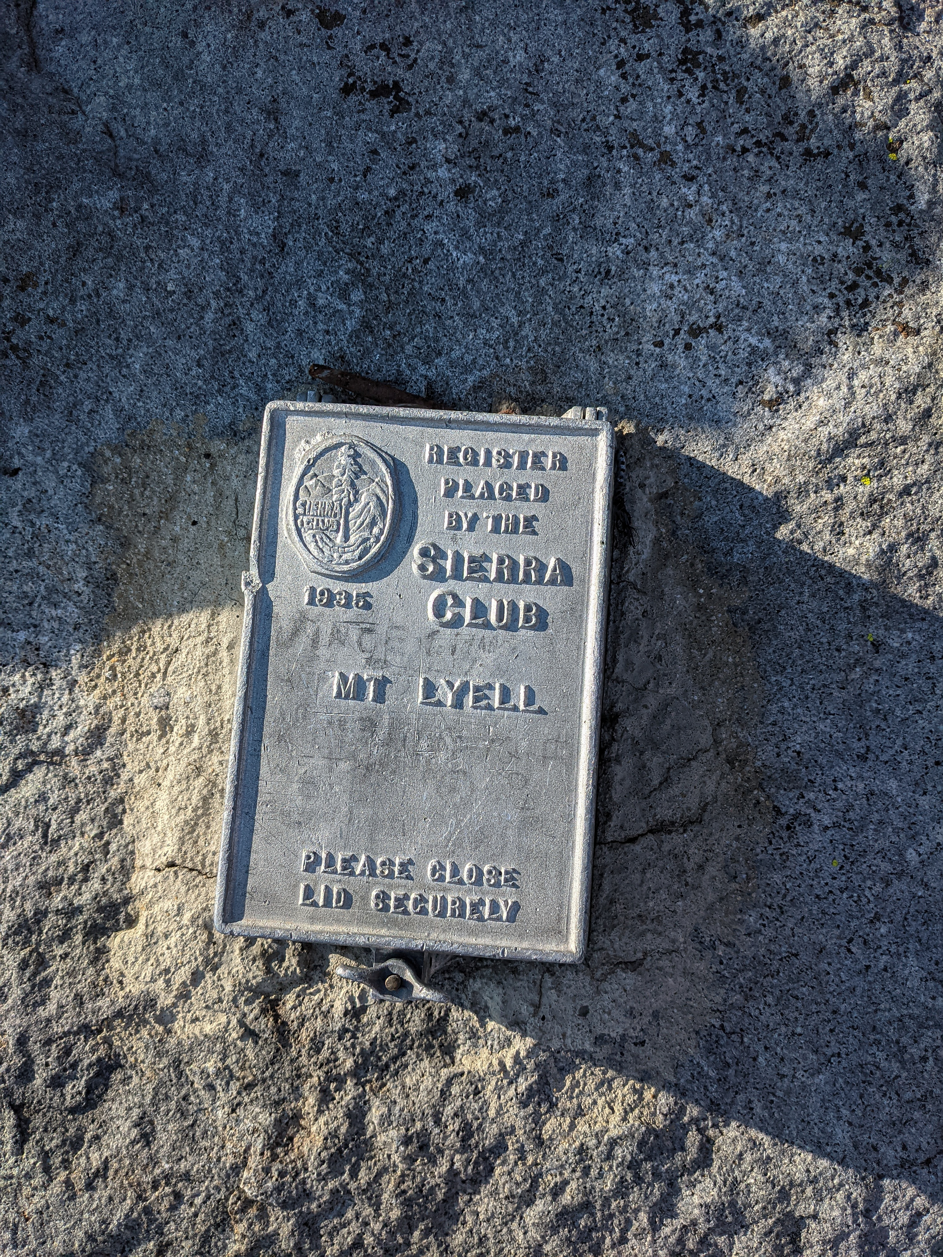
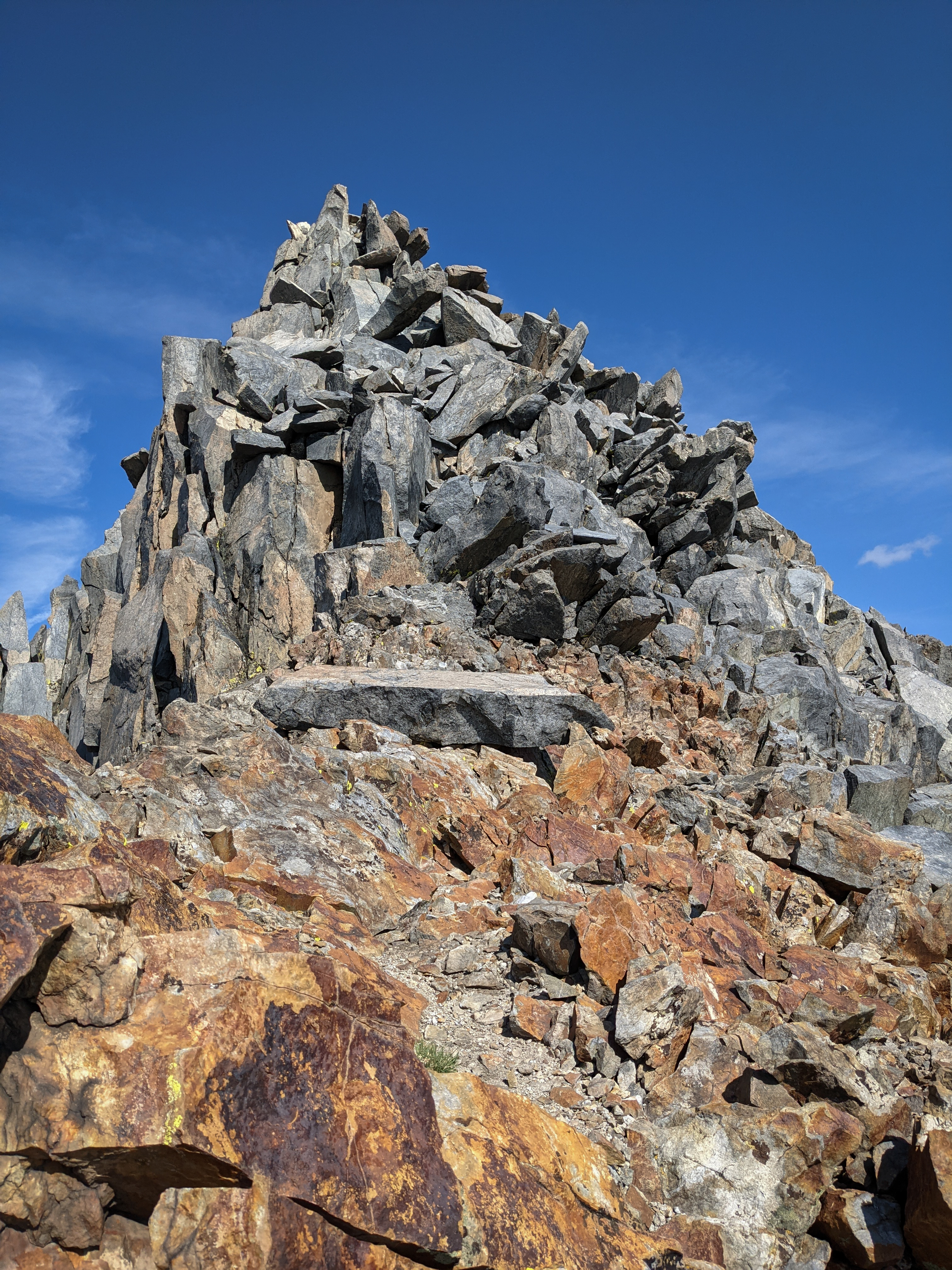
Mount Lyell is outfitted with one of the Sierra Club’s bombproof summit registers. Unfortunately all of the books were full and there were so many entries that it wasn’t particularly interesting to try and read through.
We took a nice long break on the summit and had some more breakfast-themed snacks and some water before heading down. We were a bit on the fence about climbing Mount Maclure too, but thought we’d go up and see. After all, we only had to drive an hour back to Mammoth tonight!
Mount Florence, with Half Dome peeking out behind, from the summit plateau of Mount Lyell. Soon we were back in the difficult section, taking care to try and find the easiest route down. It was a little bit easier to find it from above, and our memory of the route up helped as well.
Shannon descending Mount Lyell.
Mount Florence again.

We were happy to be off of the tricky climbing section. Here’s a photo of the route we came down, we went up / came down on the left of this photo towards the easier of the two corners, and then up from there.

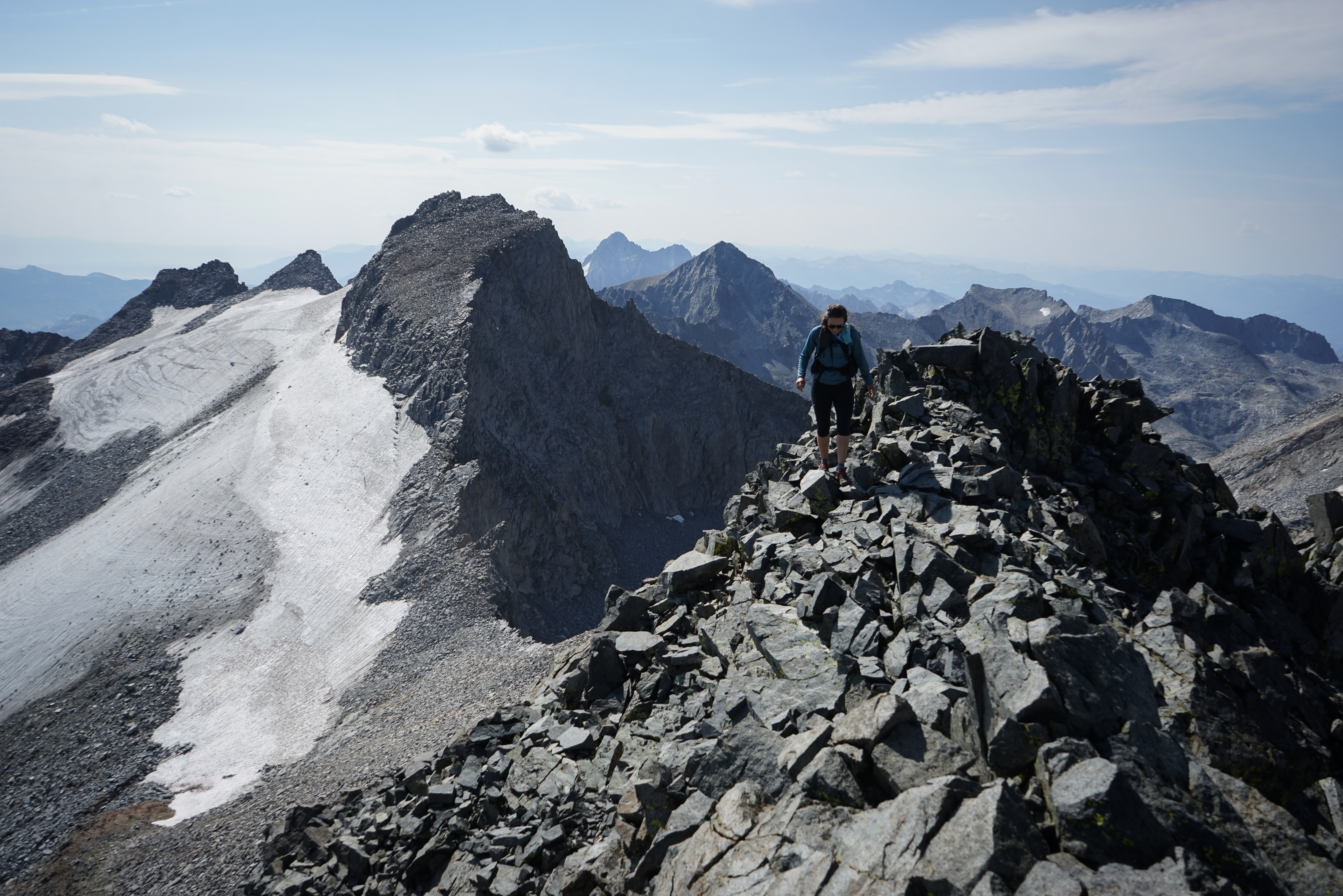
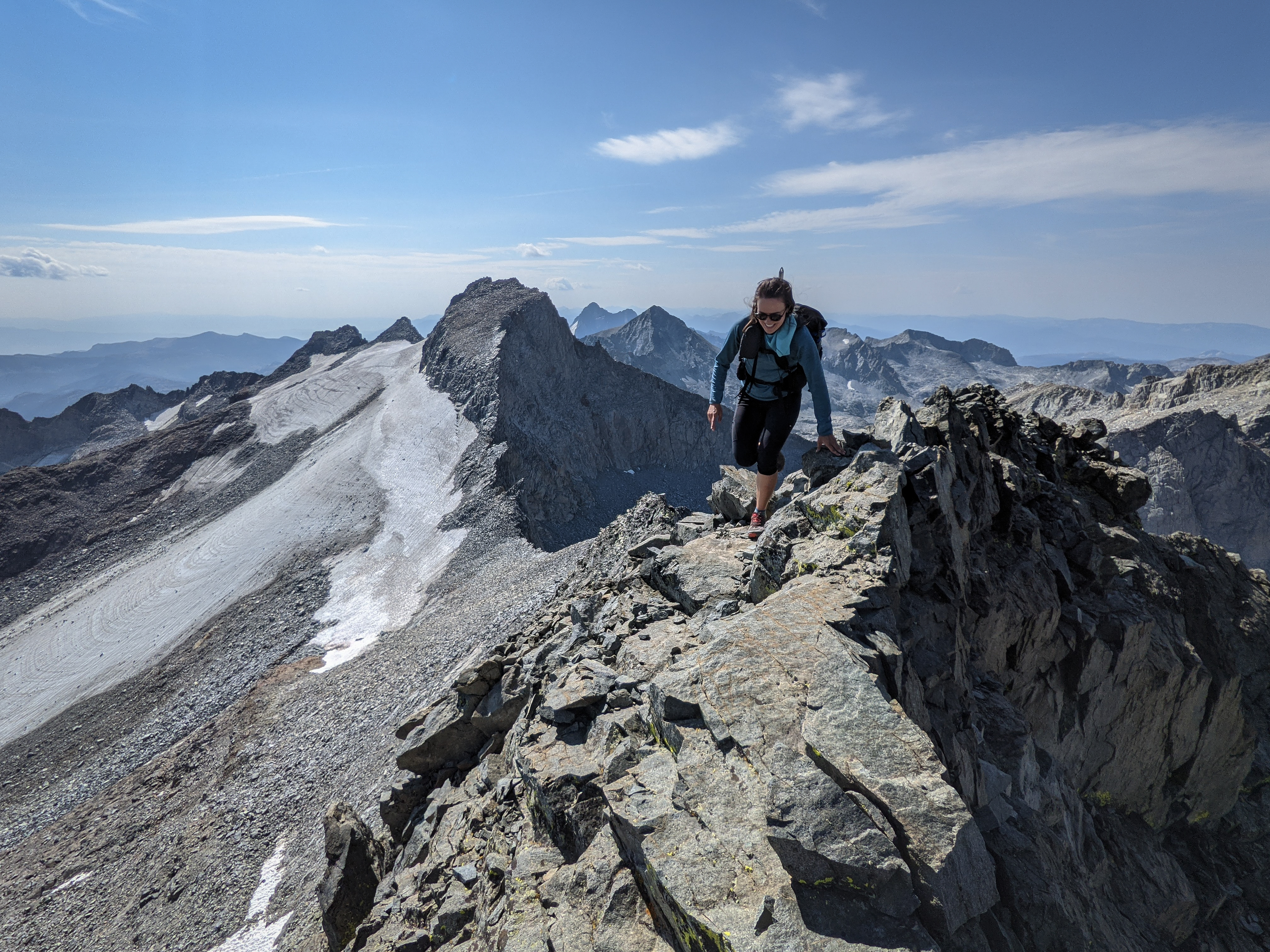
Traversing over to Mount Maclure. The climb above the glacier looks quite steep from here, we were glad to have gotten it out of the way first as Mount Maclure looked quite tame in comparison.

The climbing up the first part of Mount Maclure was easy enough. Now Mount Lyell would be getting all of the photographic attention. It did look quite impressive from this angle.
In contrast to Mount Lyell, Mount Maclure was made up of a more friable red, black, and white rock that one finds in some parts of the Sierra. It tends to break into small, sharp scree that litters the slopes below. We were very cautious on the trickier parts of this route, testing all of the hand and foot holds before weighting them. While the first portion of the route had been straightforward, there was a 200’ section in the middle where we had to traverse across some broken ledges and cut back to gain the ridgeline towards the summit, which was a little bit more challenging. Fortunately, it was pretty easy to read the terrain.
Beautiful views over Hutchins Creek and the Clark Range.
Shannon climbing on the final ridge traverse to the summit of Mount Maclure.


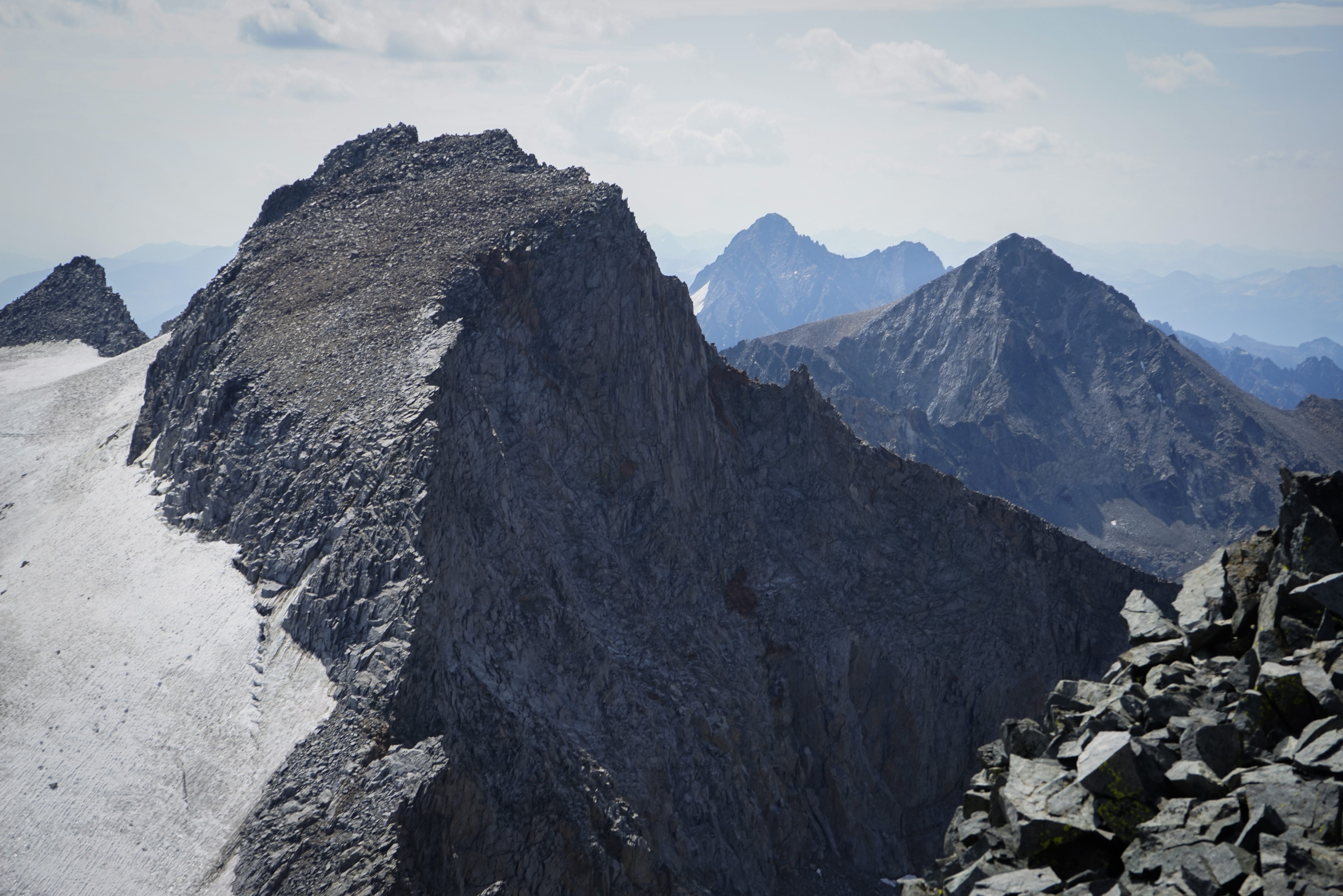
Mount Lyell from the summit of Mount Maclure.

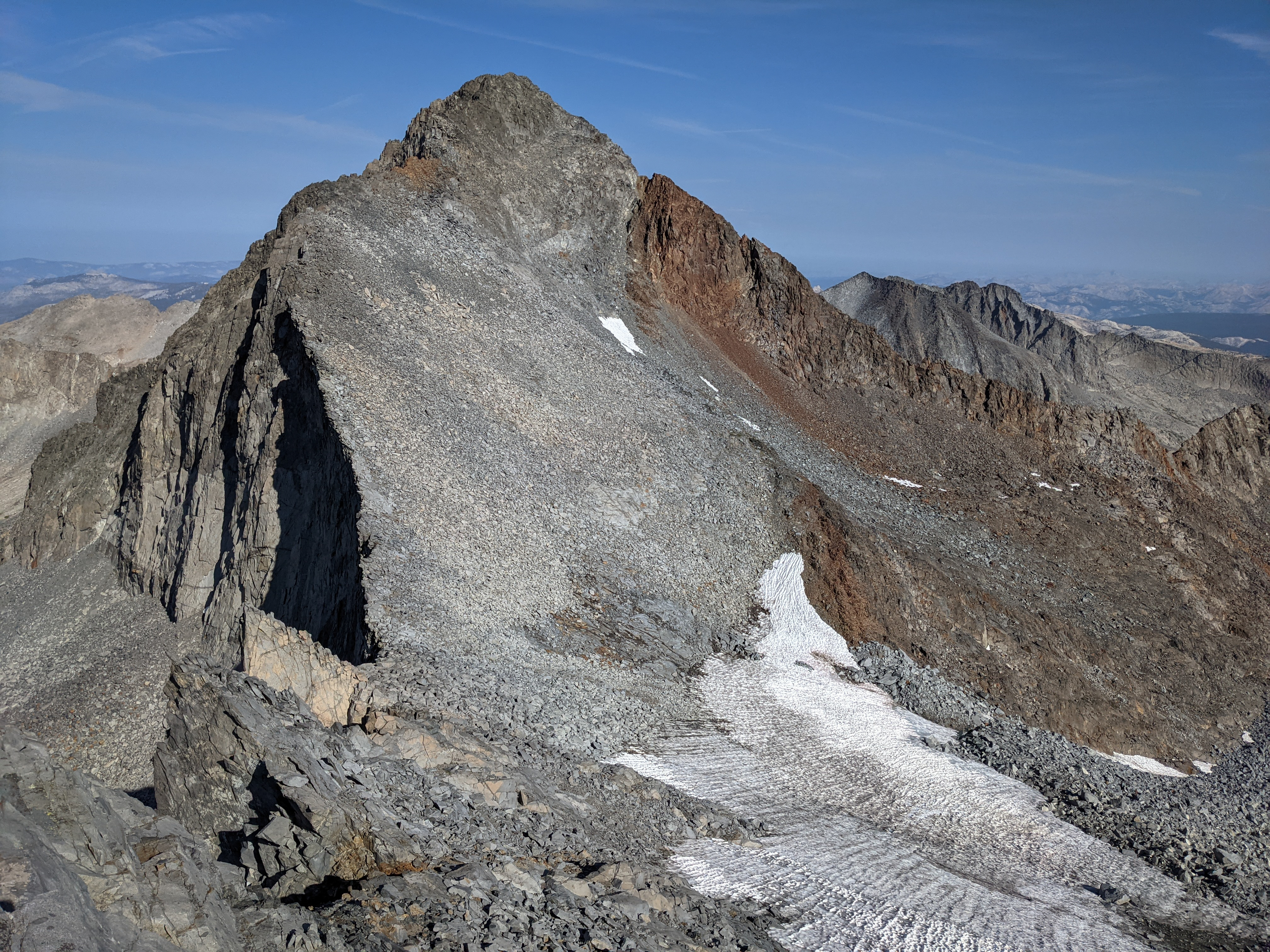
The Lyell Glacier from above. I thought it was pretty near to see the curved cracks in the ice, suggesting that it’s still flowing.

Looking west towards Mount Florence, with Half Dome, Cloud’s Rest, and El Capitan behind.


Looking north over Maclure Lake towards Tuolumne Meadows.
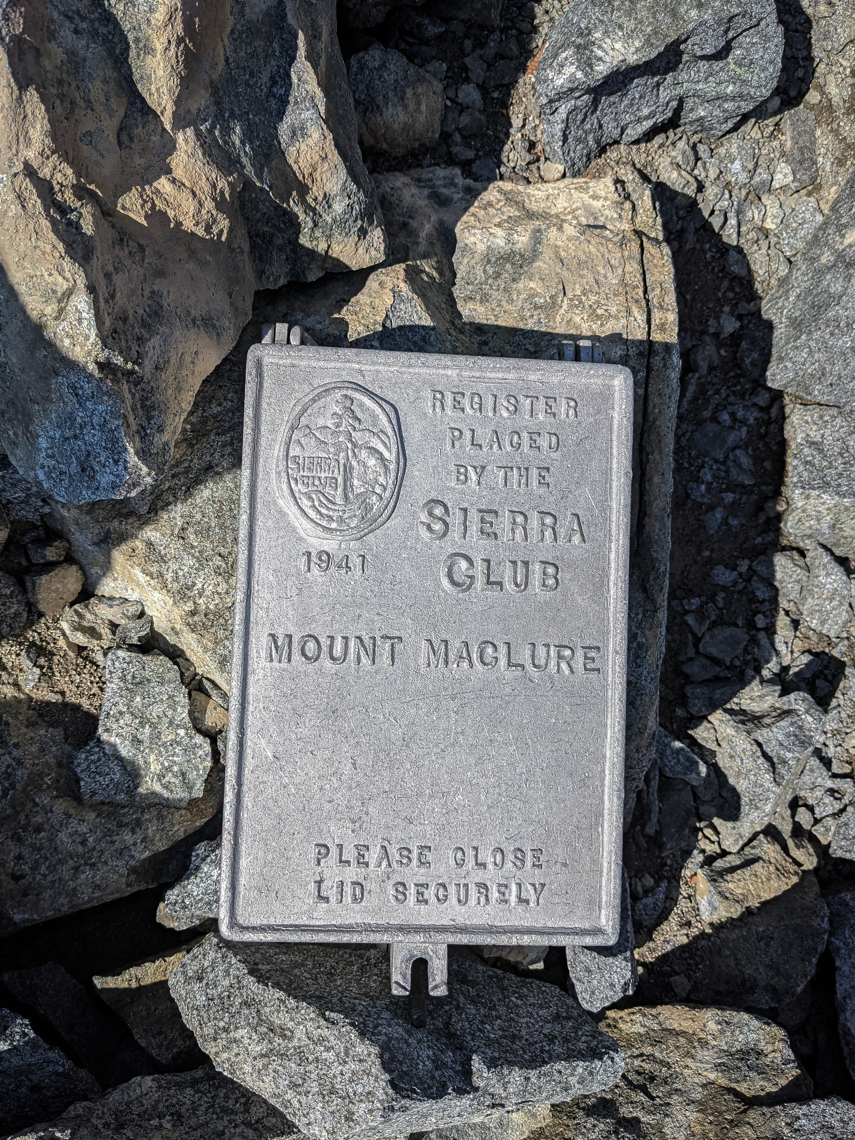
Another of the Sierra Club’s impressive summit registers.
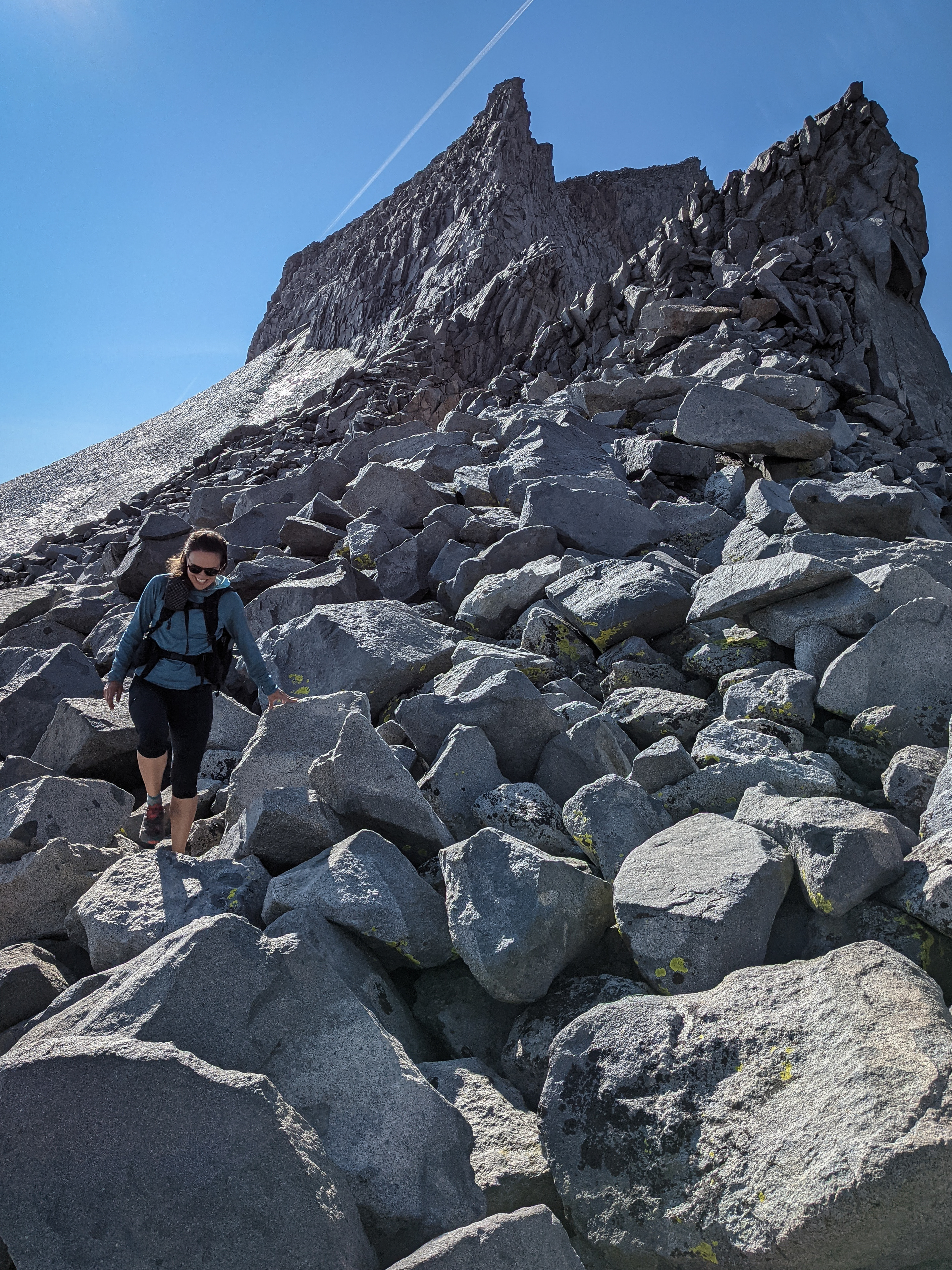
We were headed down again after a snack and drink, traversing across the ridgeline, and then carefully downclimbing the loose sections back towards Lyell-Maclure Col. We headed a little bit more directly down, when we thought the terrain looked easy enough.
Looking back up at Mount Lyell.
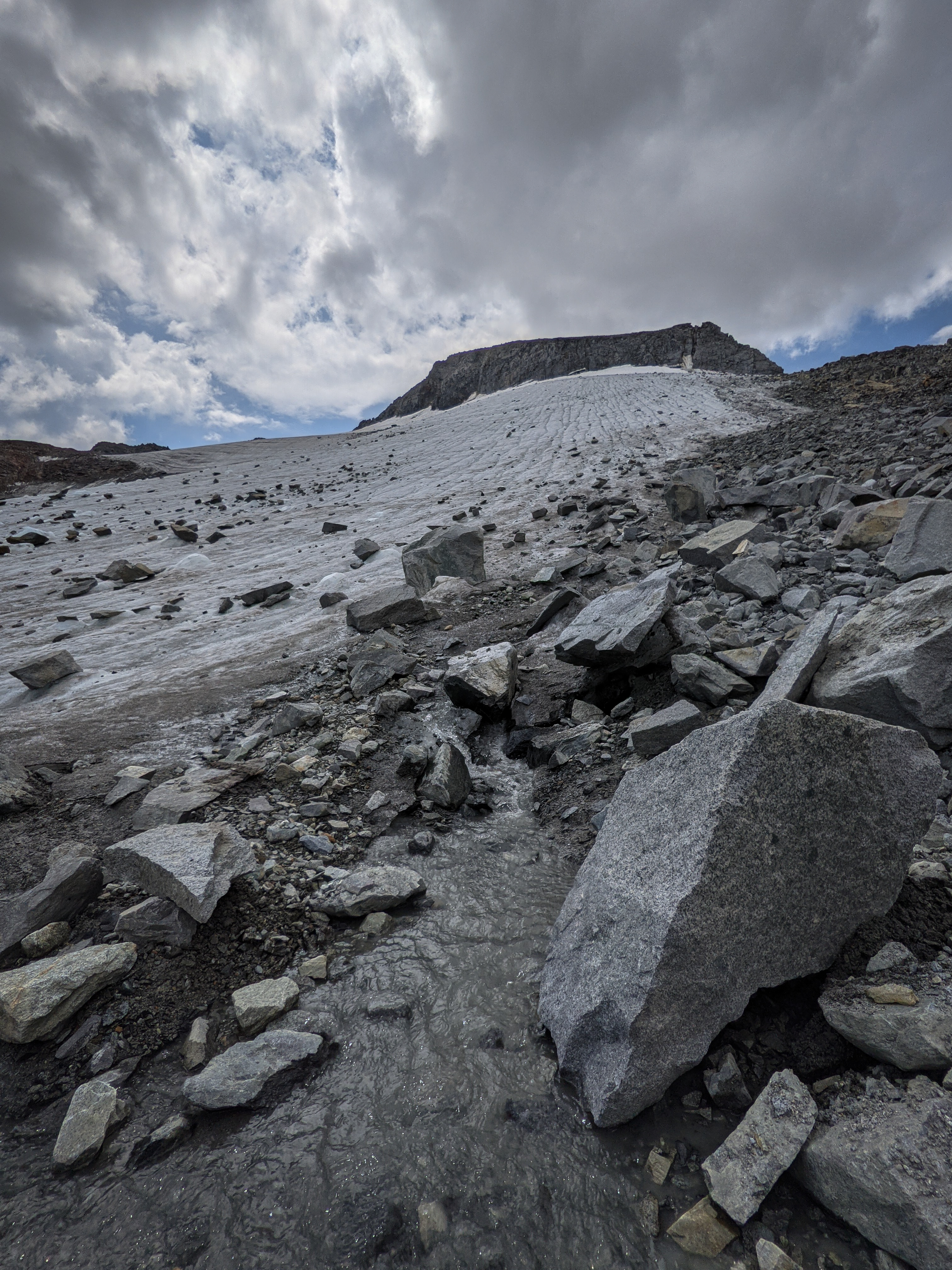
The Lyell Glacier with meltwater from below. Soon, we rock-hopped back across the moraine and found our way down the slabs back towards camp. It was much easier to find a simple route in the light, though it was still a bit steep.
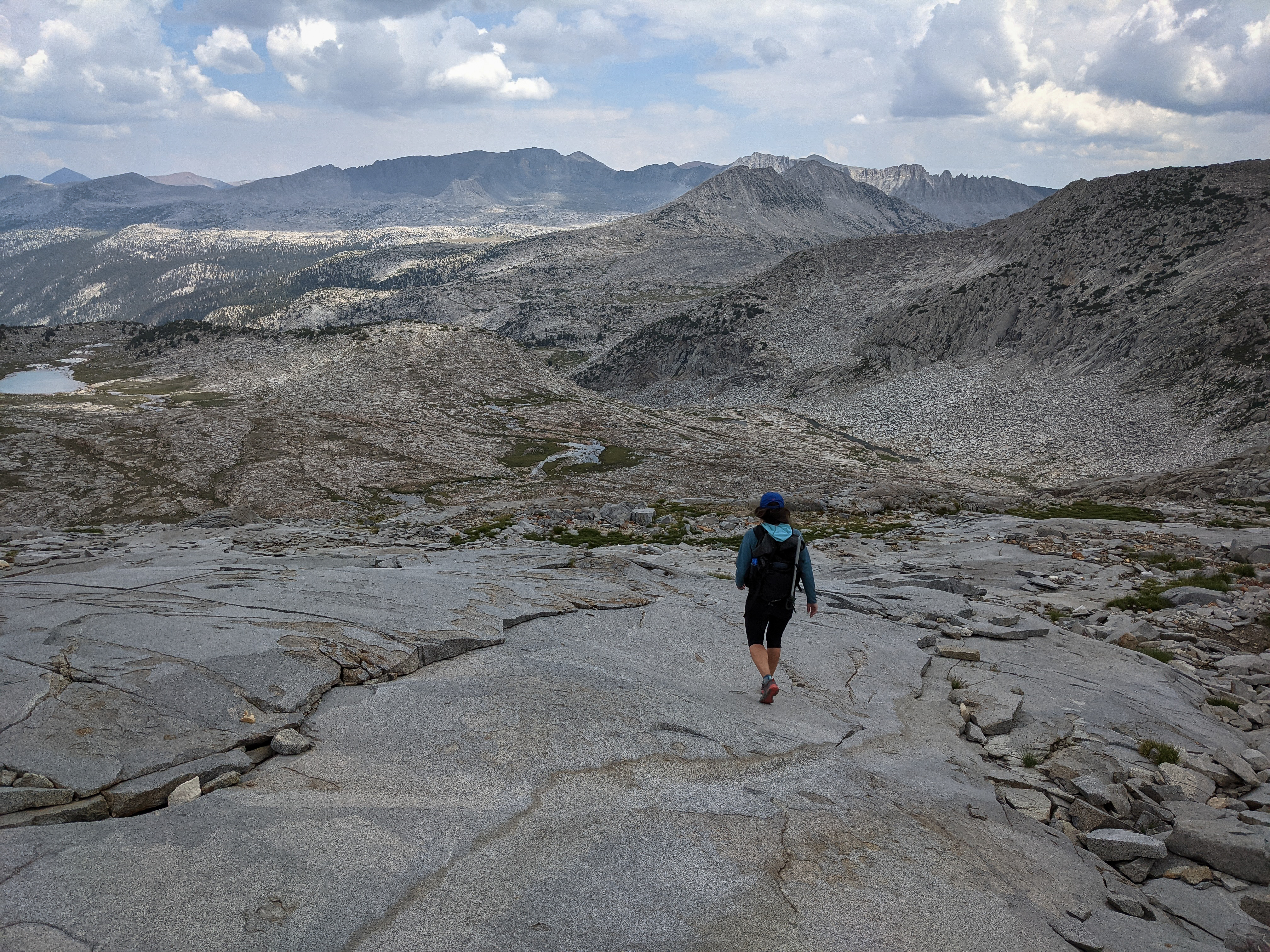
Shannon walking down the slabs towards camp. We got back to camp at about 1 o’clock, having spent about 7 hours up climbing both peaks. We brewed up some more coffee and set about packing everything up for our hike back to the car. In about 45 minutes we were ready to go.

The final stretch before hitting the JMT.
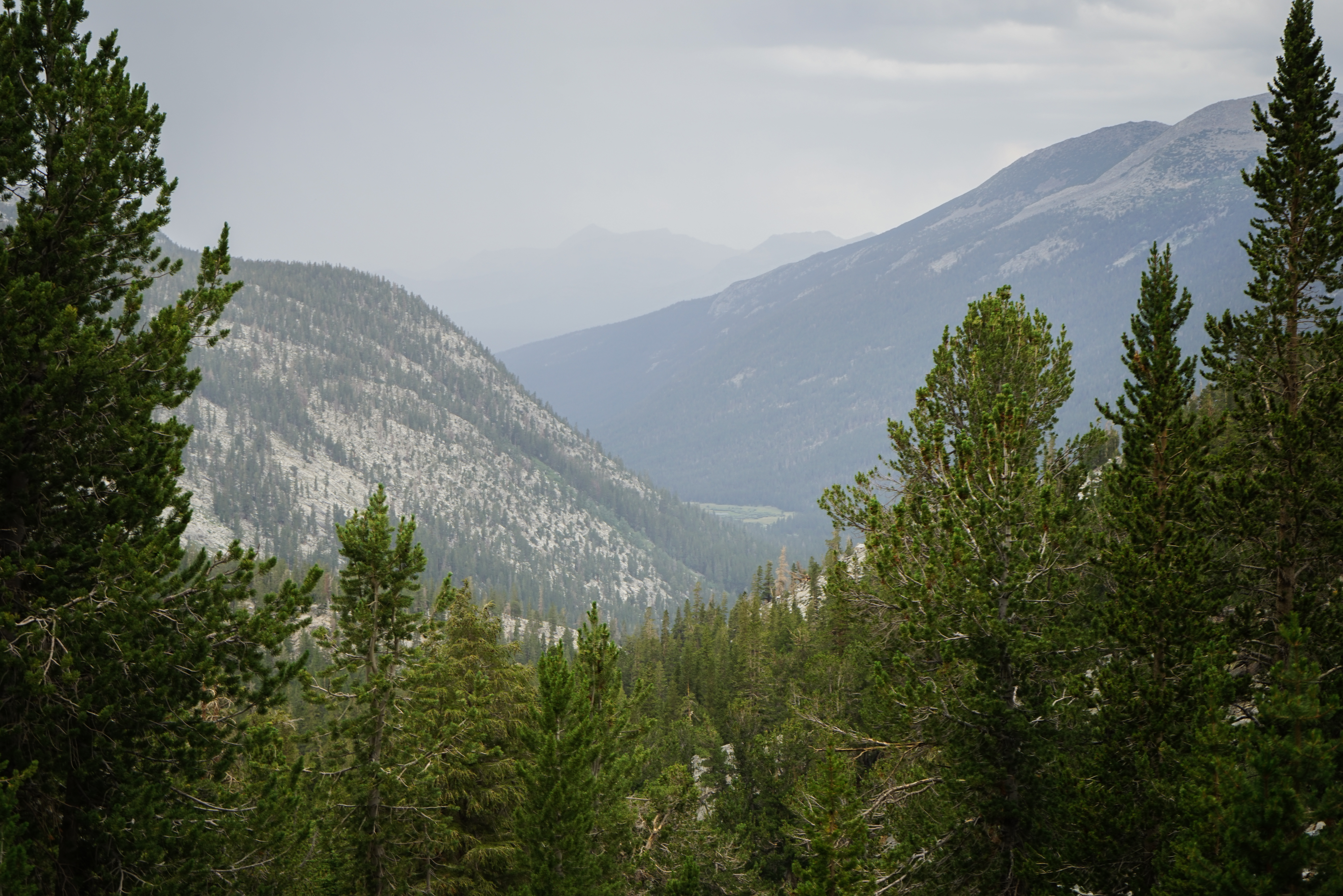

Looking down towards the meadows of Lyell Canyon from above. We passed a couple of groups heading up for Donohue Pass, but it wasn’t terribly busy. We took a break for more water and a snack once we reached the head of Lyell Canyon. It rained just enough to make us pull out our raincoats, but let up before long.
Mount Lyell from below. With just the easy hiking ahead we put our heads down and walked. I found the scenery just as nice on the way down as I had on the way up.
We had to field a few questions from backpackers about our quite conspicuous ice axes which ranged from “how high can you go with those things” to a younger guy whose camp shoes didn’t fit inside his 80 liter pack telling us that he didn’t think we needed them, a bit of a pot calling the kettle black situation. But there weren’t quite as many people out as I anticipated and we were mostly hiking alone down the canyon.
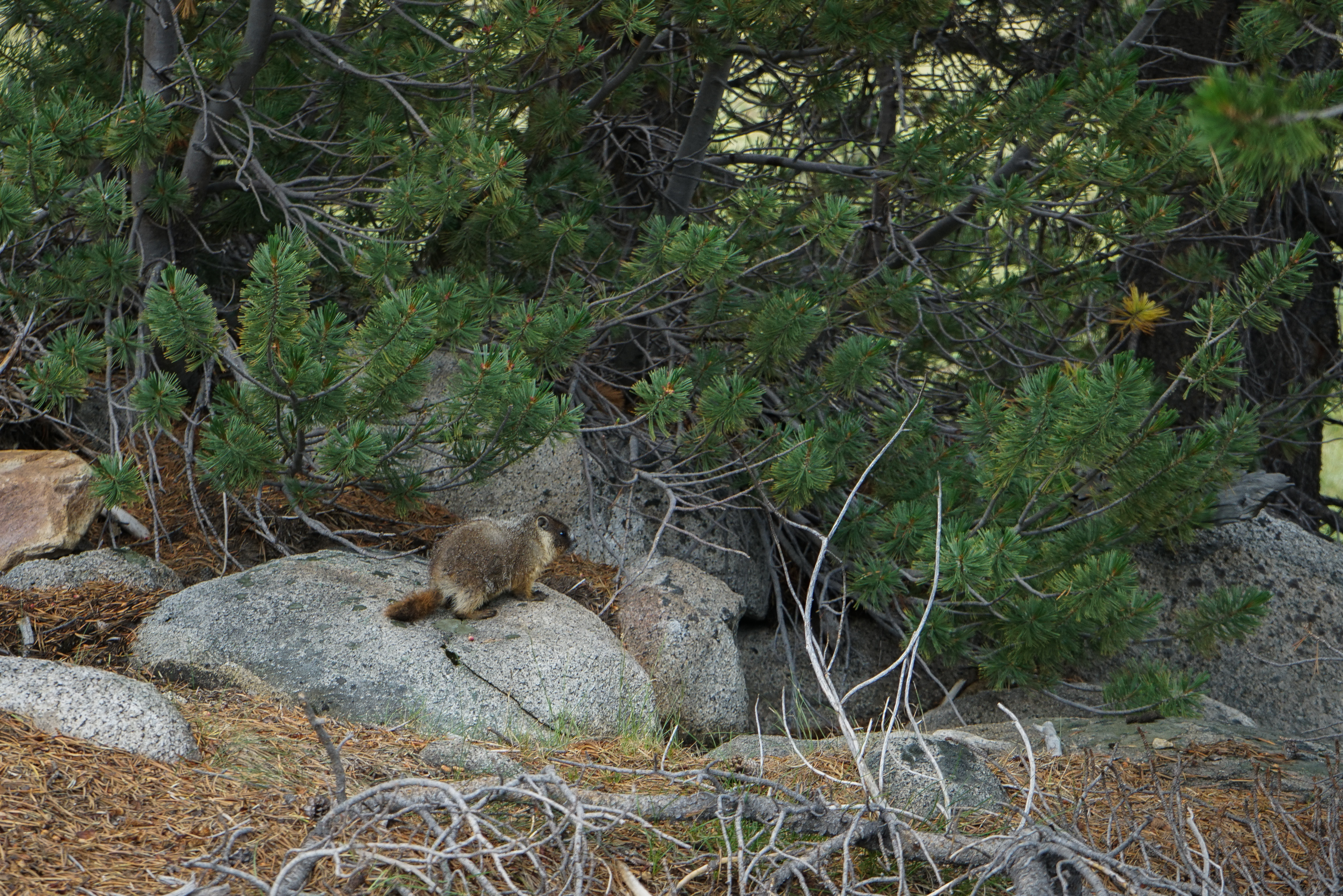
A young marmot out and about.

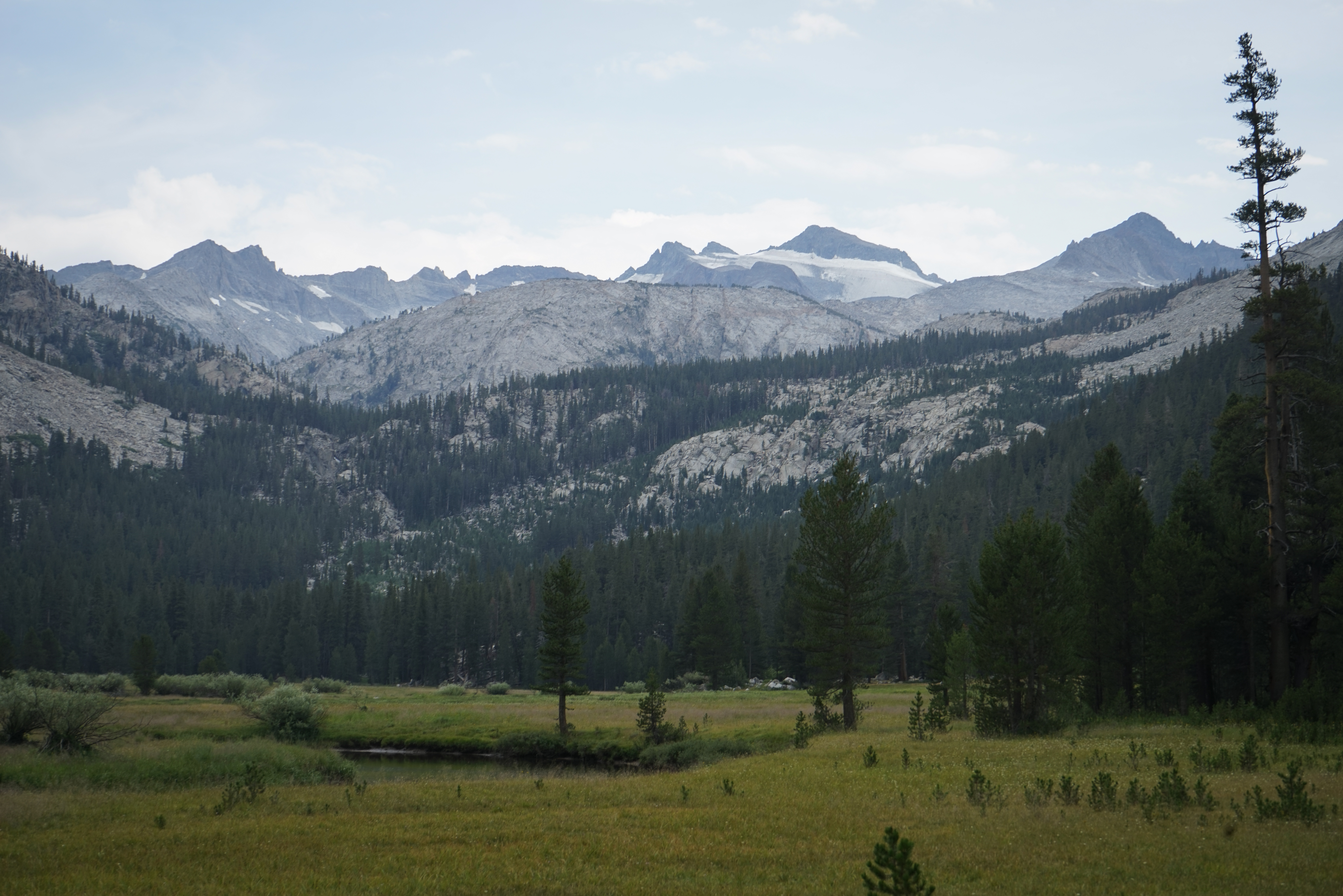
Nearing Tuolumne Meadows.
Just after 6 o’clock we got back to the big bridge across the Tuolumne, made all of the correct turns, and walked back into the parking lot. After changing into clean clothes, we got in and headed east, back to Mammoth.
In all, this was a great weekend climbing these two impressive peaks. I talked a lot about the route up Mount Lyell already, but in summary I agree that it’s on the upper end of the class 3 or lower end of class 4 rating and is pretty heads up, but that’s just for a couple hundred feet of climbing, everything else is quite easy. Mount Maclure was more straightforward, but the rock is looser, so one should prepare for that. We saw a couple of groups out climbing both in a day. While those are pretty big numbers, nine of those miles are along a very easy, flat trail, so I’d guess that it’s not quite as difficult as the almost 30 mile distance suggests. But we also found it quite fun to spend the night out, do the alpine start thing, and see the sunrise from high up on the mountain. To each their own. In any case, I’d definitely recommend these two for a reasonably fit and skilled party as they were both quite good climbs.
</section>